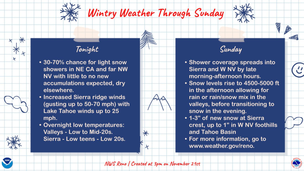
As the National Weather Service reports, a mild weather system will produce intermittent valley rain and snow from tonight through Sunday, leading to slight travel disruptions in the Sierra.
Precipitation is anticipated this evening in northeast California and extreme northwest Nevada, with activity expanding into western Nevada and the Sierra by Sunday. Even though this weekend disturbance appears less moist than the one from earlier in the week, higher altitudes could receive some snow buildup.
Drivers should use caution as roads may become slick, and the latest travel conditions are available at NVroads.com. As evening approaches, parts of northwestern Nevada will experience a 30 to 70 percent probability of light snow flurries, though minimal to no buildup is anticipated overnight.
Sierra ridge winds will increase this evening through Sunday morning with gusts reaching 50 mph to 70 mph out of the southwest. Increased cloud cover will keep overnight low temperatures around 10 degrees warmer than the previous night, according to National Weather Service forecasters.

Sunday weather models show another trough moving through the region, spreading wintry showers into the Sierra and western Nevada by late morning and afternoon. New snowfall amounts at the Sierra crest will reach 1 to 3 inches by Monday morning, alongside 1 inch of snow at Lake Tahoe level and a 0.1+ inch dusting in foothill communities like Virginia City.
Snow levels will rise above the valley floor Sunday afternoon before dropping in the evening to transition precipitation back to snow. Forecasters said that little to no accumulation is expected for the greater Reno and Carson City area, though roads will remain slick due to cold temperatures.
“Forecasters say we shouldn’t expect much, if any, accumulation for the greater Reno and Carson City area, however roads will remain slick due to the cold temperatures,” according to NWS forecasters.
Worth a look

Lions face Buccaneers Sunday at Ford Field on November 22, 2026
The Detroit Lions face the Tampa Bay Buccaneers on Sunday at Ford Field in Detroit at 1 p.m....

Wichita Mountains Refuge Collaborates With OKC Zoo to Track Monarch Migration
Monarch migration tracks Mexico in 2026 Fifteen monarch butterflies fitted with solar-powered radio tags at the Wichita Mountains...

Oklahoma State Overcomes ASU in Overtime to Win 30-27
Oklahoma State secured a 30-27 overtime victory over Arizona State on Sunday at Mountain America Stadium. The Cowboys...

Indiana Educator License Lookup: Verify Teacher Credentials Officially
Indiana teacher license lookup verifies educator credentials in seconds through the Indiana Department of Education’s License Verification and...