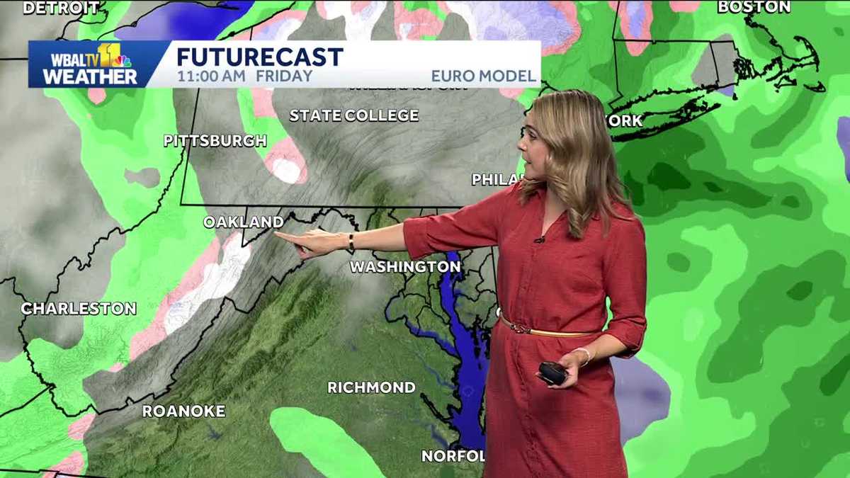
A cold air mass is moving into Maryland by the end of the week, which may bring flurries and change the autumn weather pattern, according to a report from WBAL-TV 11.
While the Baltimore metro area is unlikely to see any meaningful snow accumulation, the arrival of a strong cold front on Thursday could trigger a mix of rain and wet snow in higher elevations. The primary impact will likely be felt in far western Maryland, specifically within the higher elevations of Garrett County, where wet snow is possible from Friday afternoon into Friday night.
The coldest temperature recorded at the official weather station at Baltimore-Washington International Thurgood Marshall Airport this season was 35 degrees on October 19.
Meteorologists suggest that while much of the heavier precipitation is forecast to land in New England, central Maryland remains on the edge of the storm’s influence. For the Baltimore area, the weather outlook remains more focused on isolated flurries on Friday and Saturday rather than a major winter event.
The specific mechanics of the atmosphere are currently working against a heavy snow event for the Baltimore region. The upper-level low is expected to track too far north and east, and the upper-level trough axis is leaning forward rather than backward.
If the trough axis were to lean back sooner, the storm would move closer to the Baltimore area. The most snow accumulation is probable only in the higher elevations of Western Maryland.
The timing of the first snow in Maryland varies from year to year.
On Monday, Baltimore City officials discussed preparations for winter weather and extreme cold in anticipation of the possibility of snow this weekend. These preparations are intended to address the potential for freezing temperatures that may drop around freezing by Sunday or Monday morning as the pattern changes.
Keep reading
New York Man Andrew Laub Charged in $5 Million Real Estate Investment Fraud Scheme
Andrew Laub faces federal fraud charges A New York man is accused of defrauding friends and acquaintances of...

UNM Lobos Face UNLV to Extend Historic Winning Streaks
The New Mexico Lobos are standing on the edge of a historical breakthrough this Saturday at University Stadium....

Cardinal Joseph Tobin Continues to Recover After Successful Kidney Surgery
Cardinal Joseph W. Tobin of Newark is recovering at home following a successful procedure to remove a mass...

Sixteen New Hampshire House Recounts Begin in Concord
Sixteen candidates in New Hampshire House races have triggered official recounts following a week of changing election results....