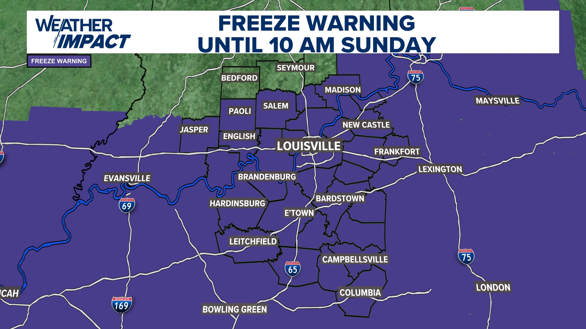
Freezing temperatures threaten crops and livestock across the Ohio Valley
A significant drop in temperature is set to sweep through the region late tonight, bringing the risk of a hard freeze to much of Kentucky, Indiana, and Ohio. The National Weather Service has issued several freeze warnings that will take effect as temperatures slide into the upper 20s and low 30s. For residents, this isn’t just a matter of reaching for a heavier coat; for farmers and gardeners, the overnight freeze poses a direct threat to survival for sensitive vegetation and livestock.
According to reports from whas11.com, the primary Freeze Warning issued by the National Weather Service in Louisville is scheduled to begin at 12 a.m. Sunday, Nov. 8, and will remain in effect until 10 a.m. that same morning. This specific warning covers a vast area, including most of the region except for Jennings and Jackson counties in Indiana. While many are used to the seasonal shift, the timing is notable, as the average first true hard freeze for this area typically occurs around November 7.
The scale of the cold snap is extensive. reports that freeze warnings have been upgraded to cover 144 counties across Kentucky, Indiana, and Ohio. Kentucky bears the largest portion of this impact with 116 counties under warning, followed by 20 counties in Indiana and 8 in Ohio. This widespread pattern suggests a deep freeze that will affect everything from urban centers to rural valleys.
Regional temperature breakdowns and local impacts
The severity of the freeze will vary depending on local geography and specific National Weather Service jurisdictions. While many areas will see temperatures in the low 30s, some locations are expected to drop even lower. The following table outlines the expected conditions and coverage areas based on reports from various NWS offices:
| NWS Office & Coverage Area | Expected Lows | Key Locations Included |
|---|---|---|
| NWS Louisville (KY & Southern IN) | Upper 20s to low 30s | Louisville, Lexington, Bowling Green, Frankfort, Elizabethtown |
| NWS Jackson (Eastern/SE KY) | 29°F to 36°F | Pikeville, Hazard, Somerset, Morehead, Middlesboro |
| NWS Wilmington (South Central/SW OH) | 29°F to 33°F | Cincinnati, Chillicothe, Portsmouth, Maysville, Covington |
| NWS Paducah (Western KY & SW IN) | As low as 31°F | Paducah, Owensboro, Evansville, Hopkinsville |
The NWS Jackson office specifically noted that the coldest readings are likely to occur in rural valleys and other low-lying spots. These “cold spots” can experience significantly sharper temperature drops than more elevated or open areas, potentially leading to localized damage that exceeds general regional forecasts.
Risks to agriculture and residential infrastructure
The implications of this freeze extend far beyond personal comfort. For the agricultural community, the stakes involve both plant life and animal safety. The National Weather Service warns that these temperatures could kill crops and other sensitive vegetation. For those managing livestock, there is a specific biological risk to monitor. notes that the NWS advises livestock owners to remove ruminants from pastures that contain high-risk plants for prussic acid, a condition that can become dangerous during sudden temperature shifts.

Homeowners also face potential property damage. The freeze could impact unprotected outdoor plumbing. To mitigate this, the National Weather Service suggests wrapping or draining pipes, or alternatively, letting them drip slowly to prevent freezing and subsequent bursting. For gardeners, the immediate recommendation is to move potted plants indoors or cover any sensitive vegetation with cloth before nightfall.
A brief reprieve before the next cold front
While the immediate concern is the Sunday morning freeze, the weather pattern shows signs of volatility. According to travelinglifestyle.net, which cited data from NWS Paducah, conditions may moderate slightly for a few days following this event. However, this window of relief appears temporary. Forecasters are already tracking another shift in the atmosphere, with a new round of cooler air expected to move through the region between Wednesday and Thursday.
For those in eastern Kentucky, the pattern of frost may be more persistent. Current forecasts suggest that dry weather will continue through the middle of next week, but frost remains a possibility nearly every morning through Tuesday. Residents can stay updated on specific local developments through official channels at weather.gov/lmk and other regional NWS sites.
As the mercury drops toward the upper 20s tonight, the question for local producers and residents remains: how much of the current season’s growth and infrastructure can be shielded before the overnight slide begins?
Related reading

Nebraska Fires Offensive Coordinator Dana Holgorsen After Four-Game Losing Streak
Matt Rhule relieves Dana Holgorsen of offensive coordinator duties Nebraska head coach Matt Rhule has fired offensive coordinator...

Jeremiah Davis Leads Montana State to 83-70 Win Over Long Beach State
Montana State secures 83-70 victory over Long Beach State Montana State moved to a 1-1 record on Saturday...

Mississippi State Women’s Basketball Heads to UT Martin
Mississippi State heads to Tennessee for first road test The Mississippi State women's basketball team is moving from...

Kiernan Stamey has recorded 268 kills for Syracuse volleyball
Syracuse Volleyball Targets Return to Chestnut Hill Kiernan Stamey has recorded 268 kills this season, leading the Syracuse...