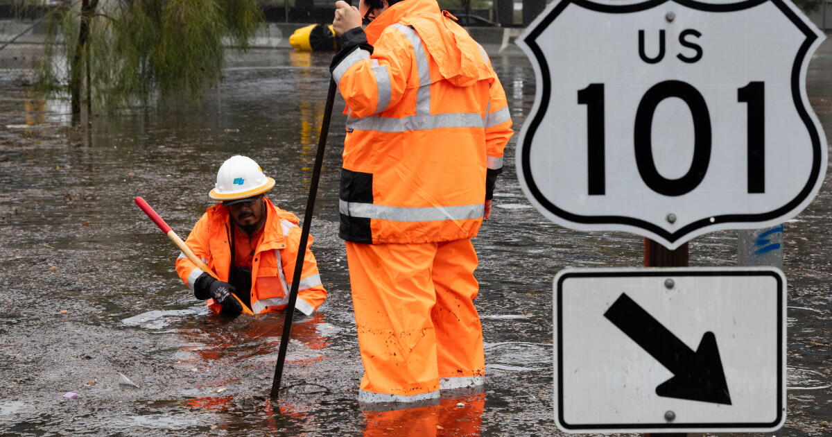
Atmospheric river moisture slammed Northern California on Wednesday, flooding San Francisco streets and stranding self-driving Waymos and U.S. Postal Service trucks, while the real target — Southern California’s fresh burn scars — braced for a direct hit starting before dawn Thursday.
The National Weather Service expects the season’s first significant atmospheric river to reach Santa Barbara and western Ventura County between 2 a.m. and 5 a.m. Thursday, then push into Los Angeles County by mid-morning, LA Times reported. Forecasters are warning of rainfall rates up to three-quarters of an inch per hour on south-facing slopes — the threshold that turns bare, fire-hardened soil into moving mud.
The warnings run from 6 p.m. Wednesday through 8 a.m. Friday, and the county Office of Emergency Services said deputies have been knocking on doors to make sure people in the highest-risk zones know they may need to leave.

California Senator Susan Rubio, who represents Altadena, said in a statement that as the holiday season approaches, it is a priority to keep families and communities safe. She urged residents to take the warning seriously and monitor official county alerts.
The burn-scar calculus
Rain on a healthy watershed soaks in. Rain on a burn scar runs off — fast. The fires stripped vegetation and left behind hydrophobic soil that repels water like a waxed car. When rainfall intensity hits half an inch per hour, the weather service says, debris flows become likely. The forecast calls for pockets of 0.75 to 1 inch per hour.
L.A. County Public Works spent the last year removing 1.3 million cubic yards of sediment from debris basins and reservoirs — enough to fill the Rose Bowl three times, public information officer Liz Vazquez said in an email. Crews have also staged Vactor trucks, excavators and generators at flood-prone roadways, and the department maintains a public list of free sandbag locations.
MORE TREES DOWN: One lane of WB Highway 92 is closed just before Main Street in @CityofHMB due to a hanging tree limb. The limb is too high for firefighters to cut so they are taping off the location. Also, firefighters are cutting a fallen tree at the Half Moon Bay… pic.twitter.com/4hZqDqlDsg
El Niño’s weighted dice
This storm arrives amid what forecasters describe as a historically strong El Niño that has already warmed coastal waters and lifted sea levels. The climate pattern tilts the odds toward a wetter-than-normal winter across Southern California, meaning this atmospheric river is likely the first of several.
The weather service puts the chance of a follow-up system next Tuesday or Wednesday at 20 percent, with a 40 percent chance of lighter rain Sunday along the Central Coast.
Northern California takes the first punch
San Francisco absorbed the storm’s leading edge Wednesday. An underground Muni Metro station flooded for more than two hours. San Francisco International Airport ground to a three-hour delay, per an FAA advisory. At the Moscone Center, water poured through the roof during a Microsoft tech conference, KRON 4 reported. Nearly 4,500 PG&E customers lost power in Oakland, with another 3,000 in Hayward.
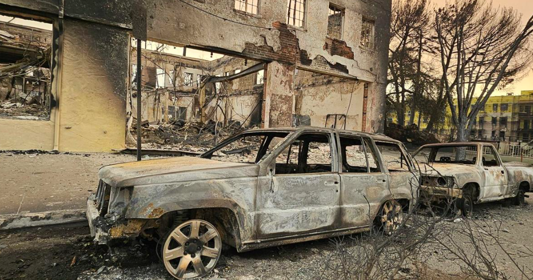
In Monterey County, the sheriff’s office warned Big Sur residents and businesses near the Timber and Plaskett fire burn areas that roads could become impassable with little warning. A hostess at Nepenthe, the cliffside restaurant that closed for days during the Timber fire this fall, told the LA Times the restaurant stayed open Wednesday evening despite the conditions.
High surf advisory warns of coastal flooding and mountain snow
A high surf advisory remains in effect through Friday for exposed west- and northwest-facing shores. The weather service cautions that large breaking waves could affect Morro Bay and Ventura harbors and may break at or over the base of the Pismo Beach and Cayucos piers. Coastal flooding is possible during peak morning high tide Thursday, with significant erosion and shallow water over low-lying beaches, walkways and parking lots.
The UC Berkeley Central Sierra Snow Lab has already recorded 35 inches this season — 190 percent of the median — and lead scientist Andrew Schwartz said another 2 to 4 feet are likely through early Friday. Mammoth Mountain opened November 5, nearly a week ahead of schedule. That snowpack matters: it provides at least 30 percent of California’s water supply when it melts.
Resources for the night ahead
The state has activated its State Operations Center to coordinate response and prepositioned swift-water rescue teams, engines and Incident Management Teams. Los Angeles County’s Winter Shelter Program has opened augmented shelters for unhoused residents, and the Sheriff’s Homeless Outreach Services Team is engaging people living in and around waterways. Residents needing shelter or transportation information are directed to call 2-1-1.
Forecasters emphasize that the window for safe evacuation closes before the rain intensifies. “Residents should not wait until conditions become dangerous to leave.”
Worth a look

Beverly Hills Names Glendale Fire Chief Jeff Brooks as New Fire Chief
“It is my honor to join the world-renowned City of Beverly Hills as Fire Chief,” Jeff Brooks said...

Mississippi Ranks 11th in Unemployment Insurance Tax Structure, Down From 6th in 2020
Mississippi now ranks 11th nationally for its unemployment insurance tax structure, a five-place slide from 6th in 2020,...

Minneapolis Cash Home Buyers: Compare Net Proceeds, Avoid Closing Surprises
Selling a house for cash can sound almost too convenient. No repairs, no open houses, no months of...

No. 18 Maryland Women Rout Coppin State 84-31
No. 18 Maryland opened a 30-point lead before Coppin State scored again, turning a competitive first quarter into...