The Mississippi and Yukon rivers are nearly equal in length, but they function as opposites: the Mississippi is a highly engineered industrial highway, while the Yukon remains a wild system that dictates the terms of human movement. While the Mississippi is managed by locks and dams to ensure constant freight flow, the Yukon’s utility is governed by the seasonal cycle of ice and snowmelt.
The scale of two continental giants
On paper, the two rivers look like peers. The Mississippi runs roughly 2,350 miles from Lake Itasca in Minnesota to the Gulf, while the Yukon stretches 1,980 miles from the Llewellyn Glacier in British Columbia to the Bering Sea. However, the geographic footprint they command is vastly different.
The Mississippi is a massive drainage system, collecting water from 1.2 million square miles—covering about 40% of the continental U.S. and touching 31 states. In contrast, the Yukon’s basin covers about 330,000 square miles. While that is smaller, it is still larger than the state of Texas. Because the Yukon spans both Canada and the U.S., managing its resources, particularly the salmon, requires international diplomacy rather than just federal oversight.
| Feature | Mississippi River | Yukon River |
|---|---|---|
| Approximate Length | 2,350 miles | 1,980 miles |
| Drainage Basin | 1.2 million sq miles | 330,000 sq miles |
| Average Discharge | 593,000 cfs | 236,000 cfs |
| Primary Use | Industrial Freight | Seasonal Transport/Subsistence |
Engineering a freight corridor vs. living with the ice
The Mississippi has been systematically “brought to heel” to serve the American economy. Left to its own devices, much of the upper river would be only 3 to 4 feet deep. To prevent this, the U.S. Army Corps of Engineers has maintained a 9-foot channel up to Minneapolis and installed 29 locks and dams north of St. Louis. Below Baton Rouge, a 45-foot channel allows ocean-going ships to reach New Orleans.
This infrastructure transforms the river into a logistics powerhouse. A single barge can carry the load of 60 semi-trucks, and towboats often push 15 barges at once. This efficiency is why the Mississippi has been engineered into a freight corridor where towboats carry Midwest corn south. It is a round-the-clock operation, with ice only affecting the northernmost stretches in late autumn.

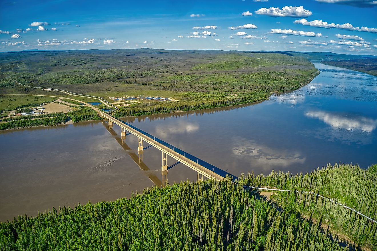
The Yukon operates on a different clock. There is only one bridge in all of Alaska—the E.L. Patton Yukon River Bridge—which carries the Trans-Alaska Pipeline. For most villages, the river is the only road, but only when the weather allows. In the summer, heavy cargo arrives by barge from May through mid-September. In the winter, the river freezes, turning into an ice road that connects villages like Fort Yukon, Galena, and Ruby.
The volatility of the Yukon is stark. At Pilot Station, flow has dropped to 35,000 cubic feet per second in 1984, but surged to 1.24 million cubic feet per second in 2005—roughly double the Mississippi’s average discharge. This massive swing is driven by the warm-season melt from glaciers and tributaries like the Tanana and White rivers.
Marine heat waves threaten Yukon Chinook salmon
While the Mississippi’s stakes are economic, the Yukon’s stakes are often biological. The Yukon Chinook, or king salmon, undertake the longest migration of any Chinook in the world, swimming 1,900 miles upriver to reach streams near Whitehorse. They do this without eating for roughly three months.
This migration is currently under threat. The 2022 run hit a record low of 50,000 fish, down from 300,000 in previous decades. A 2026 NOAA-led study linked these deaths to marine heat waves in the Bering Sea, which wiped out essential prey like capelin. In response, Canada and Alaska agreed in 2024 to halt all commercial, recreational, and domestic fishing for Canadian-origin Yukon Chinook for seven years—a full life cycle of the fish.
There are signs of recovery. The 2026 run was estimated at 103,000 fish, beating forecasts and doubling the 2022 low, though biologists warn the population remains well below average.
Highways ended Yukon sternwheeler commercial trade
The Yukon was once a hub of similar commercial ambition during the Klondike Gold Rush. By 1899, the river supported 60 sternwheelers, 20 barges, and 8 tugs. The 460-mile trip from Whitehorse to Dawson City was the final leg for many gold seekers. This era ended not because the river failed, but because the road arrived. Once a highway reached Dawson City in 1952, the river’s role as a primary trade artery faded. The S.S. Klondike, the last working sternwheeler, made its final trip in August 1955.

Today, the timing of the river’s “breakup” remains a cultural touchstone. In Nenana, residents participate in the Ice Classic, guessing the exact minute the ice will break on the Tanana River. In 2026, the clock stopped at 6:58 p.m. on May 4. The unpredictability is real; breakup has occurred as early as April 14 and as late as May 20.
The contrast between these two rivers reveals a fundamental truth about North American geography: one was built to serve the city, while the other still forces the people to serve the river.
Worth a look

Former Nexus CEO Michael Donovan Arrested on Child Sodomy Charge
Michael Donovan, the 49-year-old former CEO of Nexus Services, is being held without bond at the Middle River...

Mississippi State vs. Texas Preview: Bulldogs Struggle After Season-Ending QB Injury
Mississippi State enters its Saturday matchup against No. 11 Texas in Austin grappling with a stark identity crisis....

Louisville Basketball Dominates Mercyhurst in Preseason Finale
Louisville men’s basketball closed out its preseason schedule with a commanding 71-39 victory over the Mercyhurst Lakers on...

Children’s Mercy to stop ACA coverage starting January 1
Children’s Mercy announced patients won’t be covered by Affordable Care Act (ACA) insurance starting January 1, leaving families...