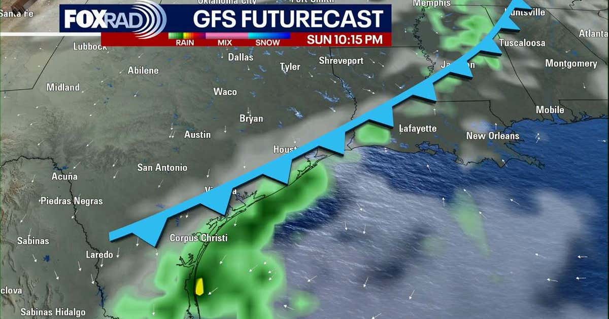
Two cold fronts will sweep through Southeast Texas this week, pushing Thanksgiving morning lows into the low 40s in Houston and the upper 30s to the north, Houston Chronicle reported.
The first front arrives Sunday afternoon with a 40% chance of scattered showers and weak thunderstorms between 5 and 10 p.m., dropping overnight temperatures into the mid- to upper 50s by Monday morning.
Sunday begins with patchy dense fog from 4 to 9 a.m., reducing visibility to less than a quarter-mile at times before dissipating by late morning. Highs will reach the upper 70s to near 80 degrees ahead of the front. Monday highs will only reach the upper 60s to near 70 degrees, about 10 degrees cooler than Sunday.
A stronger second front pushes into South-Central Texas late Tuesday night and early Wednesday, bringing the coldest air of the season so far. Overnight lows will fall into the mid-40s by early Wednesday, with wind chill values briefly dropping to the upper 30s in areas north of Houston. Wednesday afternoon highs will only reach near 60 degrees under mostly sunny skies and dry air.
Thanksgiving morning will likely start in the low 40s in Houston, while areas north of the city — including Conroe, Huntsville, and College Station — will fall into the upper 30s. Isolated spots in the Texas Hill Country may experience a brief, light freeze. Afternoon highs will rise into the low 60s with mostly sunny skies.
A wind advisory remains in effect through midday Monday for coastal counties — Jackson, Matagorda, Brazoria, Galveston, and Chambers — with gusts up to 35 mph.
Fox 26 Houston said that Thanksgiving is shaping up to be drier and cooler, with lows near 40 and highs near 60, and that Thanksgiving morning could end up being the coolest so far this season for Houston.

The Hair Palace Gives Away 1,000 Turkeys Across Richmond for Thanksgiving
The Hair Palace distributed about 1,000 turkeys across the Richmond area for Thanksgiving, CBS 6 News Richmond WTVR...

RI Cardiologist Surrenders License After Fraud Indictment; Two Other Doctors Disciplined
A Rhode Island cardiologist surrendered his medical license November 18 after a federal indictment charged him with a...

Columbus Crew Rout Inter Miami 3-0 in Playoff Opener as Messi Avoids Red Card
Columbus Crew routed Inter Miami 3-0 in Game 1 of their best-of-three MLS playoff series Saturday at Nu...

Appeals Court Rejects Rep. McIver’s Bid to Dismiss Charges in Delaney Hall Case
A federal appeals court rejected U.S. Rep. LaMonica McIver’s bid to dismiss criminal charges on Thursday, moving the...