Six bridges offer a literal step across state lines
Most people cross state borders at highway speeds, glancing at a green sign for only a fraction of a second before the scenery changes. But for a select group of travelers, that transition is much more deliberate.
The longest spans across the Missouri and Mississippi
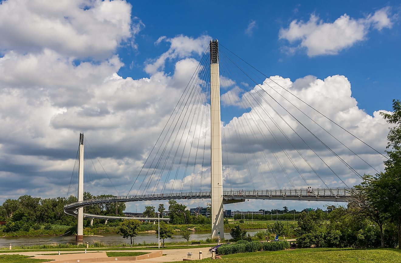
The Bob Kerrey Pedestrian Bridge, frequently called “Bob the Bridge” by locals, stands as a significant feat of modern engineering. Opened in 2008, it is the longest pedestrian bridge linking two states, stretching 3,000 feet across the Missouri River to connect Omaha, Nebraska, and Council Bluffs, Iowa.
Walking “Bob” provides a unique perspective on the region’s history. On the Nebraska side, the entrance sits near the Lewis and Clark National Historic Trail Headquarters, a nod to the Corps of Discovery’s expeditions. At the center of the 3,000-foot span, walkers can stand with one foot in each state. While the bridge offers sweeping views from 60 feet above the water, pedestrians may feel the structure sway during high winds.
Further east, the Big River Crossing provides a different sensory experience. Opened in 2016, this mile-long span connects Memphis, Tennessee, to West Memphis, Arkansas. It holds the distinction of being the longest public pedestrian and cyclist bridge across the Mississippi River. Because the Harahan Iron Bridge—the structure that makes up the crossing—remains a functional piece of infrastructure, Union Pacific Railroad still operates on the upper level. Walkers on the path often hear the horns and heavy vibrations of freight trains passing alongside them.
Historic engineering on the Ohio River
The Ohio River is home to two distinct types of crossings that highlight the evolution of American civil engineering. One is the Purple People Bridge, a 2,670-foot span connecting Cincinnati, Ohio, and Newport, Kentucky. Originally opened in 1872 as the Newport and Cincinnati Bridge, it served as the city’s first railway bridge across the river. After being repurposed as a pedestrian-only walkway in 2003, its steel was painted a bright, distinctive purple.
Not far from the Purple People Bridge sits the John A. Roebling Suspension Bridge. This structure is a National Historic Landmark, designed by the same engineer responsible for the Brooklyn Bridge. When it opened in 1866, it was the longest bridge in the world. Today, it remains a dual-purpose span for both vehicles and pedestrians. Those walking from the Kentucky side toward the Smale Riverfront Park in Ohio can hear a “singing” sound produced by the steel-grate vehicle deck as cars pass overhead.

| Bridge Name | River Crossed | States Connected | Primary Feature |
|---|---|---|---|
| Bob Kerrey Pedestrian Bridge | Missouri River | Nebraska & Iowa | Longest state-to-state pedestrian bridge |
| Big River Crossing | Mississippi River | Tennessee & Arkansas | Longest pedestrian bridge over the Mississippi |
| Purple People Bridge | Ohio River | Ohio & Kentucky | Former railway bridge; pedestrian only |
| John A. Roebling Bridge | Ohio River | Ohio & Kentucky | Historic National Landmark |
Walking the Mike O’Callaghan-Pat Tillman Memorial Bridge
In the West, the Mike O’Callaghan-Pat Tillman Memorial Bridge offers a much more intense environment. Part of the Hoover Dam Bypass project, this bridge sits 890 feet above the Colorado River between Nevada and Arizona. It is the longest single-span concrete arch bridge in the Western Hemisphere. Unlike some other crossings, the pedestrian walkway is only accessible from the Nevada side, meaning walkers can complete a 1.3-mile round trip but cannot exit into Arizona on foot.
The experience here is dictated by the desert climate. Walkers are exposed to the sun and heat of the Black Canyon, and unlike the vehicle portion of the bridge, the pedestrian path is open to the air. About three-quarters of the way across, a marker identifies the border between Clark County, Nevada, and Mohave County, Arizona.

Back in the Midwest, the Meridian Bridge offers a different kind of accessibility. Spanning the Missouri River between Yankton, South Dakota, and Cedar County, Nebraska, this double-deck vertical-lift bridge began construction in 1921. While it opened to traffic in 1924, both the upper and lower levels were opened to pedestrians and bicycles in 2011. Because the state line runs down the middle of the river, a walker can technically stand in Nebraska and South Dakota simultaneously.
These six bridges serve as more than just transit points; they are physical manifestations of how we have historically sought to conquer and connect the natural barriers of the American terrain.
Worth a look

BJ’s Wholesale Club Opens New Frankfort Kentucky Location
Frankfort, Kentucky, is getting a new retail heavyweight. BJ's Wholesale Club announced today that its second location in...

Kansas Boy Witnesses Historic Senate Victory
On Tuesday night, Adam Hamilton defeated incumbent Republican Roger Marshall, becoming the first Democrat elected to the U.S....

Boise State QB Maddux Madsen Questionable for Week 10 vs. Colorado State
Maddux Madsen listed as questionable ahead of Boise State at Colorado State Boise State quarterback Maddux Madsen is...

New England Midterm Election Results: Democrats Secure Sweeping Wins and Senate Gains
New England Democrats Ride National Blue Wave to Senate Gains, Statehouse Wins Democrats in New England are celebrating...