
Historic flooding in southwest Colorado has erased 18 miles of the Colorado Trail near Durango, cutting off the route’s southern terminus and destroying two major footbridges, The Gazette reported.
The damage, described by the Colorado Trail Foundation as the worst in its 52-year history, leaves thru-hikers facing years of detours and the organization confronting a rebuilding effort measured in seasons, not months. Paul Talley, the foundation’s executive director, said the trail “suffered a near total loss in places where it parallels and crosses Junction Creek,” according to a U.S. Forest Service assessment of the nearly 20-mile segment.
“The Colorado Trail Foundation has never experienced an event that damaged this much trail,” Talley told The Gazette. “This is the largest section of trail ever damaged in our 52 years.”
Talley wrote in a November update cited by The Gazette that over the past 52 years, The Colorado Trail has become something bigger than they could have ever dreamed. The CT is more than just a trail; it is a part of the community of Colorado.
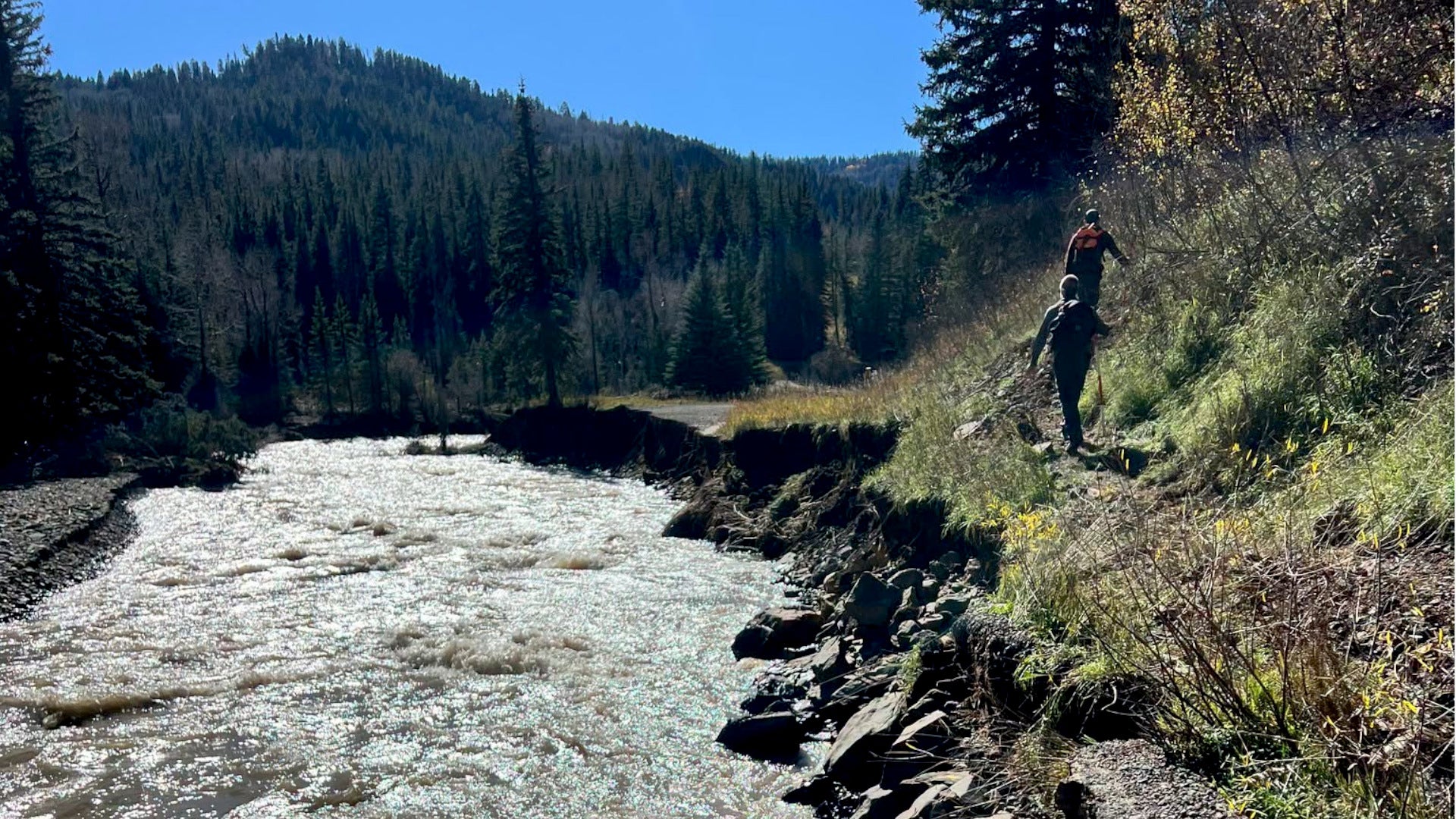
The destruction stems from late October and early November storms that sent the Animas River surging to nearly 13,000 cubic feet per second on Nov. 2 — the third-highest flow on record, behind only 1911 and 1927, according to USGS data analyzed by journalist Jonathan P. Thompson for The Land Desk. Durango City Manager José Madrigal issued an emergency disaster declaration the same day.
The scope of the loss
The Colorado Trail Foundation’s Nov. 5 update reported that at least 2.5 miles of trail from the bottom of the switchbacks below Gudy’s Rest to the southern terminus were carried off by floodwaters, along with most bridges in that stretch.
The Junction Creek trailhead, parking lot, and access roads were also heavily damaged. Backpacker Magazine, updating its coverage on Nov. 11, said that the U.S. Forest Service confirmed the trail has been “largely obliterated” in sections, with the trail bridge gone and portions buried underneath re-routed river flow.
A Facebook report from the Durango Area Trail Conditions page on Nov. 10, cited by Backpacker, added that the Walls Gulch Bridge was destroyed and the trail following Flagler Fork Creek sustained major damage. The Forest Service has warned that recovery work likely will not begin until spring or summer 2027 due to weather and current search-and-rescue demands.
Combined with the Willow Fire near Leadville, which burned over 5 miles of the trail earlier this year, almost 8 miles of the 567-mile route have been severely damaged in a single season, the foundation said. More than 800 people from 48 states and 27 countries completed thru-hikes or thru-bikes in 2026, the foundation said.
A community asset at risk
The Junction Creek area serves as the primary gateway for tens of thousands of day hikers, dog walkers, and section hikers from Durango, not just thru-hikers finishing the journey north. The trailhead sits at the end of Junction Creek Road, which partially collapsed under rushing waters.
Forest Service crews opened a temporary lane to evacuate stranded recreationists and homeowners, but water continues to run across the roadway, eroding the remaining roadbed. Reconstruction of the roadbed could start early next year, the agency said.
Rebuilding the trail itself will take much longer. “It will likely take a significant amount of time, planning, labor and money,” the Forest Service indicated in its report. Talley estimated several years for a full repair and reopening of the 18-mile segment, though he expressed confidence that detours could be established for thru-hikers by next summer.
Preparing for a new normal
The foundation and the Forest Service plan to spend the winter developing a “plan of attack” with local partners and volunteers to determine timelines and budgets.
“The combined damage is unprecedented for the past 52 years, but unfortunately I think it may be more common in the next 52 years,” Talley told The Gazette. “These climate events are becoming more disastrous, and as an organization, we’ve been preparing for several years now for how we will respond to large climate events.”
For now, the foundation is urging hikers to keep planning 2027 trips and to monitor updates at coloradotrail.org. The terminus sign that once welcomed finishers at Junction Creek now stands at the edge of a deep wash filled with flood debris — a marker not of an endpoint, but of a rupture.
Worth a look
- Escaped Inmate’s Stolen Truck Found; Ziegler at Large, WAFB Says
- Louisville Metro Council Opens 4th Annual Food Donation Drive
- Ukraine releases video of damage to Kerch Strait bridge after drone attack (newsarchyuk.com)
- No. 11 Michigan Wrestling Heads to Rider and Northern Colorado Following Back-to-Back Shutouts (world-today-news.com)

Escaped Inmate’s Stolen Truck Found; Ziegler at Large, WAFB Says
James Ziegler, 55, escaped the West Baton Rouge Detention Center on Monday afternoon in a stolen 2012 white...

Louisville Metro Council Opens 4th Annual Food Donation Drive
Louisville Metro Council opened its 4th Annual Food Donation Drive with drop-off sites in every council district. "This...

Idaho Steelheads Return Home for Maine Series After 5-Point Wichita Road Trip
Idaho Steelheads hockey returns to Boise this week after the club squeezed five of six points from a...
US Army Detonating 5 Tons Unstable Lead Azide in Iowa; Toxic Dust Plume May Reach 100 Miles
The U.S. Army will detonate nearly five tons of unstable lead azide Friday at the Iowa Army Ammunition...