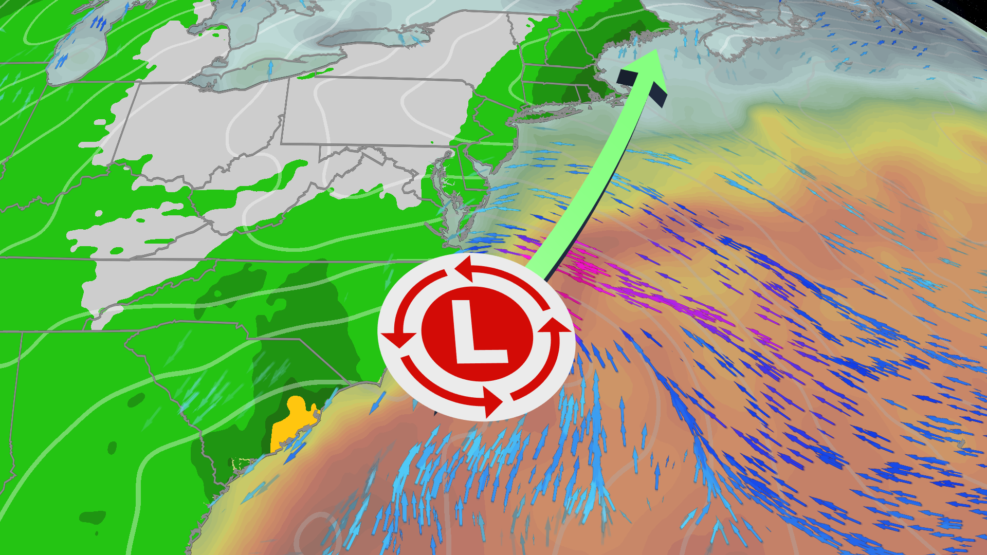
A storm system that dumped record rainfall across Florida’s Atlantic coast this week is tracking northward along the I-95 corridor, threatening to snarl one of the busiest holiday travel weekends of the year with soaking rain, gusty winds and coastal flooding from the Carolinas to New England.
The low-pressure center, which the National Hurricane Center gave only a 10 percent chance of becoming Subtropical Storm Kyle on Saturday, will accelerate overnight into Sunday, spreading heavy rain into the Mid-Atlantic by morning and across New England by evening, the National Weather Service forecast.
“Although the chances of tropical development continue to decrease, this large weather system is still expected to produce gusty winds, dangerous surf, rip currents, and coastal flooding along portions of the Southeast and mid-Atlantic U.S. coasts into early next week,” the hurricane center said in its Saturday advisory.

“One area of low pressure formed along the northeast coast of Florida on Friday,” said Brett Anderson, senior meteorologist at AccuWeather. “The storm will continue to produce heavy rain into part of South Carolina through Saturday night.”
Florida’s Space Coast still underwater
Before turning north, the system obliterated rainfall records across the eastern Florida Peninsula. Melbourne recorded 22.59 inches through November 19 — its wettest single month since records began in 1937 and nearly 13 inches above the previous November record set in 1963, The Weather Channel reported. Fort Lauderdale, Vero Beach and West Palm Beach also smashed their wettest November marks.
The St. Johns River, swollen by an early November deluge, crested above its October 1953 record flood stage west of Cocoa Beach, swamping neighborhoods and prompting evacuations and water rescues. Even with the rain ended, water levels on the northern St. Johns will continue rising for days; forecasters say it could take months for the river to fall below flood stage even if no more rain falls.
Weekend timeline: Saturday soaking to Sunday travel snarls
Rain and wind were ongoing Saturday morning across Georgia and South Carolina with widespread gusts around 20 mph and some closer to 40 mph along the coast, CNN reported. Conditions will expand north through the day, reaching North Carolina by afternoon and causing airport delays and road flooding from Jacksonville to southern North Carolina.
The storm’s quick forward speed should limit total rainfall in the Northeast — generally 1 to 4 inches — but rainfall rates of 1 to 2 inches per hour are possible, overwhelming storm drains and triggering flash urban flooding, AccuWeather warned. Its Local StormMax for the southern Atlantic Coast is 20 inches.
Travel conditions in the Mid-Atlantic deteriorate Sunday. Rain could reach Washington, D.C. airports by morning with no letup through the afternoon, while Philadelphia and New York airports should avoid most issues until afternoon, when rain and gusty winds worsen.
Interstate 95 from Virginia to New York City faces plenty of slowdowns. Rain spreads across New England — Boston, Hartford, Providence — by late Sunday afternoon or evening, exiting early Monday, though gusty winds may linger through the day.
King tides compound coastal flood threat
Compounding the surge risk is the monthly peak of astronomical high tides with the full moon on Tuesday. Any onshore push of water will ride atop this king tide, raising the likelihood of coastal flooding at high tide from the Virginia Tidewater to New England, The Weather Channel noted.
Storm surge of 1 to 2 feet could affect coastal areas from eastern Florida through the Carolinas, including the Outer Banks where Highway 12 — already battered by September and October storms — could see further damage, Yahoo News reported citing AccuWeather.

Thanksgiving week: round two looms
The disruptions may not end with this system. Another storm could impact the East Coast Wednesday into Thanksgiving Day, taking a similar track up the coast and potentially packing a stronger punch, CNN reported. Details remain uncertain, but the setup threatens a very wet and windy Thanksgiving for the Mid-Atlantic and Northeast — including New York City, home of the iconic parade.
On the West Coast, a new storm is set to drop into the Pacific Northwest late Monday into Tuesday, bringing widespread soaking rain and high-elevation snow from western Washington into Northern California, with the San Francisco Bay Area in line for a soaking later Tuesday into Wednesday.
“The timing of this storm could be especially disruptive for people getting an early start on Thanksgiving travel,” said Haley Taylor, expert meteorologist at AccuWeather.
The National Hurricane Center’s next tropical outlook is scheduled for Sunday morning.
Worth a look
ND Hunters Speak for Habitat Loss in 2026, Says Backcountry Hunters & Anglers
North Dakota hunters speak for habitat loss in 2026. Brock Wahl remembers his grandfather's morning coffee overlooking meadowlarks...

Springfield Pulls Away Late From Wayne for Division I Regional Title
Springfield was supposed to roll Wayne again — the Wildcats had won 43-12 in Week 7 — but...
Providence Police Chief Col. Oscar Perez Jr. retires Jan. 4, 2027
Providence Police Chief Col. Oscar Perez Jr. announced Tuesday he will retire Jan. 4, 2027, ending a 32-year...

Army Cadets Change Stadium Sign to ‘GO ARMY’ at Navy Stadium WRAL
Security cameras caught uniformed Army cadets inside Navy-Marine Corps Memorial Stadium between 1 and 4 a.m. Saturday, rearranging...