
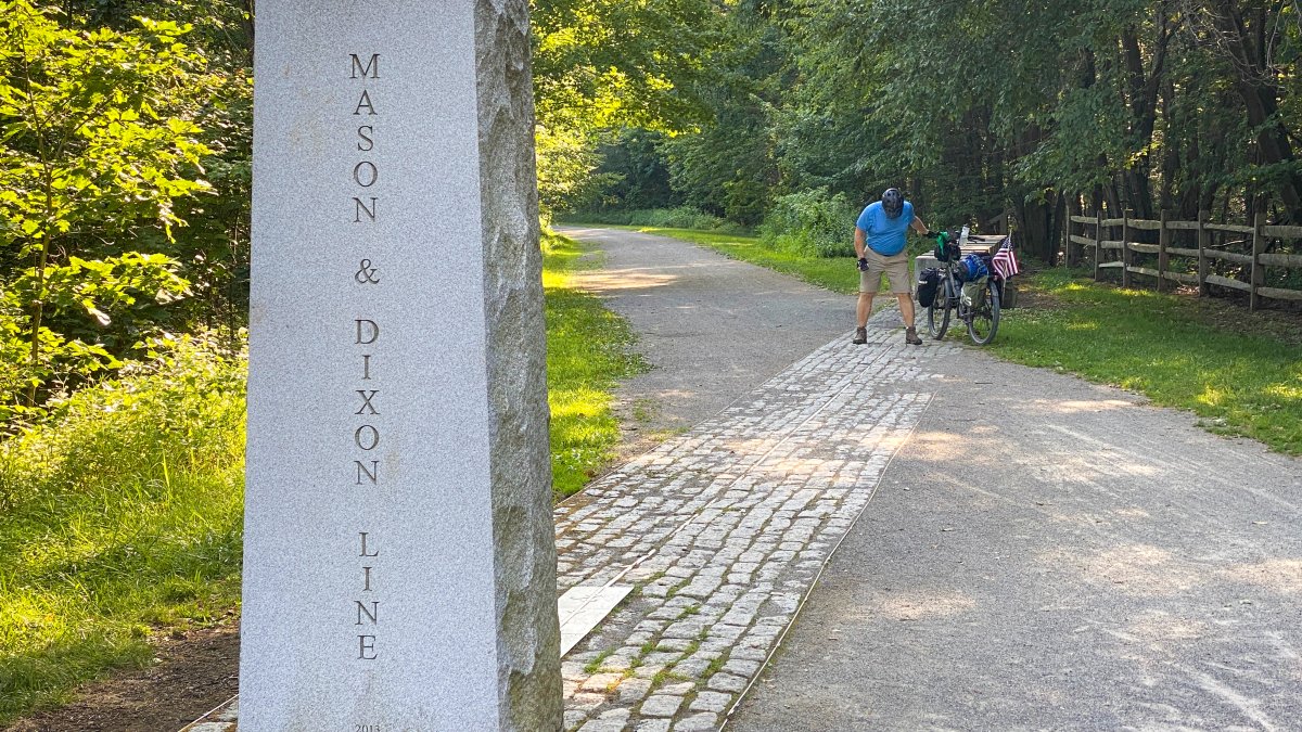
A hand-drawn survey of the Mason-Dixon Line, the document that eventually became the symbolic boundary between the free North and the slave-holding South, is headed to auction this Thursday. The map is expected to fetch between $800,000 and $1.2 million, according to reports from the Associated Press.
The sale, conducted via livestream by Brunk Auctions in Asheville, North Carolina, puts one of the most consequential pieces of American cartography into private hands. While the map is now synonymous with the deep cultural and political fissures that led to the Civil War, its origins were far more mundane: a colonial border dispute between Maryland and Pennsylvania.
A boundary born of a colonial dispute
Charles Mason and Jeremiah Dixon didn’t set out to draw a line of bondage. They were hired to settle a territorial quarrel between the descendants of William Penn and the colony of Maryland. The resulting survey was a technical achievement of its time, rendered on a linen-backed strip of paper measuring 76 inches long and 6.5 inches tall. To preserve it for the modern era, the document has been remounted on Japanese rice paper.
The map’s transformation from a legal boundary to a social one happened decades later. During the 1820 Missouri Compromise, the line was used to establish the limits of slavery in the expanding United States. By the time the Civil War erupted forty years later, the Mason-Dixon Line had ceased to be just a survey of acreage; it had become a shorthand for the fundamental divide of the American soul.
“The Mason-Dixon Line that most Americans know is this dividing line between the northern free states and the southern slaveholding states,” said Lauren Brunk, vice president of Brunk Auctions. “But the line was not drawn for that reason.”
The price of history and the budget gap
The map has a history of commanding record-breaking prices. It remained with the family of attorney Benjamin Chew—who represented William Penn’s descendants—until 1982. In a high-profile clash of interests that year, publisher Malcolm S. Forbes outbid the Library of Congress, purchasing the map for $360,000. At the time, that figure was cited as the highest price ever paid for an American map at auction.
The map changed hands again in 2002, while a separate vertical section depicting the Delaware-Maryland border was housed at Princeton University. In a move toward public preservation, Brunk Auctions contacted the Library of Congress to give them a first look at the map’s return to the market.
According to the Associated Press, Library of Congress officials stated that their current budgets do not allow them to bid on the piece. The institution remains open to the possibility of a “patriot” purchasing the map on their behalf to ensure it returns to a public archive.
The linguistic legacy of Dixon
Beyond the ink and linen, the map carries a linguistic weight. There is a widely held theory that the term “Dixie,” the enduring nickname for the American South, is derived from the name Dixon. However, the auction house notes that the true origin of the term remains a subject of dispute.
The stakes of this auction extend beyond the final hammer price. If no patriot purchases the map on behalf of the Library of Congress, it will go to the winner of the auction.
As Lauren Brunk described the experience of handling the document, she called it “awe-inspiring,” noting that it is rare to get this close to something of such immense historical importance.
Keep reading
PA skill games ban risks VFW closures and 81 employee terminations
Eighty-one employees are facing termination and some Veterans of Foreign Wars (VFW) posts are staring down potential closure...

Akili Smith Jr. Emerges as New Quarterback Option for Oregon Ducks
Oregon Ducks head coach Dan Lanning is considering giving sophomore quarterback Akili Smith Jr. more playing time this...

Thunder face Mavericks tonight with several players listed as out
The Oklahoma City Thunder face the Dallas Mavericks tonight, Wednesday, Oct. 28, 2026, at 8:30 p.m. CT at...

OPA Awarded $2M to Expand Rural Pharmacy Services in Ohio
The Ohio Pharmacists Association (OPA) has secured a $2 million grant from the Ohio Department of Health to...