High Plains drivers zoom past slatted wooden barriers without a second thought, but those structures represent a hard-fought engineering victory against some of the most punishing winter weather in North America.
Along a notoriously hazardous 77-mile corridor of Interstate 80 in southeast Wyoming, snow fences have slashed highway crashes by 75% and kept a vital transcontinental artery open through blinding blizzards.
The story of how this high-altitude stretch became the world’s premier testing ground for wrangling blowing snow is detailed in an archive report from High Country News. In 1944, the federal Public Roads Administration approved a national system of interstate highways. Officials in southeast Wyoming decided to build their portion of Interstate 80 closer to the Medicine Bow Mountains than the existing state road to shave off 19 miles of driving.
Local residents warned against the new alignment. The proposed highway sat almost entirely above 7,000 feet of elevation—making it the highest stretch on the entire transcontinental route—and faced twice as much snow alongside fiercer winds than the alternative path.
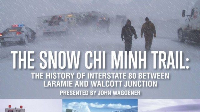
Post-war American engineers believed they could control the environment through sheer technical prowess, according to John R. Waggener, author of Snow Chi Minh Trail: The History of Interstate 80 between Laramie and Walcott Junction.
The new stretch opened on October 3, 1970, with a ribbon-cutting ceremony, a high school band, and a bold promise that the state would keep the road open all the time.
Just four days later, a harsh snowstorm triggered at least five crashes and forced a partial closure. That inaugural winter logged 151 crashes and 208 hours of closures, prompting locals to dub the route the “Snow Chi Minh Trail” in a grim nod to the Vietnam War.
The Winds That Built a Wind-Tunnel
When University of Wyoming scientists investigated why the route was so treacherous, they concluded that Interstate 80 had been paved smack-dab in the middle of a natural wind-tunnel.
In southern Wyoming, the interstate cuts through a high, wind-scooped basin edged by tall peaks at the lowest spot on the Continental Divide. Air pours west to east through the Rockies seeking lower pressure, turning the path of I-80 into a massive atmospheric funnel.
Winds here regularly blow 30 mph and occasionally hit 100 mph, easily knocking over semi-trucks. That relentless wind moves immense volumes of winter snow, occasionally filling highway underpasses and forcing road crews to deploy bulldozers to clear dozens of 16-foot drifts.
To tame the drifting snow, the Wyoming Highway Commission brought in Ronald Tabler, a Forest Service research scientist who embraced severe weather. Kathy Ahlenius, winter research coordinator for the Wyoming Department of Transportation and a trainee of Tabler, recalled his enthusiasm: “The worse the better.” She said he kept a highway department radio in his personal vehicle so he could go out on closed roads.
Tabler and his colleagues applied rigorous scientific experimentation to understand wind-transported snow particles. He calculated that doubling wind speed increases its snow-carrying capacity by 14 times, meaning that cutting wind speed in half reduces snow transport by 94%.
The Engineering Behind the Wyoming Snow Fence
Tabler’s signature design stood 12 to 14 feet tall, tilted at a 15-degree angle downwind, and used wooden slats spaced to achieve 50% porosity. Crews also left a calculated gap between the ground and the first slat equal to 10% to 15% of the fence height, stopping snow from banking up in front and ruining its effectiveness.
By 2006, Tabler and his co-authors documented a 75% reduction in crashes on I-80 segments protected by his fences. Based on winter traffic counts, he estimated the barriers prevented 275 crashes, 124 injuries, and more than three deaths annually, while cutting road closures by about eight days each year.
Interstate 80 traverses 402.76 miles across southern Wyoming, linking the state capital Cheyenne with Evanston, Green River, Rock Springs, Rawlins, and Laramie. Between Evanston and Rock Springs, a segment known as the Three Sisters creates an optical illusion of the road reaching toward the sky.
Today, Wyoming maintains more than 450 miles of snow fencing, including vertical variants of Tabler’s design and living fences made of strategically planted shrubbery. Roughly 50 miles of that fencing lines the old Snow Chi Minh Trail, creating what is likely the densest concentration of snow barriers on earth.
Worth a look

14-Year-Old Dead, Woman Critical in Kensington Shooting; Police Probe Link to Prior Shooting
A 14-year-old boy is dead and a 34-year-old woman is in critical condition following a daylight shooting in...

NYC Carriage Drivers Sue to Halt Ban After Mayor Mamdani Signs Bill
Central Park horse-drawn carriage drivers sued New York City in federal court on Thursday, challenging Mayor Zohran Mamdani...

2026 Tennessee Invitational Day 3: Grimes, Hayes, Heilman Win; North Carolina Sweeps Men’s 50 Free
North Carolina swept the men's 50 free with PJ Foy, Sean Setzer, and Martin Kartavi finishing 1-3, while...

Kulusevski Returns After Year-Long Knee Injury; Finnigan Also Back
Dejan Kulusevski was sidelined by a serious knee injury two weeks before the end of the 2024-25 season,...