
Based on projections from the Center of Economic and Law Studies shared via the Jakarta Globe, acute respiratory infections now threaten roughly 17.4 million residents across 12 Indonesian provinces due to widespread forest and land fires across Indonesia have put an estimated 17.4.
The total includes people diagnosed with respiratory infections in the past month as well as those experiencing symptoms without seeking medical treatment. Health costs linked to diagnosed upper respiratory tract infections are estimated at Rp 19.2 trillion, or $1.1 billion. That figure could climb to Rp 224.65 trillion if individuals experiencing symptoms without a formal medical diagnosis are included.
Smoke pollution from the blazes caused 1,700 deaths in August alone. Driven by a prolonged dry super-El Niño, carbon emissions from the fires approached 200 million tonnes by November 15, making 2026 the third-worst year for fire emissions since 2003, according to the European Union’s Copernicus Atmosphere Monitoring Service, as reported by The Jakarta Post.
Those emissions slightly exceeded levels from 2019, though they remain below the totals recorded in 2006 and the record-breaking 2015 fire season. Senior scientist Mark Parrington noted the persistence of the fires and substantial regional differences across the archipelago.
On the ground, the National Disaster Mitigation Agency recorded 521 active hotspots across various regions as of November 12, with the total affected land area reaching 1,332 hectares, according to Kompas. Acting head of data and disaster communication Berton Panjaitan explained that southern Papua saw a 25 percent decrease in hotspots compared to the previous day, while Southeast Sulawesi recorded a 146 percent increase.
East Kalimantan saw a 5 percent increase, and Central Sulawesi logged a 38 percent rise. To combat the spread, the government deployed 35 aerial units across eight provinces by November 11, utilizing 15 aircraft for patrols and weather modification alongside 20 helicopters for water bombing.
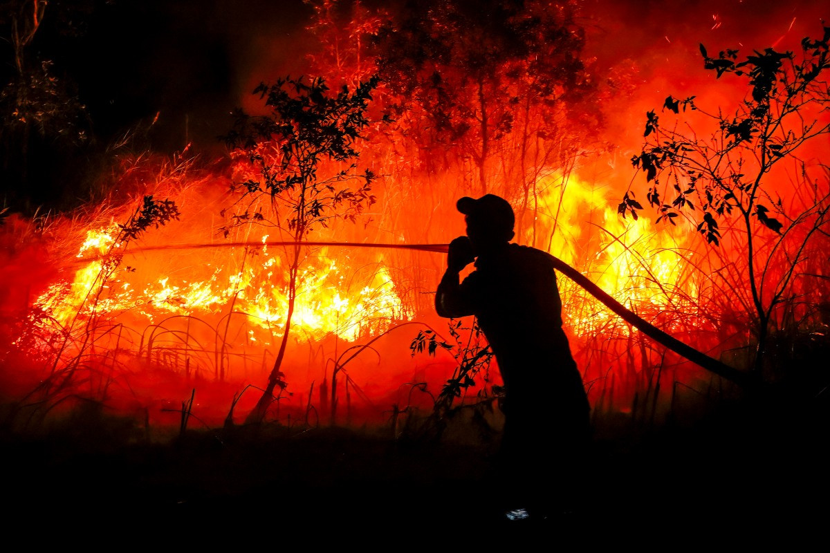
Beyond Kalimantan and Sumatra, the ecological crisis hit Papua hard. Data from the Nusantara Atlas compiled in a report by the Center for Economic and Law Studies showed that land burned in South Papua reached 319,119.68 hectares from January through October, surpassing the 277,127.29 burned hectares recorded in Kalimantan over the same period, as detailed by Dompet Dhuafa.
In Central Papua, the Mimika Regency Health Office recorded 81,355 acute respiratory tract infection cases from the beginning of the year through October 30. The Ministry of Health subsequently recorded 401,586 cumulative cases across seven provinces and 63 districts and cities as of November 2.
Vulnerable groups face severe gaps in protection. Rizky Pontiviana Akbari, chair of the Indonesian Breastfeeding Mothers Association in West Kalimantan, pointed out that pregnant women, breastfeeding mothers, and newborns are not formally recognized as vulnerable populations in disaster response protocols.
“Respiratory infections in West Kalimantan once surged to 1,337 cases in a single day, yet pregnant women, breastfeeding mothers, and newborns have not been designated as vulnerable groups and remain excluded from disaster response protocols. Without smoke-free safe spaces and emergency breastfeeding guidelines, mothers and infants are forced to bear multiple health risks,” said Rizky Pontiviana Akbari, chair of the Indonesian Breastfeeding Mothers Association in West Kalimantan, told the Jakarta Globe.
Social protection policies have also drawn criticism, with Meike Inda Erlina, a campaign officer at Trend Asia, voicing strong objections regarding the discontinuation of PBI premium subsidies provided by BPJS Health for between 11 million and 13.5 million beneficiaries.

“Social protection must not merely be a reactive, charitable ‘remedy’ applied after the forests have burned. True social protection must be transformative—beginning with recognizing the sovereignty of indigenous territories, ensuring law enforcement, and taxing polluting corporations (‘tax the polluter’) as well as oligarchs (‘tax the rich’) to fund ecological restoration,” Meike Inda Erlina, Trend Asia campaign officer, told the Jakarta Globe.
National Disaster Mitigation Agency (BNPB) head Kristomei Sianturi launched a satellite-based monitoring system integrated with land concession maps four days after his appointment in November 2026. Operated by the Directorate of Operations Control, the platform combines satellite imagery with concession data from the Ministry of Agrarian Affairs and Spatial Planning to identify landowners, burned areas, and hotspot patterns in real time, distinguishing community forests from industrial plantations and mining zones.
Color-coded indicators track fire progression, and recurring hotspot clusters along concession boundaries have been flagged for suspected land clearing by burning. Data is shared with regional administrations, ministries, and law enforcement to support permit evaluations and legal action. Beyond fires, the system maps flood risks and provides early warnings in areas including South Papua and South Tapanuli District, reflecting a shift toward prevention and early mitigation.
CERAH advocacy and outreach coordinator Dzatmiati Sari added that current financial relief and healthcare assistance remain reactive measures deployed only after disasters strike.
Related reading

12 High-Fiber Fall Casseroles for Weight Loss
Fall produce inspires a new collection of lower-calorie dishes designed to support healthy weight loss goals. EatingWell released...

Clondalkin Man Jailed for Three Years After Savage Assault on Neighbour
A 46-year-old man who subjected his neighbour to a savage assault by punching him and hitting him with...

Andy Doig Supports Men Being Group for Movember Campaign
In a column for the Renfrewshire Gazette, Renfrewshire councillor Andy Doig announced that he has put his razor...

Isabela City Opens Southeast Asia’s First Over-Water Museum, Museo Pantán
Set over coastal waters at Fuego-Fuego Beachfront in Barangay Tabiawan, Isabela City opened Museo Pantan to the public...