
Status Yellow rain warnings will take effect for Cork, Kerry and Waterford on Saturday night as Met Éireann forecasts a “changeable and unsettled” week ahead.
The national forecaster said low pressure has brought cool and damp conditions, with heavy rain expected to bring difficult travelling conditions, localised flooding and possible disruption to outdoor events.
The warnings for Cork and Kerry run from 10pm on Saturday until 8am on Sunday, while a separate alert for Waterford is valid from midnight until noon on Sunday, Met Éireann said. “It will be breezy at times with spells of rain, turning heavy and persistent at times. Temperatures will be around normal for the time of year,” the forecaster added.
Saturday will be mainly dry in the east and north with bright or sunny spells, though rain and drizzle will develop in the southwest during the afternoon and become persistent in the evening. Highest temperatures will range from 7 to 12 degrees. Overnight, rain will spread northeastwards to cover the whole country before easing, with lowest temperatures of 2 to 7 degrees.
⚠️Yellow Rain warning for Cork, Kerry ⏲️Valid: 22:00 Sat 21/11/26 to 08:00 Sun 22/11/26 ⚠️Yellow Rain warning for Waterford ⏲️Valid: 00:00 Sun 22/11/26 to 12:00 Sun 22/11/26 ❗️Potential impacts: Difficult travelling conditions Localised flooding possible Outdoor events impacted pic.twitter.com/WL8TFRKZic
Sunday will be mostly cloudy and windy with outbreaks of rain over the southern half of the country and in west Connacht, while further north stays mainly dry. Highest temperatures of 7 to 10 degrees are expected with gusty easterly winds, strongest near coasts. Sunday night will remain cloudy in parts of the south and west with scattered light rain and drizzle, and temperatures of 3 to 8 degrees.
Monday will stay dry at first before cloud from the Atlantic brings rain eastwards, with daytime highs of 8 to 12 degrees and evening lows of 4 to 8 degrees. Tuesday morning will be rainy before showers clear eastwards and bright spells arrive from the west, with afternoon temperatures of 8 to 12 degrees and a cooler evening at 1 to 5 degrees.
Wednesday is forecast to be cloudy with rain likely on the east coast but mainly dry elsewhere, with sunny intervals and temperatures of 5 to 8 degrees. Thursday should be mostly dry with a chance of rain spreading from the Atlantic later, and highs of 5 to 9 degrees. Friday and the weekend are predicted to remain changeable with wet and breezy conditions nationwide.
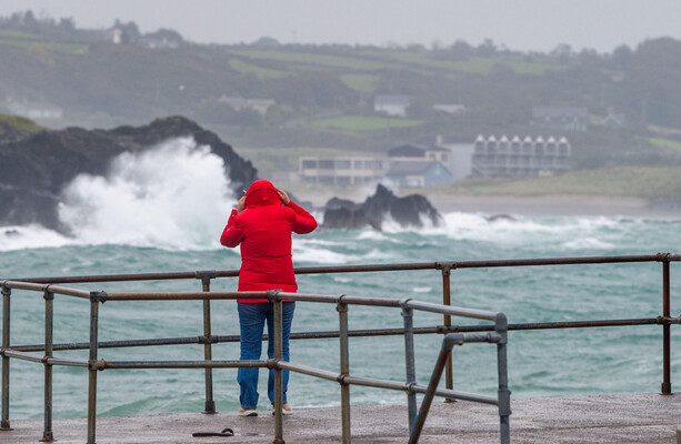
Met Éireann has warned it will “become more unsettled through the weekend and into next week,” adding that “it will be breezy at times with spells of rain, turning heavy and persistent at times.”
Highest temperatures are forecast to be between 8 and 11 degrees, according to Met Éireann.
Mostly cloudy☁️ & windy today, with outbreaks of rain & drizzle, mainly affecting the southern half of the country & parts of Connacht🌧️. Largely dry elsewhere with some sunny breaks, mainly in Ulster⛅️. Highs🌡️ of 7 to 11°C in fresh, gusty easterly winds, strong near coasts🍃. pic.twitter.com/286VEhhcWF
Sunday will be mostly cloudy & quite windy, with outbreaks of rain over the southern half of the country & in west Connacht 🌦️ 🍃 Status Yellow Rain warning for Cork, Kerry & Waterford ⚠️ https://t.co/daaKPKyROX It will be mainly dry further north ☁️ Highs of 7 to 11°C 🌡️ pic.twitter.com/4ByXEMs6wT
Worth a look

Scientists Discover Rare Genetic Eye Disease Causing Night Vision Loss
Scientists identified a rare genetic eye disease that causes progressive vision loss by interfering with night vision and...

NUPL Criticizes Marcos Remark on Pax Silica Protests Citing Government Actions
The National Union of Peoples’ Lawyers (NUPL) criticized President Ferdinand Marcos Jr.’s remark that there is no deal...

Indian and Chinese Commanders Meet to Cool Border Tensions in Arunachal Pradesh
Indian and Chinese commanders met to cool border tensions in Arunachal Pradesh, aiming to set out clear engagement...

Multiple Myeloma Has Highest 1-Year Heart Attack Risk After Cancer Diagnosis, Danish Study Finds
Patients with multiple myeloma face the highest relative risk of a heart attack within one year of a...