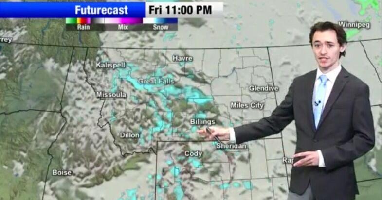
A storm system arriving Friday promises the first measurable snow of the season for many Montana valleys, even as mountain passes brace for half a foot of accumulation through Saturday.
The National Weather Service has hoisted a Winter Weather Advisory for the Beartooth and Red Lodge foothills from 11 a.m. Friday until 11 a.m. Saturday, warning of reduced visibility and snow-covered roads, NonStop Local Montana reported.
Forecasters say lower elevations southwest of a line from Alzada to Melstone hold a 25% to 80% chance of seeing at least an inch, with Red Lodge positioned for one to four inches and locally higher amounts.
“Developing low pressure to the southeast will favor north to northeast winds across the region, potentially enhancing snowfall along the foothills through upslope flow,” Q2 Meteorologist Aden Lieser told KTVQ. “Most areas have a chance of receiving accumulating snow, and Billings could potentially see its first one-inch snowfall of the season.”
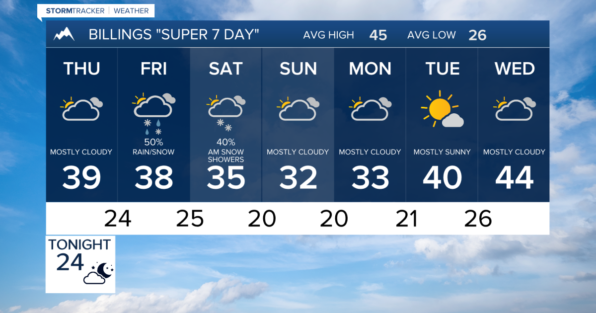
Western Montana faces a sharper threat. Areas along and east of U.S. Highway 93 carry a 60% to 90% chance of accumulating at least a tenth of an inch through Saturday morning, according to the Weather Service. Travelers crossing Marias and Homestake passes along the Continental Divide should prepare for winter driving conditions, with snowfall capable of obscuring mountain terrain.
The highest peaks of the Absaroka, Beartooth, Crazy and Bighorn ranges could collect up to six inches by Saturday morning. That contrast — a dusting for the plains, a half-foot for the high country — defines the weekend’s split personality. Q2’s forecast notes limited moisture will keep overall totals modest, but the cold air is entrenched: highs stall in the 30s through Monday before finally moderating into the 40s by midweek.
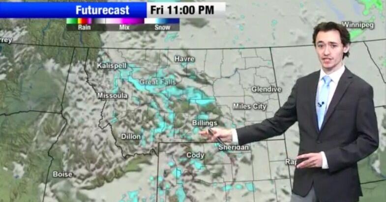
Overnight lows will dip into the teens and lower 20s, a sharp bite for mid-November. Patchy fog greeted drivers Thursday and Friday mornings in river valleys east of Billings, particularly near Miles City, briefly dropping visibility for the commute.
The Absaroka Range stretches roughly 150 miles north-south along the Montana–Wyoming border, forming the eastern boundary of Yellowstone National Park and the Paradise Valley. Its name comes from the Hidatsa word for the Crow people, meaning “children of the large-beaked bird.”
John Colter likely traveled along the foot of these mountains in 1807 during his reconnaissance of the Yellowstone region, and the range’s volcanic origins date to the Eocene Epoch, between 53 and 43.7 million years ago. The eroded remnants of ancient stratovolcanoes here helped establish many terms still used in volcanology today.
The main low pulls away Saturday evening, but an upper-level disturbance lingering over the state will keep scattered snow showers in the forecast Sunday, adding a trace to an inch in spots.
KTVQ cautions that confidence in the timing and impacts of individual systems remains low heading toward Thanksgiving week, though the overall pattern stays active. For now, the message is straightforward: the season’s first real winter driving test has arrived.
Worth a look
Charleston ReLeaf Initiative to Plant 118 Trees in Westside Neighborhood With 19% Canopy Coverage
Charleston's Westside carries just 19 percent street-tree cover against a 43 percent benchmark, and on Dec. 5 the...

Louisiana Truckers Seek Insurance and Lawsuit Reforms Amid Staged-Crash Cases
The sentencing punctuates a sprawling federal investigation into collisions staged with tractor-trailers to generate fraudulent insurance claims and...

Dr. Cristina García Cáceres Shows Aligners and Skeletal Anchorage Can Replace Jaw Surgery in More Adult Cases
In a Madrid clinic founded by her father, Dr. Cristina García Cáceres is rewriting the playbook for severe...

Penn Women’s Basketball Travels to Maine Before Palestra Hofstra Doubleheader
Penn women's basketball, sitting at 5-1 after snapping a five-year skid against Saint Joseph's, travels to face Maine...