Enjoy the sunshine this afternoon — highs will climb into the upper 50s and lower 60s across Greater Boston — because a coastal storm is set to unload up to three inches of rain and gusty winds starting Sunday night, NBC Boston reported.
Saturday is the “pick of the weekend” with mostly sunny to partly cloudy skies, according to the station’s First Alert weather team. Temperatures will drop to the mid-40s tonight under mostly cloudy conditions.
Big changes arrive Sunday as an area of low pressure tracks from the Mid-Atlantic coast toward southern New England. Widespread rain and gusty winds prompt First Alerts for Sunday evening and Monday. Periods of rain will move into Greater Boston starting late Sunday evening, with the heaviest rain tracking over the area Sunday night before tapering off through Monday morning.
Most communities could see up to two inches of rain, though a few isolated spots could see up to three inches. While major flooding is not expected, localized flooding could develop on roads.
Wind gusts could climb to 30 mph or higher, especially along the coast. The strong winds combined with an astronomical high tide could produce minor coastal flooding and splash-over in flood-prone areas. High tide at Boston Harbor is at 9:09 p.m. Sunday and 9:22 a.m. Monday.
Rain showers will diminish by Monday afternoon as a cold front swings through, ushering in drier but colder weather for Tuesday. Highs on Tuesday will reach the mid-40s, and by Wednesday highs will only reach the lower 40s.
The Greater Boston region has historical significance dating back to the founding of the first colony in New England in 1620. Furthermore, the late 18th century saw Boston become known as the “Cradle of Liberty” for agitation leading to the American Revolution.
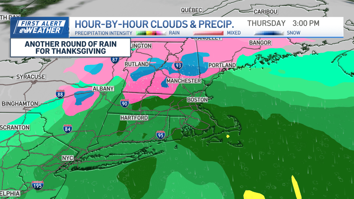
Another coastal storm could move into the region by Thanksgiving Day, potentially bringing another round of rainy, windy weather to Boston and a mix of rain and snow to parts of northern New England.
Worth a look

Southern Nazarene Loses 0-21 to Southwestern Okla
Southern Nazarene took a decisive 0-7 loss to Southwestern Okla. on Saturday following the game's conclusion. The contest...

Groups Petition Idaho Fish and Game to Ban Killing Wolf Pups
Conservationists and a lifelong hunter delivered a petition to the Idaho Fish and Game Commission on Tuesday demanding...

KU Health System names John Worden St. Francis Campus CEO
John Worden will take over as chief executive of the University of Kansas Health System's St. Francis Campus...

White House Seeks to Limit Information Contractors Should Share With Congress
Democrats won the midterms expecting a flood of subpoenas; instead, the White House built a wall around the...