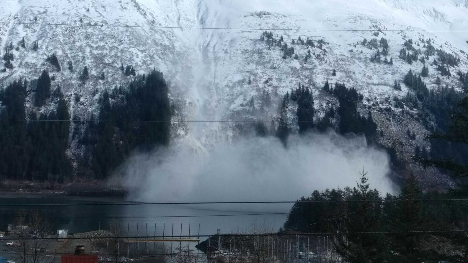
“Alaska’s roads traverse some of the most active and least monitored avalanche terrain in North America,” Gabriel Wolken said.
Researchers at the University of Alaska Fairbanks have mapped snow avalanche risk across Alaska’s entire road network, creating a statewide baseline for understanding the danger as climate change shifts temperature and precipitation patterns. The Alaska Department of Transportation and Public Facilities had previously mapped nearly 300 avalanche paths across the state’s highway system. But Wolken said hundreds more miles of public roads could be hit by avalanches.
The stakes are concrete. Sixty-two percent of the threatened road segments the model identified exceed the three-kilopascal threshold for human safety, and roughly 38 percent surpass the 30-kilopascal mark where structures start to fail. Those pressures are not abstract: the 2014 “Damalanche” on the Richardson Highway near Valdez buried a half-mile of road under 100 feet of snow, blocked the Lowe River, and cut the town off for 12 days.
Southeast Alaska dominates the risk profile. The Haines Highway, the Eagle River road network, and Juneau’s Thane Road — where state-contracted helicopters routinely trigger slides over the pavement — see frequent, high-pressure events.
Southcentral corridors like the Klondike and Seward highways face less frequent slides, but the rare 300-year events there can be massive. Wolken presented the findings at the International Snow Science Workshop in Whistler this fall; the study has not yet been peer-reviewed.
“There are people that could assume that those impact pressures are uniform throughout a certain area of avalanche path, and they’re not. They’re specific to what you construct.”
David Hamre, retired Alaska Railroad avalanche program manager
David Hamre, who spent nearly 40 years running the railroad’s avalanche program and helped build the 2023 Avalanche Hazard Index for state highways, warned that engineers could misuse the generalized pressure values. He also flagged a known path at milepost 3 on the Copper River Highway that the model missed.
Wolken acknowledged the gap, attributing it to a display issue on the project’s public map viewer and emphasizing that the tool is a broad, automated screening layer meant to be refined by local knowledge.
Hank Statscewich, president of the Alaska Avalanche Information Center, called the study a valuable baseline and said the next question is how shifting rain-snow lines will rewrite the map. Wolken expects the answer to vary by elevation and coastal influence — more snow and more slides in some bands, more rain and more landslides in others.
From the Department of Transportation’s perspective, the risk equation is simpler: traffic. Tim Glassett, the statewide avalanche and artillery program manager, said state projections show Alaska’s population declining over the next 15 years, which means fewer vehicles in avalanche zones and, by his calculation, stable or falling exposure regardless of climate trends.
Keep reading
- Cook Out Lists Two GM Roles in Frankfort, KY With Differing Pay, Schedules
- 120+ Moloka’i Youth Attend County Baseball Clinic with Four Former MLB Players
- Cameron Bancroft claims entire Australian team knew about Sandpapergate plot (newsarchyuk.com)
- Cameron Bancroft Claims Entire Australian Team Knew of 2018 Sandpaper Plot and Slams Pat Cummins (world-today-news.com)

Cook Out Lists Two GM Roles in Frankfort, KY With Differing Pay, Schedules
Cook Out is hiring a General Manager for its Frankfort, Kentucky location with a salary range of $75,000...

120+ Moloka’i Youth Attend County Baseball Clinic with Four Former MLB Players
More than 120 Moloka‘i youth converged on “Duke” Maliu Regional Park from Nov. 13 to 15 for the...
Klein: “Definitely a Possibility” Avery Johnson Returns for Fifth Season in 2027
Kansas State coach Collin Klein said Wednesday he expects "a lot of discussions" in the coming weeks about...
Army to Detonate 68 Drums of Lead Azide in Iowa, Plume May Reach 100 Miles
The U.S. Army will intentionally detonate 68 drums of deteriorated lead azide at noon Friday at the Iowa...