
New England’s fourth coastal storm of the season arrives Sunday night with a soaking rain and wind gusts to 60 mph on Cape Cod, then clears by Monday lunch — a narrow window that still threatens the Monday morning commute and the opening moves of Thanksgiving travel.
The Boston Globe reported the system will race up the East Coast, reaching Southern New England after 3 p.m. Sunday and spreading heavy rain into Boston between 7 and 10 p.m. The heaviest bands lift north overnight, tapering to scattered showers by late Monday morning, with a dry, breezy afternoon to follow.
Widespread rainfall of one to two inches is likely across Southern New England, with isolated pockets of three inches possible from eastern Connecticut through Rhode Island, central Massachusetts and the Maine coast, according to the Globe’s forecast maps. The Berkshires should see slightly less. Boston proper is pegged for one to one and a half inches.
Wind is the sharper hazard near the water. Gusts of 40 to 55 mph are forecast for southeastern Massachusetts, the Cape and Islands, and the South Coast, with the Globe’s model guidance showing a peak of 50 to 60 mph on the outer Cape late Sunday into Monday. Inland, including Greater Boston, peaks drop to 25 to 40 mph.
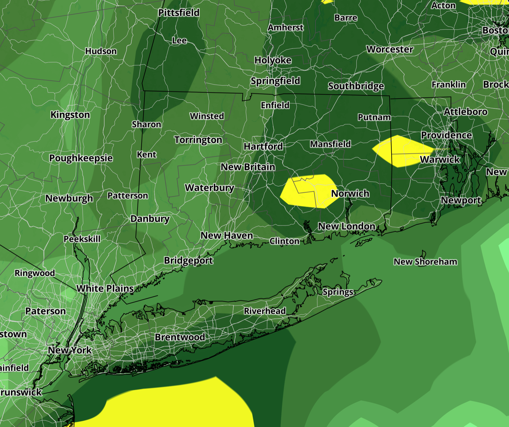
The Hour and CT Insider, drawing on the same National Weather Service guidance, narrowed the highest rainfall risk to Connecticut, where one to three inches could fall with the heaviest downpours Sunday night. A slower or more westward track would push totals higher; a faster, more offshore jog would cut them. As of Saturday afternoon, the higher-end scenario was trending less likely.
Coastal Connecticut faces gusts of 25 to 35 mph, with a chance of 30 to 40 mph if the low hugs the coast. Inland areas stay lower. Temperatures will sit in the 50s — more than 20 degrees above the normal late-November low — keeping precipitation entirely rain.
Forecast confidence rests on the storm’s exact track. The European model takes the low directly over New England after brushing the Mid-Atlantic. The GFS-AI run shows a similar path but with a deeper, more intense low.
The Euro-AI variant nudges the center slightly east, bringing the rain shield in earlier Sunday evening but still exiting Monday morning. All three agree on the narrow duration: in and out in roughly twelve hours.
Moisture transport is robust. Precipitable water values — a measure of atmospheric juice — are running well above normal for late November, which explains the high rainfall rates in such a fast mover.
With rain falling in a compressed window, the Globe emphasized ponding on roadways and scattered poor-drainage flooding rather than river flooding. The Monday morning commute is the primary vulnerability: standing water on highway ramps and low-lying streets before the heaviest rain ends.
Coastal flooding risk remains minor. Astronomical tides are not running especially high, and the storm’s quick passage limits the duration of onshore flow. Still, splash-over is possible on the most exposed east-facing roads at high tide Sunday night.
The storm’s exit by late Monday morning buys a 36-hour window before the next system — a potential Wednesday-into-Thanksgiving rain maker — arrives.
If the low slows or deepens beyond current guidance, the Monday morning clearance tightens. The next 24 hours of model runs will determine whether the buffer holds.
“The higher-end scenario is looking a bit less likely, as of this afternoon,” the Hour and CT Insider noted in identical forecast discussions, reflecting the consensus shift toward a quicker, slightly less intense solution.
Worth a look

National Weather Service in Topeka Issued Zone Forecast for Cold Front Saturday
A fast-moving cold front will sweep across northeast Kansas Saturday, dropping temperatures nearly 30 degrees and bringing a...

Sam Houston Picked up First Road Win Over Boise State at ExtraMile Arena
Sam Houston picked up its first road win of the season with a convincing 83-69 victory over Boise...

Waltner: Resist the ‘Spirit of Party’ for the Common Good – Mitchell Daily Republic
South Dakota shows red dominance on November 3, 2026. The state remained bright red on November 3, 2026,...

Racing Louisville Departure Signals Systemic Underinvestment in Women’s Sports, Says Opinion Piece
Racing Louisville's departure signals more than just a team moving; it points toward systemic underinvestment in women's sports,...