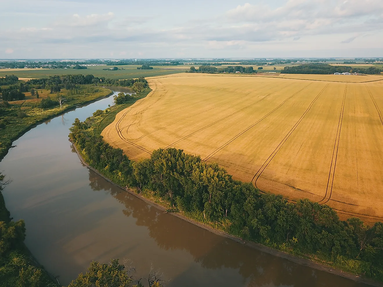
The Red River of the North flows north because its entire valley sits on the flat floor of glacial Lake Agassiz, which tilted toward Hudson Bay as the heavy ice sheet melted and the land beneath it rebounded. That ancient lakebed, a subtle slope of about one foot per mile, carries water from the Minnesota–North Dakota border through Winnipeg and into Lake Winnipeg.
The river’s odd compass bearing starts at a nearly invisible divide in Browns Valley, Minnesota. There, a rise of only ten feet separates water bound for Hudson Bay from water headed to the Gulf of Mexico.
Lake Traverse, on the north side of that bump, drains into the Bois de Sioux River, which meets the Otter Tail at Wahpeton to form the Red River. Big Stone Lake, just south of the divide, sends its water the other way, down the Minnesota River.
Why does the river run north instead of south?
About 13,000 years ago, the Laurentide ice sheet dammed meltwater into Glacial Lake Agassiz, a basin larger than all the modern Great Lakes combined. The ice blocked any northern exit, so the lake spilled south over the Big Stone Moraine, carving the Traverse Gap with a torrent called Glacial River Warren.
The Minnesota River now trickles through that oversized channel. Once the ice retreated far enough north, Lake Agassiz found a lower outlet toward Hudson Bay, dropped below the gap, and the southern spillway went dry. The continental divide now crosses the flat floor of that abandoned channel, so a ten-foot rise is all it takes to tip water north.

How flat is the valley floor?
From Breckenridge to the Canadian border — about 200 miles as the crow flies — the valley drops roughly one foot per mile. The river needs nearly 400 miles of meandering to cover that distance. The National Weather Service describes the Red’s flow as slow because the grade is so gentle, and the U.S. Geological Survey notes the low slope encourages water to spread overland rather than stay in the channel.
“The warmest temperatures and the first runoff begin at the southern, upstream end of the basin, and that meltwater heads north toward a channel that can still be frozen.”
What does that mean for flooding?
Spring melt starts in the south and pushes north into ice that has not yet broken up. Ice jams act like dams, backing water up over the flat plain. In April 1997, the river at Grand Forks crested at 54.35 feet, more than five feet above the previous record, forcing the evacuation of ninety percent of the city.
That same spring, water spread across more than 700 square miles of southern Manitoba, an expanse nicknamed the Red Sea. Winnipeg now routes floodwater around the city through the 29-mile Red River Floodway, built in the 1960s. Fargo is completing a 30-mile diversion channel of its own, scheduled for 2027.
Is the land still moving?
The crust is still rebounding from the weight of the ice sheet, which was up to two miles thick and depressed the ground by as much as 1,300 feet around Hudson Bay. The valley floor rises one to four millimeters a year — up to about an inch and a half per decade — while the Hudson Bay region rises roughly two feet per century.
Ancient Lake Agassiz shorelines reveal the tilt: the Campbell beach’s northern end now stands more than 490 feet above its southern end because the terrain farther north was depressed more and has rebounded more since the ice melted. That ongoing uplift gradually reduces the river’s already slight gradient.
Where does the water end up?
The Red empties into the south basin of Lake Winnipeg, one of the last remnants of Lake Agassiz, which covers about 9,200 square miles. From there the Nelson River carries the flow to sea level at Hudson Bay. The valley the river drains is the former Agassiz lakebed, today farmland planted in sugar beets, potatoes, corn, and wheat.
Runoff from those fields and valley towns carries nutrients north; about half of the phosphorus in Lake Winnipeg comes from the Red, and concentrations run nearly three times higher in the south basin than in the north. Algal blooms fed by that phosphorus have covered hundreds of square miles of the lake.
Worth a look

Cheyenne Parent Charity Campfield Seeks Wyoming Bill for Post-Suicide School Support
Cheyenne parent Charity Campfield is asking Wyoming lawmakers to introduce a new suicide-prevention bill after her daughter died...

18 Track Titles Awarded; Brunner Wins 5th Cyclocross Race
Eighteen Stars and Stripes jerseys changed hands at Detroit's Mad Track Arena this week as the Madison Track...

St. Albans Tree Contest Uses Canned Votes for Christ’s Kitchen Pantry
St. Albans is banking on holiday generosity again this year, with the annual Christmas tree decorating contest set...
$34M Seattle Public Utilities Land Deal Threatens Three North Seattle Businesses
A $34 million land deal on Aurora Avenue could shut down three North Seattle businesses that have operated...