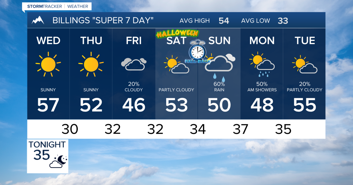
Billings and the surrounding region will see a window of quiet, seasonable weather from Wednesday through Friday before a more unsettled pattern returns this weekend. According to KTVQ, the region can expect mainly dry conditions and lighter winds Wednesday, with highs reaching the upper 50s in Billings, Miles City, and Sheridan, and potentially hitting the lower 60s around Hardin.
This brief stabilization comes as a reprieve for residents and local businesses in southeast Montana and northern Wyoming.
Dry conditions hold through Friday
The shift begins Tuesday night as winds gradually ease, leading to overnight clearing with lows dipping into the 20s and 30s. Wednesday is expected to be the quietest day of the stretch, characterized by mainly dry conditions and temperatures that remain consistent with the season.
Thursday follows a similar pattern under a ridge of high pressure. While some breezy conditions may return occasionally, no significant wind event is forecasted. Temperatures will generally hover in the 50s, though southeast Montana and northern Wyoming may see highs reach the upper 50s.
By Friday, the window begins to close. While the day remains mostly dry and seasonable, clouds will increase as a new disturbance approaches. Precipitation is expected to return to portions of western and south-central Montana later in the day, with highs ranging from the upper 40s to the middle 50s.
Uncertainty looms for the weekend
The weather pattern turns unsettled starting this weekend and potentially extending into Monday. A low-pressure system is expected to develop over the Rockies, bringing an increased chance of rain and mountain snow.
However, the exact impact of this system remains unclear. Because there is considerable uncertainty regarding the track of the low-pressure system, the precise timing and amount of precipitation will not be confirmed for several more days.
Worth a look
88th Annual Nevada Day Parade: Schedule, Events, and Parking Guide
The 88th Nevada Day Parade arrives in Carson City this Saturday, Oct. 31, bringing a rare collision of...

University of Nebraska convenes committee to search for UNL chancellor
The University of Nebraska has convened a 30-member advisory committee to lead the search for the next permanent...

Montana PSC Delays Decision on NorthWestern Energy and Black Hills Energy Merger
“I think the intent here is just full transparency,” said Montana Public Service Commission Vice President Jennifer Fielder...

Garth Brooks Cancels Kansas City Show After Ticket Bots Overwhelm Sale
Garth Brooks has canceled a newly added Saturday matinee performance at Kansas City's T-Mobile Center after ticket-buying bots...