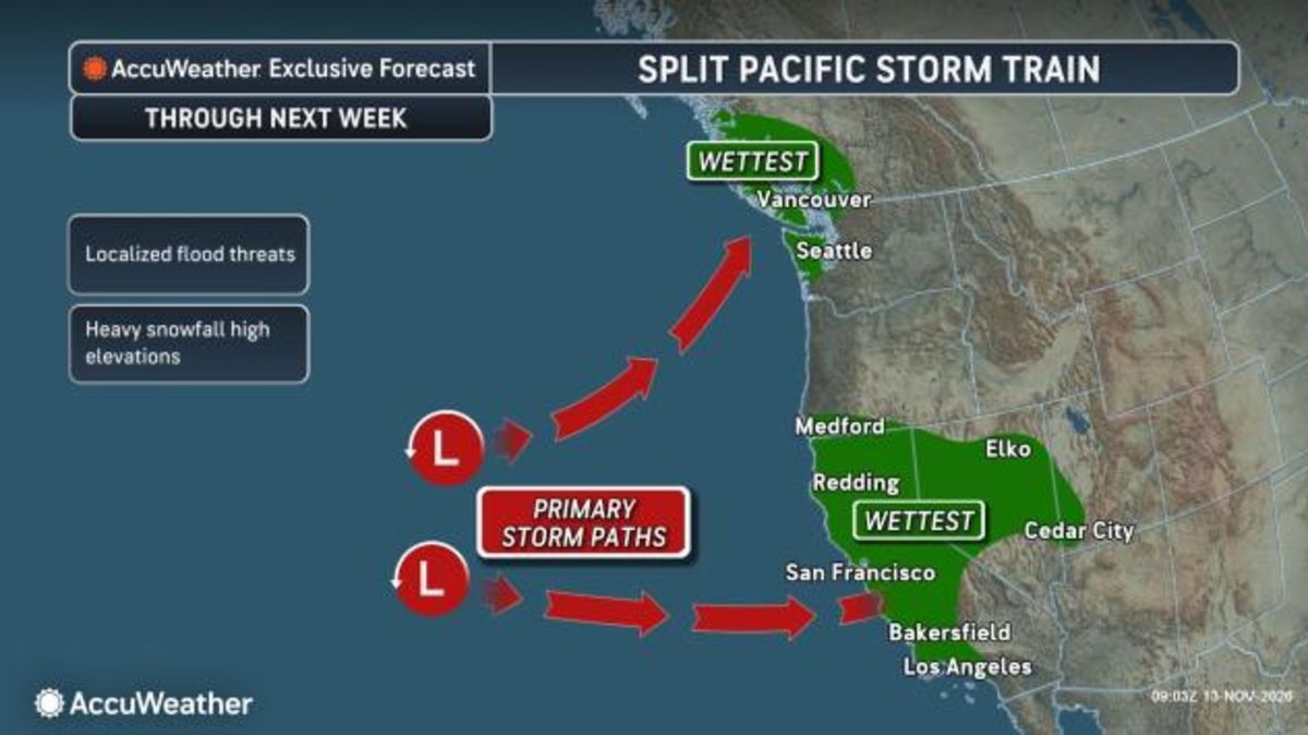
Northern California faces heavy rain, mountain snow, and large waves as a powerful Pacific storm arrives on Friday.
Pacific Storm Triggers Coastal Flooding and Heavy Sierra Snow
The National Weather Service office in Sacramento and Reno issued winter storm warnings as moisture moves southward along the U.S. West Coast. The warning runs from 10 a.m. Friday until Saturday, November 14, at 10 a.m.
Snow accumulations near 12 inches are anticipated above 7,000 feet, up to 6 inches below 7,000 feet, and up to 20 inches along the crest west of Lake Tahoe. Ridge winds are forecasted to gust between 70 and 90 mph. Truckee and Lake Tahoe communities face gusts of 45 to 55 mph and wave heights of 2 to 5 feet on the lake.
Yosemite received an updated winter storm warning valid from 10 a.m. Friday until Tuesday, November 17, at 4 a.m.
Total snow accumulations reach up to 20 inches with winds gusting as high as 50 mph across Yosemite, the San Joaquin River Canyon, the Upper San Joaquin River, Kaiser to Rodgers Ridge, the Kings Canyon National Park Grant Grove area, and Sequoia National Park.
A Pacific storm system will bring heavy low elevation rain, and gusty winds to northern California and the Pacific Northwest, as well as possible blizzard conditions to the Sierra Nevada beginning Friday. Additional storm systems are likely into next week. Visit… pic.twitter.com/6Q6LCK9EUz
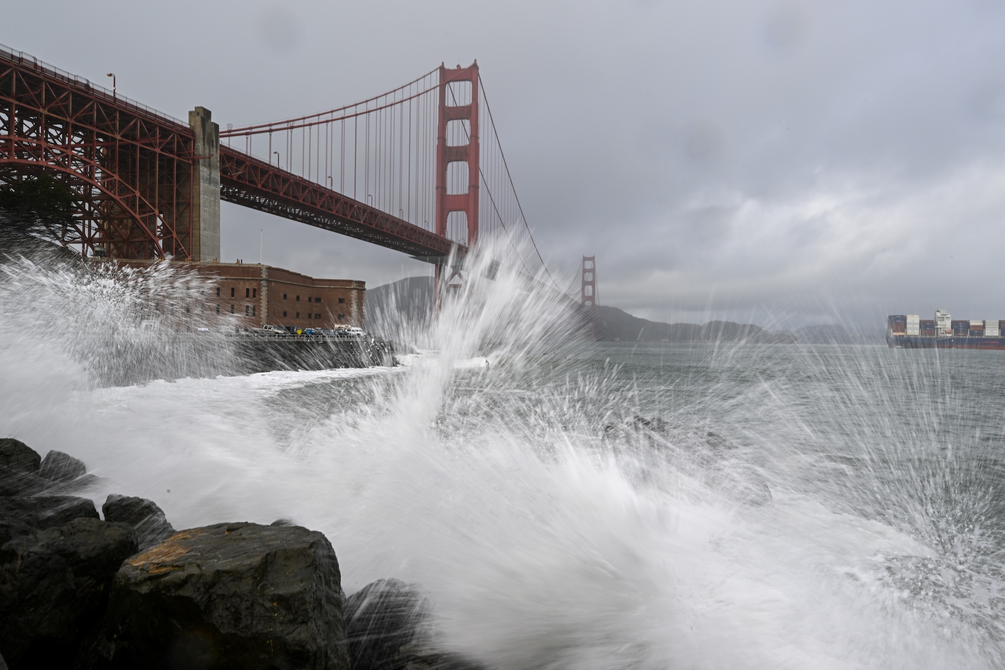
Significant wave heights of 20 to 30 feet are forecast along the Northern and Central California coast on Saturday.
Occasional 50-foot waves hit popular surf spots like Mavericks along the San Mateo County coastline.
A High Surf Warning is in effect from 6 p.m. Friday to 4 a.m. Sunday from the coastal North Bay through Big Sur.
A Coastal Flood Advisory covers vulnerable spots experiencing up to 1.5 feet of inundation during peak high tide in San Pablo, San Francisco, and Monterey Bays.
Along the coastline this weekend is going to be deadly, frankly.
Merchant, National Weather Service
Rain Moves Through Bay Area
Moderate to heavy rain began pushing into the North Bay in the morning before reaching San Francisco and Oakland around noon and the South Bay in the early afternoon on Friday, November 13.
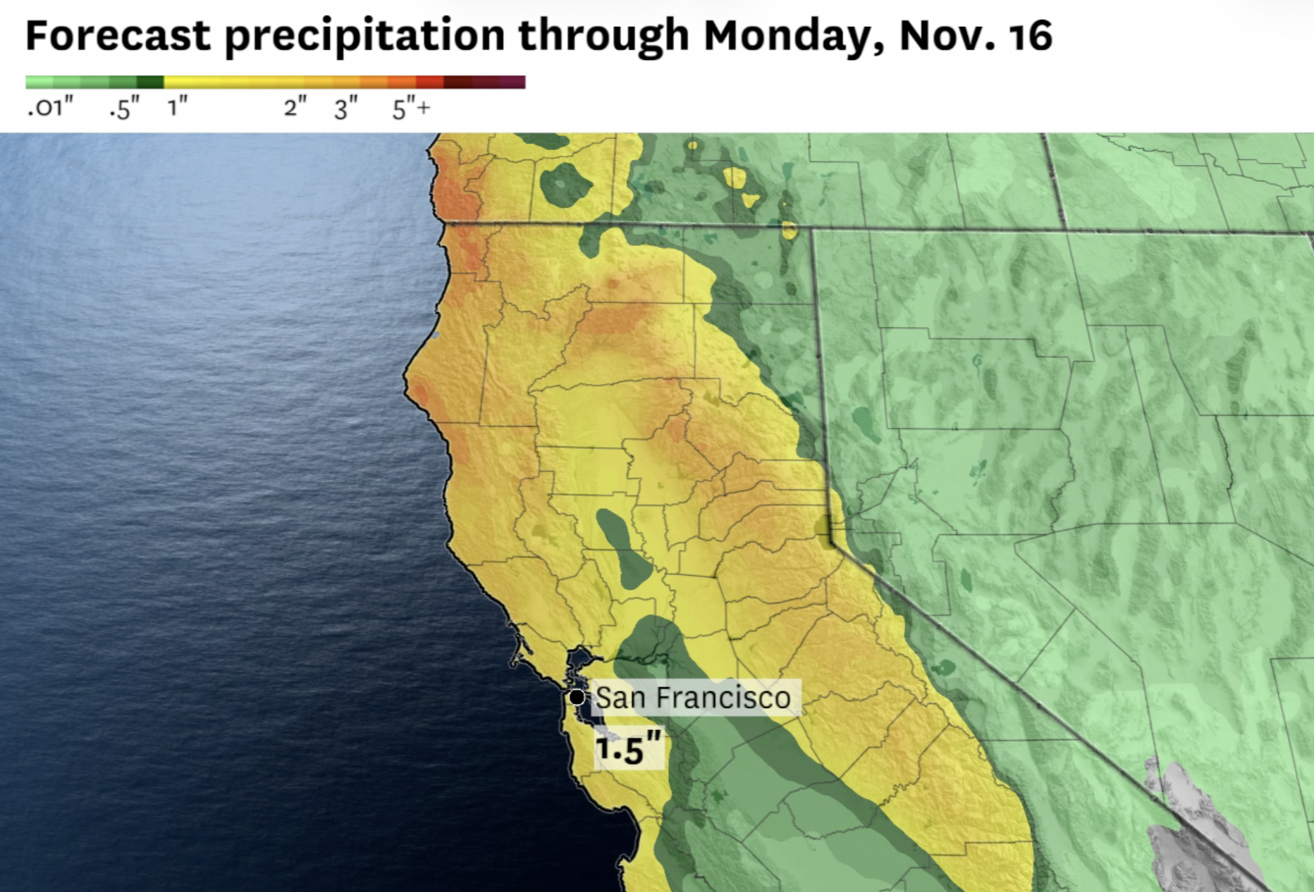
Rainfall totals of 1 to 2 inches are forecast through Monday morning in the San Francisco Bay Area.
South winds could reach 25 to 35 mph ahead of the front, with brief gusts hitting 45 mph or greater as it passes. A slight possibility of thunderstorms brings brief downpours and lightning.
San Jose received only 0.27 of an inch of rain since the start of the rainy season and is among the areas experiencing this event.
Nevada County foothills and surrounding areas experience heavy downpours, strong winds, and isolated thunderstorms with small hail.
Fall weather in this week's forecast planner AKA swinging from warm temps + clear skies to cool, rainy, breezy WX. We're expecting 2 storm systems with a period of mostly dry WX in-between them this weekend into next week, but we're still nailing down exact timing & rain amounts. pic.twitter.com/Nwrf3cmZsN
Wind advisories were issued for Friday across the north and central Sacramento Valley and the Delta as winds might top 35 mph alongside heavy rain.
The National Weather Service office in Reno issued similar wind advisories for Carson City for south to southwest winds of 20 to 30 mph with gusts up to 55 mph.
Wind-prone areas along the U.S. Highway 395 and Interstate 580 corridor may see gusts up to 65 mph.
El Niño Patterns Influence Storms
Forecasters track a developing El Niño pattern in the Pacific as the storms arrive.
Historical El Niño winters such as 1982–83 and 1997–98 brought exceptionally heavy rainfall. Sacramento recorded about 167% of its normal water-year rainfall in 1997–98.
Other strong events like the winter of 2015–16 showed that a strong El Niño doesn’t guarantee more rain.
A second storm system is projected to arrive in Northern California on Sunday following a calmer atmosphere on Saturday with a 20% chance of early morning showers and mostly sunny skies.
Sunday’s system brings impacts similar to Friday’s system before pivoting southward to Los Angeles on Monday and inland from Monday to Tuesday in Las Vegas and Phoenix.
A series of storms will move over the area, with mainly light to moderate rainfall. This graphic shows rainfall totals from Thursday night through Saturday, with most of the rain falling Friday night. Use caution driving on wet roads and change outdoor plans as necessary. #CAwx pic.twitter.com/6byOxWqpHn
That system brings another period of snow to the Sierra Nevada from late Monday to Monday night.
Snow is predicted to advance from north to south across a large portion of California from next Wednesday through Friday due to a third incoming storm.
An active weather pattern remains in place with periods of substantial rainfall and mountain snow every one to three days extending into the third week of November.
Earlier coverage: Coastal Flood Advisory and High Surf Hit Los Angeles and San Diego
Keep reading

Matthew Steinaway Discusses Market Trends at Boston Business Roundtable
On Nov. 5, 2026, almost 150 students and alumni gathered in downtown Boston to attend the Boston Business...

UL-Monroe Falls to Louisiana 42-21 to Remain Winless at Home
UL-Monroe dropped to 2-8 on the season and remained winless at home after a 42-21 loss to Louisiana...
University of Baltimore B.S. in Health Management Program Update
The University of Baltimore has discontinued new student enrollments for its B.S. in Health Management program within the...

Freedom Park Teacher Receives Palmetto Citizens Foundation Grant – Augusta Good News
Fifty-seven South Carolina and Georgia teachers secured classroom funding through the Palmetto Citizens Foundation’s inaugural Teacher Grant Program,...