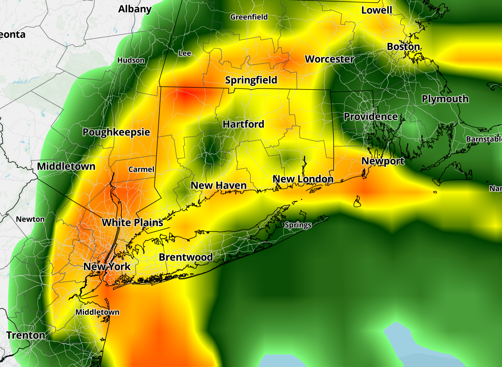
A coastal storm will bring heavy rain and gusty winds to Connecticut Sunday night, with 1 to 3 inches of rain possible across much of the state, CT Insider reported.
Most of Sunday morning should remain dry with clouds thickening and temperatures climbing through the 50s. Showers become more likely during the afternoon, particularly across southern Connecticut, before rain becomes steadier statewide after sunset.
The heaviest rain is expected this evening into the overnight hours as the storm strengthens along the East Coast. That amount is enough for some ponding on roads and localized flooding, especially in poor-drainage areas, though the storm’s relatively quick movement should limit the risk of widespread serious flooding.
Leaf-clogged storm drains could enhance any minor flooding that occurs.
Along the shoreline, gusts around 25 to 35 mph are possible, with somewhat lighter winds inland. The strongest winds should occur tonight into Monday.
Temperatures will remain relatively mild Sunday, with highs generally in the upper 50s to middle 60s. Clouds and rain will prevent it from feeling especially warm, and readings could start dropping Sunday afternoon as the storm’s circulation draws nearer.
Shoreline areas, including Stamford, Bridgeport, New Haven and New London, will see highs of 58 to 63 degrees. Inland areas, including Danbury, Waterbury, Greater Hartford and Windham, will reach 57 to 63 degrees. The Litchfield Hills, including Torrington, Litchfield and Winchester, will be cooler with highs of 53 to 59 degrees.

Monday starts wet, with rain likely lingering into the morning before gradually tapering. Improvement will spread from west to east during the afternoon, though the day stays cloudy and breezy.
A much colder air mass follows, with temperatures dropping sharply Tuesday. Tuesday and Wednesday look much colder, with highs mainly in the 40s.
Wednesday night into Thanksgiving Day brings another chance for rain and possibly a rain-snow mix, although there is still plenty of time for that part of the forecast to change.
Related reading

Luxury Travel Magazine: Three Days in Juneau With Whales, Glacier, Mining Trails
Three days covers Juneau's main highlights — humpback whales at Auke Bay, Mendenhall Glacier and mining trails —...

How a Viral ‘Pick Another Protein’ Ad Helped Scott Colom Flip Mississippi’s Senate Seat
"Pick another protein? "Shiiii – I'd rather pick another senator instead," Russ Hudson said in an ad posted...
Kansas City Spine Surgery Offers Advanced Surgical Care for Complex Spinal Conditions in Overland Park
Kansas City Spine Surgery in Overland Park, Kansas, provides surgical evaluation and treatment for conditions affecting the cervical,...

City Commission Fires Manager After 7 Weeks, May Cost $2M
The Tallahassee City Commission fired City Manager Karen Jumonville on November 18 after seven weeks on the job,...