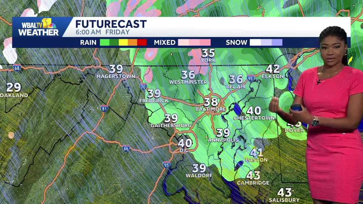
Baltimore could see its first snow flurries of the season as a cold air mass moves through Maryland this week, WBAL reported.
The shift in weather patterns brings a sharp departure from the milder autumn temperatures seen earlier this year. While a major snowstorm is not currently expected to hit the central Maryland region, the arrival of much cooler air on Thursday and Friday introduces the possibility of wintry precipitation.
The timing of this chill is notable for the region. According to data from the official weather records station at Baltimore-Washington International Thurgood Marshall Airport, the season’s first freeze in Baltimore has been delayed. While a freeze typically arrives before November 10, the coldest temperature recorded so far this autumn was 35 degrees on October 19.
The forecast for Thursday and Friday
The incoming weather pattern will bring breezy conditions and much lower temperatures. On Thursday, Baltimore expects periods of light rain with a high near 60 degrees. By Thursday night, the skies will turn cloudy and colder, with lows dipping to approximately 39 degrees.
Friday brings the most uncertain conditions for those watching for snow. The forecast calls for mostly cloudy and windy weather with a high around 49 degrees. WBAL reported that a chance of morning showers exists, alongside the possibility of a few flurries mixed in.
Meteorologists are tracking a coastal storm that appears to be moving closer to the New Jersey coast. This positioning is a critical factor for Maryland residents. Because the upper-level low is forecast to stay further north and east, steady precipitation is not expected for Baltimore at this time.
For snow to become a more consistent reality for Central Maryland, the trough axis would need to lean back rather than forward. Currently, the axis is leaning forward, which favors rain over snow for the Baltimore area. However, the higher elevations of Western Maryland are in a different position.
Snow potential in Western Maryland
While Baltimore may only see a few flurries, the impact will be more pronounced in higher elevations. In far Western Maryland, particularly within Garrett County, the rain could transition into a mix of wet snow on Friday and Saturday.
The current weather pattern suggests this year’s potential for early snow may fall within these historical windows, though the exact timing remains dependent on the storm’s track near the coast.
City preparations for extreme cold
The shift toward wintry weather has prompted local government action. On Monday, Baltimore City officials discussed preparations for winter weather and extreme cold in anticipation of the possibility of snow this weekend.
These preparations are essential for managing the logistical challenges that sudden temperature drops pose to urban infrastructure and vulnerable populations. The pattern change expected this weekend could drop temperatures toward the freezing mark by Sunday or Monday morning.
As the coldest air mass of the season moves through the state, residents are monitoring the potential for frost and icy conditions. Whether the flurries turn into more snow accumulation depends on how the storm track settles near the New Jersey coastline over the coming days.
Keep reading

ICE Raids at NM Construction Sites Stall Projects, Say Developers
Federal immigration agents have significantly ramped up enforcement operations at residential construction sites across Albuquerque and Santa Fe...

New Mineral Techniques to Immobilize Radioactive Technetium-99 Waste
Researchers at the University of Manchester have developed new ways to immobilize Technetium-99, a highly mobile radioactive byproduct...

Seahawks face Raiders in NFL Week 10 at Allegiant Stadium
The Seattle Seahawks prepare to visit the Las Vegas Raiders at Allegiant Stadium on Sunday, Nov. 15, for...

KC Royals Partner With Elevate to Shape New Downtown Ballpark Experience
The Kansas City Royals announced a multi-year partnership with global sports and entertainment agency Elevate to shape the...