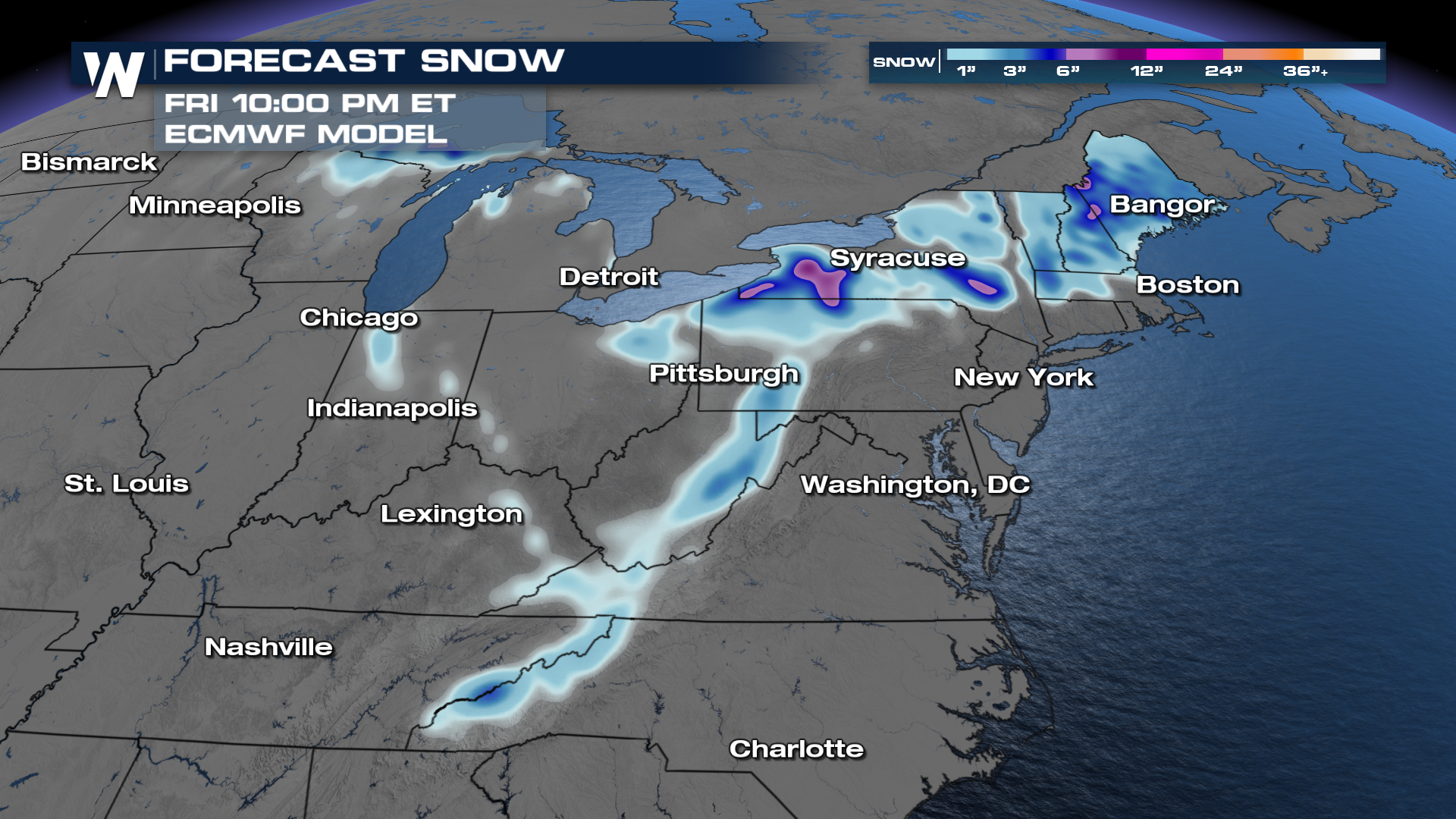
A measurable burst of late-week snow is possible across parts of the Eastern United States as a large cold weather system pushes eastward, WeatherNation reported. While northern areas have seen occasional flakes this fall, forecasters emphasize that timing and precise cold air placement remain uncertain.
Fall weather is finally taking a sharper turn toward winter across the eastern half of the country. A substantial weather trough is digging down from the north, setting the stage for potential winter weather impacts by the end of the week.
Will it actually snow where you live?
WeatherNation reported that the exact placement of the incoming trough and its associated cold air still need to be worked out by forecasters. Forecast model ensembles consistently show a cold low-pressure system moving across the region, but they vary significantly regarding its timing and overall strength.
A larger upper-level trough will help several shortwaves swing through the eastern half of the country. These disturbances provide extra lift that could pull moisture from the Atlantic Ocean directly into the cold air mass, amplifying the potential for heavy rain and snow.
What are the expected snow totals?
The Weather Prediction Center is highlighting a chance for winter impacts from Friday into Saturday. Confidence remains highest for the mountains of New England and West Virginia, while overall confidence in widespread lowland snow remains low for now.
Computer forecast models show distinct differences in their projections. The ECMWF, or Euro model, shows solid snow potential for the same areas highlighted by the Weather Prediction Center. Meanwhile, the GFS model also indicates snowfall potential, though meteorologists note that the GFS tends to overestimate snowfall by turning borderline icy conditions into snow too readily.
How much rain is heading to the Northeast?
As the trough pulls Atlantic moisture into the Northeast, the risk for heavy precipitation increases. The ECMWF model shows rainfall totals ranging between 1 and 4 inches for parts of the Northeast, with the heaviest rain expected from Thursday into Friday.
These precipitation totals could change as forecasters better predict when the low-pressure systems will arrive. WeatherNation noted that computer models can completely bust in the 5-to-10-day window, meaning residents should not rush out just yet to stock up on household supplies.
Worth a look

Alabama Could Reach CFP First-Round Bye as Texas Nears Top-Four Seed
Alabama secured a 31-13 win over LSU inside Death Valley, shifting the team's postseason trajectory and putting a...
India Becomes World’s Third-Largest Startup Ecosystem
India has climbed to the position of the world’s third-largest startup ecosystem, backed by over 2.62 lakh recognized...

Wisconsin DNR Proposes Statewide ATV and UTV Open Container Ban
Drivers and passengers riding all-terrain vehicles and utility terrain vehicles across Wisconsin would face strict statewide prohibitions against...

The Thunderbirds Converted a Two-Point Try in Overtime, Ending the Broncs’ State-Record 40-Game
The Thunderbirds converted a two-point try in overtime, ending the Broncs’ state-record 40-game home win streak. The showdown...