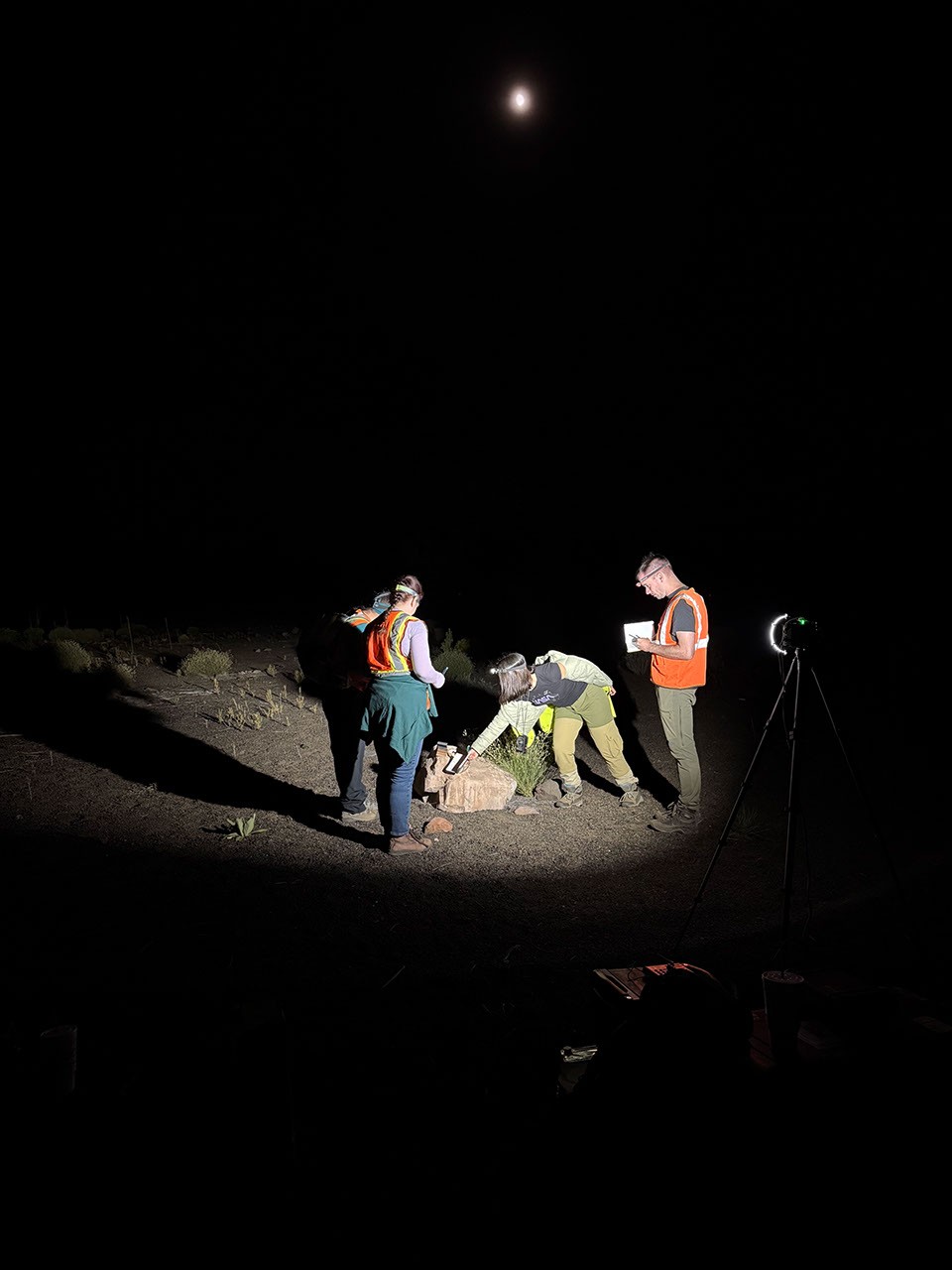
NASA scientists spent September turning northern Arizona into a dress rehearsal for the Moon and Mars, dragging radar sleds across a 50,000-year-old impact crater and laser-mapping a mile-long lava tube to refine the toolkit future explorers will carry off-world.
The Goddard Instrument Field Team fanned out across four sites near Flagstaff — Meteor Crater, Lava River Cave, the Cinder Lake crater field, and the volcanic slopes of SP Crater and Petrified Forest — practicing the geophysics and sampling strategies that will eventually guide astronauts and rovers through analogous terrain on other worlds, NASA Science reported.
“Standing at the edge of Meteor Crater is as close as most visitors will get to peering into an impact crater on the Moon,” the agency’s field log noted, explaining that the 4,000-foot-wide basin remains one of Earth’s best-preserved impact structures because it has escaped the rain, wind, volcanism, and plate tectonics that erase similar scars elsewhere.
Reading the violence written underground
At Meteor Crater, researchers moved ground-penetrating radar antennas meter by meter along lines stretching from the rim across the ejecta blanket — the debris thrown out when the impactor struck. A second crew followed with seismic detectors, striking the ground with a sledgehammer at each station to measure how vibrations travel through the shattered subsurface.
Each dataset fills a different gap: the radar sees layering and dielectric contrasts, while the seismic lines reveal velocity changes that betray fracturing and compaction. Together they will help scientists reconstruct how far the ejecta traveled, how deeply the explosion excavated, and how the stratigraphy was overturned — answers that directly inform how lunar scientists will interpret similar structures on the Moon, where erosion has not blurred the record.
A third group worked the rim with handheld spectrometers, hunting for geochemical shifts caused by the immense pressure and heat of impact. The goal is to build a field protocol that lets future explorers recognize the most scientifically valuable samples — the ones that record the moment of collision — without needing a lab to confirm them.
Mapping the dark where GPS fails
West of the crater, beneath Coconino National Forest, Lava River Cave offered a different challenge. The sinuous lava tube — formed when the crust of a flow hardened while molten rock drained beneath — stretches nearly a mile underground. GPS cannot penetrate the roof, and iron in the basalt throws off compasses.
To bridge the gap, the team scanned the interior with laser-ranging systems from multiple stations, captured the entrance from every angle, and flew aerial photogrammetry over the forest floor to georeference the underground model. They also logged temperature, humidity, and rock-hardness profiles every few yards — environmental baselines that will shape habitat designs and EVA planning if astronauts ever shelter in lunar or Martian tubes.
These terrestrial lava tubes are among the closest analogs to the skylights and rilles imaged by orbiters on the Moon and Mars, making the Arizona survey a rare chance to validate remote-sensing interpretations with ground truth.
Color, vesicles, and the clock of erosion
At Cinder Lake — where Apollo astronauts once trained on a simulated lunar mare — researchers worked day and night measuring how human perception of rock color shifts under the harsh, high-contrast lighting of the lunar surface, a persistent headache for traverse planners.
Meanwhile, teams on SP Crater hammered vesicles — frozen gas bubbles — from different flow units. Back in Maryland, lab analysis of those bubbles will reveal the volatile content of the original magma and the dynamics of its eruption and cooling.
Eastward in Petrified Forest National Park, the expedition compared two volcanic end-members sitting side by side: geologically young lava flows and ancient ashfall clays. On Mars, similar paired terrains are common but poorly understood. By documenting how each material weathers differently, the team hopes to build a diagnostic key: given an erosion pattern seen from orbit, what erupted, and when?
About 37 miles east of Flagstaff, Meteor Crater — also called Barringer Crater — was formed roughly 50,000 years ago when a nickel-iron meteorite some 160 feet across struck the Colorado Plateau, releasing energy estimated at 10 megatons of TNT.
The impact vaporized much of the projectile and left a basin 3,900 feet wide and 560 feet deep, surrounded by a rim that rises 148 feet above the plains. Because the dry climate has slowed erosion, the crater retains its squared-off outline and ejecta blanket, making it the best-preserved impact structure on Earth and a National Natural Landmark since 1967.
Daniel M. Barringer was among the first to argue for an impact origin, acquiring the site in the early 20th century; it remains privately owned by the Barringer family. In 1891, mineralogist Albert E. Foote published the first scientific description of the Canyon Diablo meteorites, and that same year U.S. Geological Survey chief geologist Grove Karl Gilbert incorrectly concluded the crater was a volcanic steam explosion.
With the field campaign complete, the focus shifts to lab follow-up and years of data analysis. The week’s measurements are poised to feed planetary science and exploration architecture for missions still on the drawing board — a reminder that the path to other worlds still runs through the pines and cinders of northern Arizona.
Keep reading

Chicago Holiday Season Opens Nov. 20 With Free Tree Lighting, Skating, Parades
Chicago's holiday season opens on Nov. 20 with the 113th Christmas tree lighting in Millennium Park, kicking off...
Volpe Appoints Patrick Springer Deputy Fire Chief Effective Dec. 1
Patrick Springer takes over as deputy fire chief on Dec. 1, filling the vacancy left when Daniel Volpe...

West Tennessee Healthcare, Le Bonheur Expand Pediatric Care in Paris, Dyersburg
"Bringing these services closer to the families who need them is incredibly important to us," said Deena Kail,...

Orchestra Noir Marks 10th Anniversary With R&B and Hip-Hop Classical Arrangements
Atlanta’s Orchestra Noir marks a decade of reframing the symphonic canon this Friday, turning the Cobb Energy Performing...