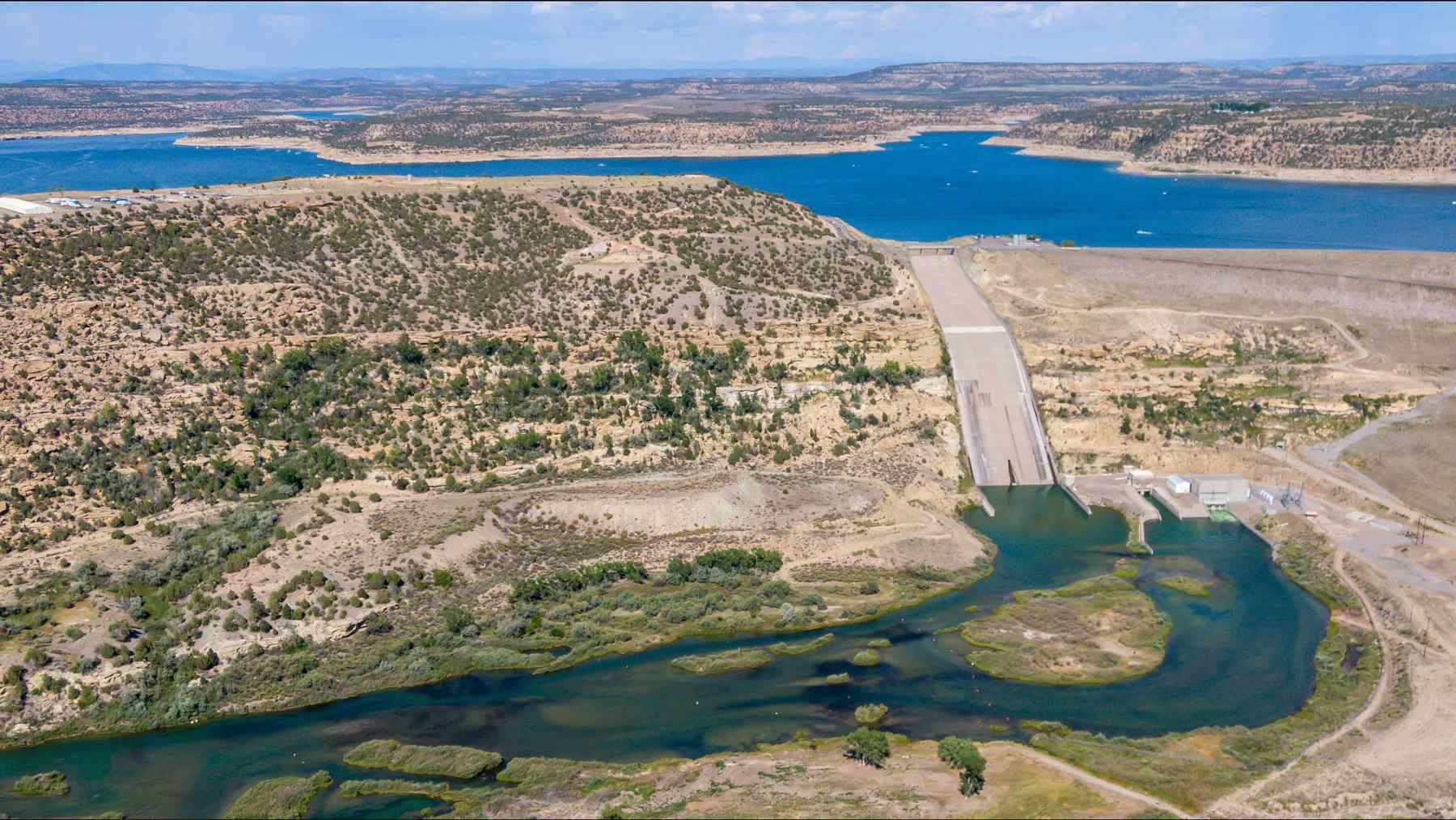
On November 2, the Bureau of Reclamation’s 40-day operations table shows Navajo Dam releasing just 250 cubic feet per second into the San Juan River — about 1,870 gallons a second — while roughly 52,053 cubic feet per second, around 389,000 gallons every second, poured into the reservoir behind it, according to the agency’s own numbers, as autonocion.com reported. The 402-foot earth embankment about 34 miles east of Farmington, New Mexico, absorbed the blow without turning a single gate, and the flooding that swamped San Juan County came from everywhere the dam can’t reach.
That gap between what came in and what went out is the whole story of this fall’s floods in northwest New Mexico. Two storm waves — the leftovers of Hurricane Trudy, which pushed inflow to 44,238 cfs on October 23, and a Halloween-night system that hit already-soaked ground — drove the reservoir from 6,021.95 feet and 883,785 acre-feet on October 21 to 6,064.80 feet and 1,354,774 acre-feet on November 3. That’s a 42.85-foot rise and 470,989 acre-feet in 13 days, or roughly 153 billion gallons, with the November 2 inflow alone comparing to 15,397 cfs during the big September 1970 flood on the same river.
The lake is still 20 feet below the spillway — and the spillway has no gates
The reservoir extends 35 miles up the San Juan, 13 miles up the Pine and 4 miles up the Piedra, and all three rivers flow directly into it. Even so, the water hasn’t come close to overtopping anything. The spillway crest sits at 6,085 feet and the top of the dam at 6,108 feet; as of November 3 the lake was 20.2 feet below the spillway and 43.2 feet below the top. Reclamation’s page for the dam describes a rolled earthfill structure 3,648 feet long built between 1957 and 1963, with a concrete spillway crest on the right abutment that has no gates — a fixed lip, so if the lake ever passes 6,085 feet, water goes over on its own. The reservoir’s listed maximum is 1,696,000 acre-feet, so at 1,354,774 acre-feet on November 3 it was about 80% full, with 341,226 acre-feet of room left. The dam has been higher: a high-water mark of 6,087.25 feet on July 3, 1973, with 5,447 cfs released that day.
Farmington’s flood came from rivers with no dam on them
Over 20,000 people in San Juan County received evacuation notices covering anyone within half a mile of the Animas, the La Plata or the San Juan, the Albuquerque Journal reported on November 2.
“It’s wide and it’s fast,” county spokesperson Devin Neeley told the paper.
The Animas runs down from Durango and joins the San Juan at Farmington, well below the dam, and neither it nor the La Plata has anything like Navajo on it. USGS gauges put the Animas at Farmington peaking at 13.46 feet and 18,900 cfs at 12:15 a.m. on November 3 — a moderate flood level that did not break the record crest of 16.5 feet set October 6, 1911, which the National Weather Service lists. The San Juan at Farmington topped out at 12.20 feet and 24,900 cfs early on the afternoon of November 2, a major flood level, and it did set a preliminary height record during the first wave — 14.1 feet on October 23 against the old 12.3. But Jonathan Thompson at The Land Desk notes that the 33,100 cfs measured that day still falls short of flows recorded there in 1927 and 1929, so “record” deserves an asterisk.
Without the dam, Thompson wrote, October’s flows would have been “far larger, and far more destructive.”
That’s his inference, not a Reclamation figure — but a daily average of 52,053 cfs coming in against a 24,900 cfs peak at Farmington is hard to argue with. It won’t mean much if you’re shoveling mud out of a house in Harper Valley.
Why only 250 cfs went out
Reclamation has not publicly explained the release, yet its notices page indicates releases are intended to maintain 500 to 1,000 cfs flowing through the endangered fish habitat between Farmington and Lake Powell — and with the river already at 24,900 cfs at Farmington, the fish require no assistance from the dam. The 250 cfs figure is one Reclamation’s own planning documents describe as the low end. A hardware constraint exists as well: the main outlet works are capable of passing 4,200 cfs when the lake stands at 6,101.6 feet, far below 52,053. Adding water to a river that’s already in people’s houses isn’t something any operator volunteers for anyway. Even below the dam, a USGS gauge about 5 miles downstream read 5,300 cfs at 4:30 p.m. on November 1 on a day Reclamation lists a 250 cfs release — most likely side drainage from normally dry arroyos like Gobernador Canyon and Cañon Largo, the same conclusion water writer John Fleck reached about October’s wave.
Rivers are falling; the lake is full and nobody has posted a new release
Around 1 a.m. on November 4, USGS reported the San Juan at Farmington had dropped to 5.84 feet and 7,740 cfs, while the Animas fell to 9.29 feet and 6,560 cfs. Neeley told the Journal he expected the river back to normal by Tuesday or Wednesday, and the forecast is dry into the weekend. Reclamation’s next Colorado River study is due November 13. Releases were not posted for the November 3 row in the operations table, and the newest public notice dated to September 16. The Bureau of Reclamation’s 40-day table recorded a release of 250 cubic feet per second on November 2, with no further updates since then.
For now, the dam did exactly what it was built to do: it took 153 billion gallons in thirteen days, held them 20 feet below an ungated spillway, and let the flood that actually hurt Farmington come down rivers it never controlled.
Barbie exhibition at Virginia Museum of History and Culture explores icon’s evolution
A Cultural Icon Takes Center Stage in Richmond For generations, the image of Barbie has been fixed in...
Bryce Alan Zundel, 66, dies leaving a legacy of family and work
The life of Bryce Alan Zundel, a man whose presence was defined by both a rigorous work ethic...

Austin Election Results: Key Propositions Pass and Fail
Austin voters have reshaped the city’s civic framework, greenlighting a suite of tax-funded infrastructure projects while simultaneously rejecting...

Marco Pierre White Method Uses Heat Transfer to Perfect Mushroom Risotto
The Mechanics of the Perfect Risotto For most home cooks, risotto is less a recipe and more a...