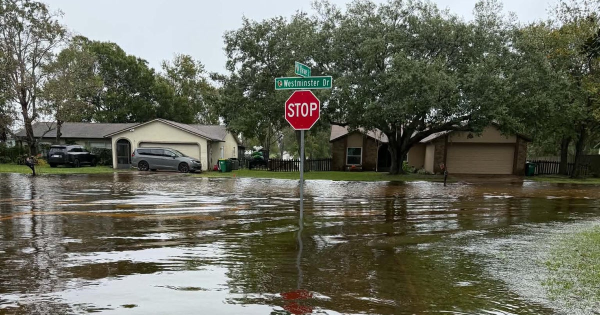
Central Florida recorded nearly 25 inches of rain in three days last week, driving the St. Johns River to levels not seen in 70 years, the Orlando Sentinel reported.
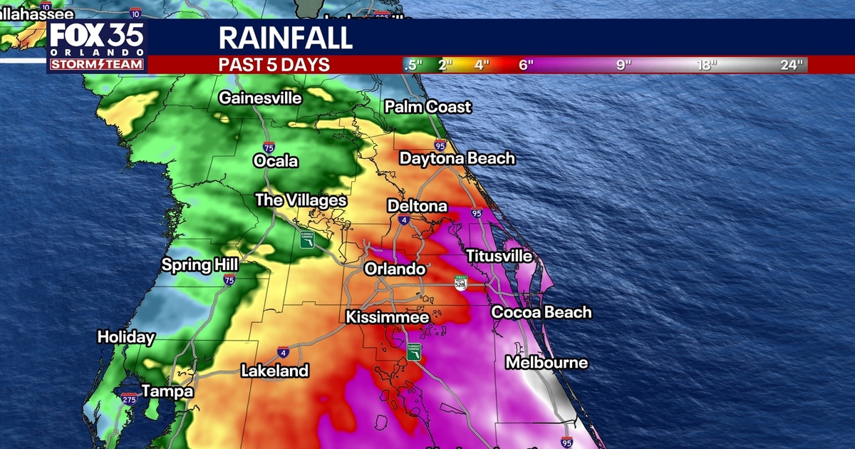
The National Weather Service in Melbourne posted a preliminary summary showing 56 observation sites across Brevard, Volusia, Orange, Lake and Seminole counties measured at least 10 inches from Wednesday through Friday. NWS preliminary reports listed Grant-Valkaria with 24.69 inches, Malabar with 24.52 inches and Palm Bay with 22 inches as the highest totals. John. The heavy deluge hit inland as well.
Fox 35 Orlando reported the heaviest rain fell Sunday, Nov. 1, and Monday, Nov. 2, with Grant-Valkaria logging 24.69 inches, Malabar 24.52 inches and Palm Bay 22 inches. The Weather Service issued a flash flood emergency for West Melbourne, Palm Bay and Grant-Valkaria as 15 to 20 inches overwhelmed roads and neighborhoods, Fox 35 said. Indian River County Sebastian Inlet recorded 14.48 inches, Vero Beach South 14.27 inches, Pine Tree Park 13.16 inches, Roseland 13.05 inches and Wabasso 9.67 inches.
The National Weather Service also reported significant rainfall in St. Lucie County, where one location west of the Port St. Lucie River recorded 16.70 inches. Seminole County Lake Harney measured 8.53 inches, Oviedo 7.69 inches, Chuluota 7.47 inches, Geneva 7.01 inches and Winter Springs 6.53 inches.
Orange County Eatonville recorded 7.73 inches, Azalea Park 6.88 inches, Fairvilla 6.12 inches and Orlando Executive Airport area 6.09 inches. Lake Marian area in Osceola County measured 6.66 inches, Alligator Lake area 6.45 inches and Kenansville 6.42 inches.
CBS News said Brevard County alone recorded more than 100 water rescues, many in Cocoa, where the St. Johns River crested at 18.77 feet early Saturday — surpassing the 17.6-foot record set in 1953.
“While we may have substantial property damage, we’ve got vehicles that are damaged, businesses that are damaged, right now we have absolutely no one that has lost their life from this storm,” Brevard County Sheriff Wayne Ivey said at a Thursday press conference. “Very minimal injuries across the board. That’s the most important thing.” The town had just held a reopening ceremony on Monday.
Residents described flooding without precedent. “I’ve talked to people that’ve been here for 20 and 30 years and this has never happened,” Rockledge resident Sherry Mitchell told Weather Channel reporter Jim Cantore on Nov. 19. “I’m worried to death,” Robert Spinning told “CBS Mornings.” “I don’t have flood insurance. I can’t afford it.”
Lake Harney in Seminole County reached 12.82 feet Sunday, topping the 12.7-foot mark set during Hurricane Ian in 2022, with a projected crest of 13.1 feet, the Sentinel reported. It had begun at 5.43 feet Wednesday morning.
At Sanford near Lake Monroe, the river stood at 7.43 feet Sunday morning and is forecast to hit major flood stage at 8.2 feet by Wednesday. DeLand hit major flood stage at 5.3 feet Sunday, projected to reach 6.1 feet by Friday. Astor in Lake County reached 4.13 feet Sunday, forecast to crest at 4.3 feet late this week.
Extreme flooding in central Florida has led to hundreds of water rescues due to more than 2 feet of rain over the past two days in some locations — and the threat is not over. https://t.co/LWjabUKVck
Flood warnings remain in effect at Cocoa, Geneva, Sanford, DeLand and Astor as runoff moves through the 300-mile river system, Fox 35 reported. The same system holds a 50% chance of becoming Subtropical Storm Kyle as it moves up the East Coast, CBS News said. The St.
Keep reading
Four-Man Team Sets Mississippi River Speed Record: 16 Days, 20 Hours From Source to Sea
A four-man canoe team paddled the Mississippi River from Lake Itasca to the Gulf of Mexico in 16...

Chargers Activate Ladd McConkey vs. Jets; Tarheeb Still Inactive
Los Angeles wide receiver Ladd McConkey will return Sunday against the Jets after missing the Chargers' win in...

Fuchsia Dunlop Profiles Sichuan Cooking in New Cookbook
NPR Rob Schmitz profiles British food writer Fuchsia Dunlop on her latest cookbook, "Five Tastes: Delicious Flavors For...

Man Killed, Two Women Critically Injured Walking to Play at Quince Orchard High School
A man died and two women were critically injured Saturday night when a 2022 BMW i4 struck them...