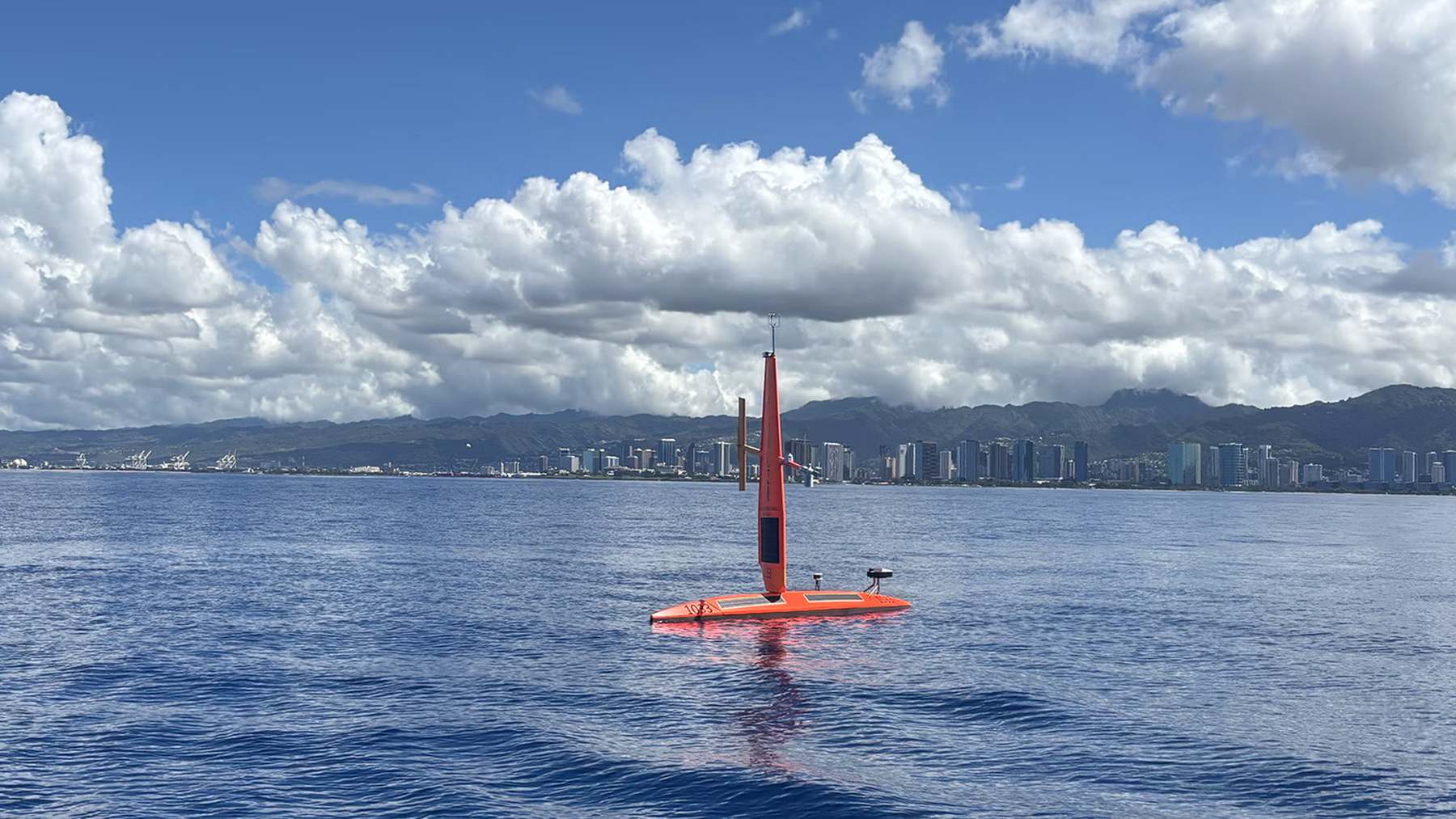
“A monumental El Niño is knocking at the door,” Michael McPhaden, a former senior scientist at PMEL now with NOAA’s cooperative institute at the University of Washington, warned in a recent agency announcement. To see if that door is actually swinging open, NOAA has deployed four uncrewed, 23-foot sailboats from Honolulu to the equatorial Pacific to take the temperature of the ocean firsthand, Autonocion reported.
This isn’t just a scientific curiosity; it is a high-stakes weather reconnaissance mission. These Saildrone Explorers are heading for the “Niño 3.4 region,” the specific patch of ocean NOAA uses to determine the strength of an El Niño event. If the data holds, we could be facing the strongest event since NOAA’s records began in 1950. For people in the southern U.S., that translates to a risk of heavy rain and flooding, while Australia may face drought.
The 4.5-Degree Warning
The urgency of the mission is written in the numbers. According to an October 26 update from the Climate Prediction Center, the weekly reading in the Niño 3.4 box was 4.5°F above normal. Further east, the water off the coast of South America was running 7.9°F warm. While a single hot week doesn’t define a record, the three-month average from July through September was already 3.1°F above normal.
NOAA currently estimates an 83% chance that this will become a historic event between October and December. To put that in perspective, an event is officially labeled “El Niño” once the water in that central Pacific box stays at least 0.9°F above normal. This current trend isn’t just meeting the threshold; it’s obliterating it.

The scale of the warming across the equatorial Pacific is detailed below:
| Region | Location | Weekly Departure from Normal (Oct 26) |
|---|---|---|
| Niño 4 | Western Pacific | 0.0°F |
| Niño 3.4 | Central Pacific (Target) | +4.5°F |
| Niño 3 | Eastern Pacific | +6.5°F |
| Niño 1+2 | Off South America | +7.9°F |
Why Satellites Aren’t Enough
You might wonder why NOAA is sending physical boats into the middle of the ocean when we have satellites and moored buoys. The answer is a matter of precision. Satellites read the ocean from orbit, and buoys are anchored to the seafloor hundreds of miles apart. They provide a great general map, but they can’t chase the weather.
Meghan Cronin, the PMEL research oceanographer leading the project, notes that scientists need to physically dip sensors into the water to verify those orbital numbers. The Saildrones log data every minute and can be steered precisely across the “edges” where warm water meets cool water. Since those edges shift and drift, a boat is the only tool that can follow them in real-time.
In a mid-September post in the mission’s logbook, Cronin wrote that the boats averaged about 1.7 knots on the way down, which works out to roughly 2 mph, adding that you can walk this fast.
The drones aren’t just measuring temperature. They carry sensors for salinity, humidity, air pressure, and a current profiler that tracks water movement down to 250 feet. Most interestingly, two of the boats carry a custom carbon dioxide sensor. Normally, the eastern Pacific releases CO2 into the air as cold, deep water wells up. An El Niño can shut that process down, and NOAA wants to know exactly how much less carbon is escaping into the atmosphere this time.
Dodging Hurricanes to Measure the Heat
The journey has not been a straight line. The first pair of boats, SD1033 and SD1077, left Honolulu on August 21. The timing for the other two, SD1088 and SD1090, is slightly disputed: the agency’s announcement suggests they left the week before August 31, though the mission logbook lists August 31 as the date.
By early September, the drones were already fighting the very symptoms they were sent to study. El Niño often triggers more hurricanes in the eastern Pacific. In this case, the drones had to navigate around Hurricane Lowell, a Category 4 storm, forcing a 180-nautical-mile detour. While some Saildrones are built with reinforced wings to sail directly into hurricanes, these “Explorer” models are designed for endurance and speed (relatively speaking), not for surviving hurricane-force winds. They faced 36-knot winds and 14.8-foot waves even during their detour.
Some skeptics might argue that relying on uncrewed, 1,500-pound plastic and metal boats to monitor global climate shifts is a gamble. However, the alternative—deploying a full research vessel with a crew of scientists for months—costs significantly more and covers less ground. These drones run on solar power and can stay at sea for a year or more, feeding data directly into the Global Telecommunication System used by weather agencies worldwide.
The boats are likely already operating in the equatorial zone, though the mission log has been silent since September 15. If the four-month schedule holds, the first pair will begin the long, slow crawl back to Honolulu by the end of the year. In the meantime, the world waits for the NOAA Research community’s next official discussion on November 12 to see if the “monumental” event has officially arrived.
Worth a look

MSU Student Groups Spark Debate Over Dorm Voter Registration
Student volunteers at Michigan State University are facing a backlash over "dorm storm" voter registration drives that some...

Massachusetts voters to decide on record-tying nine ballot questions
Massachusetts voters will decide on a record-tying nine ballot questions next week, a surge in direct democracy that...

Why SIX Musical Is a High-Energy Must-See at The Hippodrome
The North American Tour of "SIX" is currently playing at The Hippodrome Theatre in Baltimore, delivering a high-energy,...

Portland Public Schools rescinds campus ban on Allison Roberts
Portland Public Schools has rescinded a one-year trespass order against Allison Roberts, a parent who was banned from...