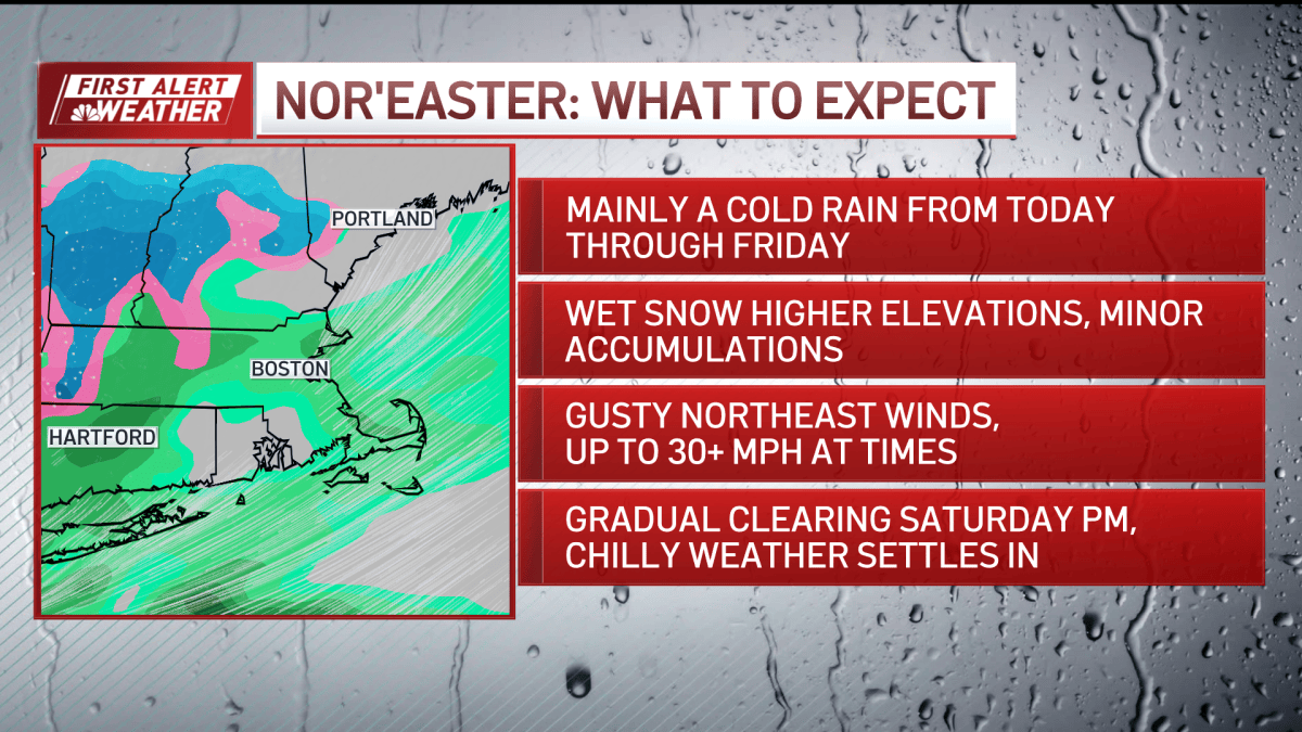
A Nor’easter will bring rain, strong winds, and the first significant winter snowfall to parts of New England starting tonight, according to NBC Boston.
The storm is expected to impact the region through Friday, creating a split between coastal rain and higher-elevation snow. While much of the area will face breezy, colder conditions, the specific timing of the rain-snow line will determine whether residents deal with wet commutes or accumulating snow.
The weather pattern shifts this evening as low pressure tracks south of the coast. This movement will trigger increasing northeast winds and rain across southern New England. As temperatures drop overnight, the transition from rain to wet snow is expected in the Worcester Hills and parts of southern New Hampshire.
Accumulations will vary significantly based on elevation and proximity to the coast. The Berkshires could see a few inches of snow, while the Worcester Hills and southern New Hampshire have the potential for a coating to a few inches depending on how high the terrain sits. NBC Boston reported that any light accumulation in lower elevations will likely favor grassy surfaces rather than major road impacts.
The coastal communities and the Greater Boston area are expected to remain in the rain zone. However, a brief period of wintry mix is possible in the Merrimack Valley during the early hours of Friday morning.
Temperature fluctuations will determine how the storm settles. Forecasted conditions include:
- Higher terrain: Temperatures will hover near freezing.
- Inland areas: Temperatures are expected to reach the upper 30s and lower 40s.
- Coastal areas: Temperatures will stay in the upper 40s.
Beyond the precipitation, the storm brings wind concerns for offshore areas and coastal residents. Northeast winds could gust to 40 mph offshore, creating rough sea conditions. There is also a risk of minor coastal flooding around Nantucket Harbor during the high tide on Friday afternoon.
Despite these factors, the storm is characterized as a relatively low-impact event for most communities. The primary consequence for the general public will be the return of breezy and colder conditions heading into the weekend.
Residents can track the movement of the system using live radar to monitor the rain-snow transition in real time.
Keep reading

New Mexico Lawmakers Consider New Office for MMIP Crisis
New Mexico legislators may soon consider establishing a permanent state-level office to address the crisis of Missing and...

Prologis Files Federal Lawsuit Over Trenton Data Center Ban
Prologis filed a federal lawsuit on Thursday, Nov. 12, challenging a recent voter-approved ban on data centers in...

House Democrats Nominate Alexis Simpson as Next Speaker
Rep. Alexis Simpson has been selected by House Democrats to serve as the next Speaker of the House....

Former NC Rep Jason Saine Indicted in Greater Carolina Corruption Case
“I do not understand why I have been charged in this case,” former N.C. Rep. Jason Saine told...