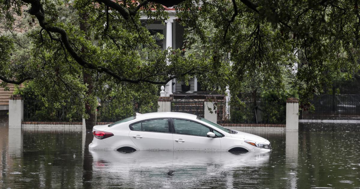
An offshore storm system could throw a wrench into Thanksgiving travel plans across the Southeast starting Thursday, with heavy rain and high winds expected from Florida through the Carolinas.
The system arrives just days before the final king tide cycle of the year, set to run November 24 through 27, creating a double-barreled threat of coastal flooding and hazardous driving conditions for holiday travelers, Post and Courier reported. AccuWeather senior meteorologist Brett Anderson noted water temperatures are marginal for tropical development, though a narrow ribbon of 80-degree water within the Gulf Stream offers a window for the system to organize.
“Water temperatures are marginal for tropical development, although a narrow ribbon of water near 80 degrees Fahrenheit extends off the Southeast coast within the Gulf Stream.”
AccuWeather vice president of forecasting operations Dan DePodwin added that disruptive wind shear is also expected, which might prevent tropical development entirely. “If a subtropical or tropical storm did develop, it’s possible that it could bring strong winds, heavy rain and coastal flooding to the Carolinas and mid-Atlantic this weekend. However, it’s also possible the storm only grazes the coast and moves out to sea,” he said.

The distinction between a tide prediction and a tide forecast becomes critical this week. Predictions, based on the relative positions of the moon, Earth, and sun, can be made far in advance. Forecasts, which account for weather factors like wind speed and rainfall, are only available up to 72 hours out and usually end up being more accurate.
The present projection, derived from a National Weather Service tide gauge in downtown Charleston, indicates levels will stay below flood stage, though that forecast has not yet been firmly locked in for the holiday period. Residents can track the most up-to-date forecasts on the city’s TideEye website.
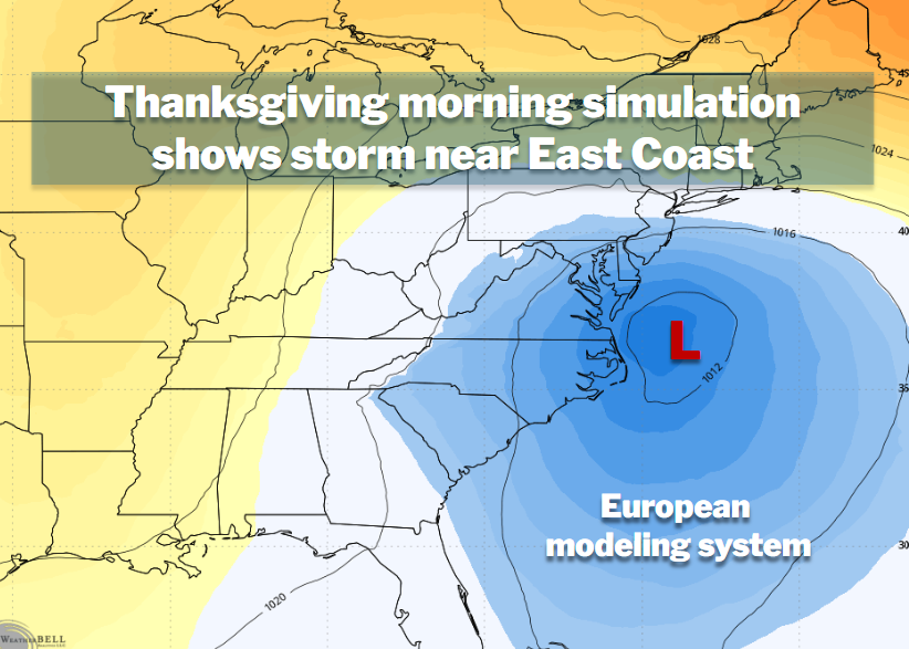
Further north, multiple computer models suggest a separate coastal storm could develop early next week, potentially bringing disruptive weather to parts of the East Coast from Wednesday into Thanksgiving Day. That system could bring heavy rain to the Mid-Atlantic and Northeast, with some wet snow possible in the mountains, though a track farther offshore would mean only a glancing blow.
The potential shift to stormier weather comes as El Niño helps strengthen the subtropical jet stream, transporting moisture from the Pacific toward the southern and eastern United States. Computer models hint at the possibility of yet a third coastal storm over the holiday weekend, though confidence in that scenario remains low.
Charleston, founded as Charles Town in 1670 by English colonists, sits on Charleston Harbor where the Ashley, Cooper, and Wando rivers meet the Atlantic. The city served as a primary entry point for enslaved Africans, with almost one-half of those imported to the United States arriving there.
It remained among the nation’s ten largest cities through 1840, even after the state capital moved to Columbia in 1788. Today, its metropolitan area holds an estimated 870,000 residents.
Any rainfall would offer a measure of relief for South Carolina’s entrenched drought. As of the last update on October 15, the S.C. Drought Response Committee still listed much of the state under “moderate” or “severe” drought status. Downtown Charleston is running about 16 inches short of its usual rainfall totals for the year, per Weather Service records. Just 0.17 inches has fallen over the past month in the capital region.
Worth a look
- CDT Hikers Face Volatile Water Conditions in Wyoming Basin
- Moberly Man Charged With Attempted Sex Trafficking of a Minor, Faces Life in Prison
- Southeast coastal storm threatens Thanksgiving travel as potential Subtropical Kyle forms (newsarchyuk.com)
- Indonesia Could Secure Another US$15 Billion in Investment Commitments From China on Friday (world-today-news.com)

CDT Hikers Face Volatile Water Conditions in Wyoming Basin
"So much water," the report read, a simple thumbs-up emoji punctuating the relief of a hiker who had...

Moberly Man Charged With Attempted Sex Trafficking of a Minor, Faces Life in Prison
A Moberly, Missouri man faces up to life in federal prison after a grand jury indicted him Wednesday...

AGC/VT Graduates First Leadership Academy Class of Fourteen Vermont Construction Professionals
Fourteen Vermont construction professionals graduated Monday from the inaugural AGC/VT Leadership Academy, a new workforce program built to...

New Mexico Governor Seeks More PRC Candidates in Letter to Nominating Committee Chair
Gov. Michelle Lujan Grisham asked a nominating committee for more candidates to fill a seat on the Public...