“So much water,” the report read, a simple thumbs-up emoji punctuating the relief of a hiker who had just topped off at Bull Springs on October 18.
That single entry, logged on FarOut, captures the volatile reality facing Continental Divide Trail travelers across Wyoming’s Great Divide Basin this season. The crowd-sourced water reports, spanning the first half of October, swing wildly from bone-dry desperation to abundant flow, often at the same sources just days apart.
“10/16 there was some fairly gnarly water here. Not the greatest source. I filled up at Sweetwater River north of here and Weasel Spring south of here,” the same user, klinto.bean, noted two days earlier at Bull Springs. The contrast highlights a critical lesson for anyone traveling the CDT’s longest roadless stretch: recent weather rewrites the map daily, and a single data point is a gamble.
The Great Divide Basin offers no easy exits. Water intelligence isn’t convenience here — it is survival logistics.

“This pool is dried up now. Only mud left which I scooped up a handful on the top pool which gave way to just a cup of water left but I assume will not be there a day longer this season! Even going down past the moss covered logs there is n…”
Nick, October 7, FarOut
Nick’s October 7 entry at a small pool — described only as “Small Pool of Water” on the app — reads like a dispatch from the edge. By October 6, sMiles had reported “Good flow, good log” at a creek crossing.
Twenty-four hours later, Nick found mud. That velocity of change forces hikers into a brutal calculus: carry extra weight on the hope the next source holds, or push miles further on empty bottles.
The cluster of reports from October 17 tells a different story. “Tons of water” at a creek crossing. “Flowing great” at Piped Spring. “Water is easily accessible now after recent rains” at Weasel Spring. The rains arrived, and the basin drank deep. Electric Water Well, a rare mechanical source in this wilderness, was “Flowing great” the same day.
Upper Mormon Spring offered a quiet “Water here” on October 18. Pinky-rob had found “So much water” at Bull Springs on October 5, two weeks before klinto.bean’s “gnarly” description. The swings are not anomalies; they are the basin’s rhythm.
Experienced CDT hikers treat the FarOut comments as a rolling intelligence brief, not a guarantee. A “flowing great” on the 17th means nothing for a hiker arriving on the 20th if the sun bakes the clay and the wind steals the moisture.
When Nick scoops mud on October 7, the infrastructure hasn’t failed. The sky just hasn’t opened lately.
Water never leaves the Great Divide Basin. It is an endorheic basin in Wyoming’s Red Desert where rain evaporates or sinks into alkali flats instead of reaching an ocean. The Continental Divide splits around it: the Green River watershed drains west to the Pacific, the North Platte east to the Gulf of Mexico.
Pioneers avoided the arid Saline Plain, routing the Oregon Trail north over South Pass and the Overland Trail south over Bridger Pass. The Union Pacific Railroad later crossed the southern basin directly, a path followed by the Lincoln Highway and Interstate 80. Today the basin remains sparsely populated; Wamsutter, the only incorporated town, had 203 residents in 2020.
“Good flow, good log,” sMiles wrote on October 6. The log matters — a stable platform to filter from without stirring silt. By the next day, the platform sat above dust.
Worth a look

Westborough Police Chief Todd Minardi Found Drunk in Cruiser, Globe Reports
Westborough Police Chief Todd Minardi spent more than 24 hours parked outside a Shrewsbury liquor store in his...

Portland State CS B+M Program: Earn Master’s in One Extra Year with 18 Shared Credits
Portland State University lets computer science undergraduates bank up to 18 graduate credits at undergraduate tuition rates before...
Portland State CS Bachelor’s + Master’s Program: 18 Shared Credits at Undergraduate Tuition
Portland State University offers a direct path to a master's degree that lets computer science undergraduates bank graduate...
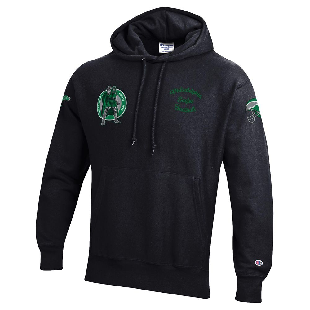
Disney, NFL Pair Eagles With Doctor Doom on Champion Hoodie
Disney and the NFL have paired the Philadelphia Eagles with Marvel's Doctor Doom for a new Champion reverse...