Phoenix is waking up to crisp temperatures in the 40s under mostly clear skies today, offering a brisk change of pace as a fresh weather system approaches the state.
Afternoon temperatures across the Valley will climb into the low 70s, marking a slightly cooler-than-average day following a trough of low pressure that dropped rain across Arizona on Tuesday, AZ Family reported.
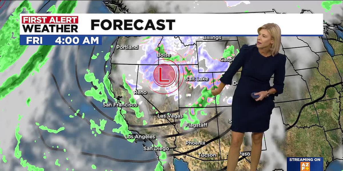
That system is now moving away, leaving behind sunshine and light winds. However, another storm is currently moving onshore in California and will track just north of Arizona on Thursday and Friday, according to AZ Family.
While the Valley is expected to stay dry through the weekend, this incoming system will reinforce the cooler air currently settled across the Southwest. Morning lows will hover in the 40s and low 50s, with afternoon highs staying in the low 70s.

Moving across the Great Basin toward the end of the week, the storm will bring both rain and snow to the northern half of the state. Light snow is possible down to 6,000 feet, with a couple of inches of accumulation expected at higher elevations such as the San Francisco Peaks and the Kaibab Plateau, arizona-express.com reported.
The cold front will also whip up windy conditions throughout the high country on Thursday and Friday, raising the possibility of a Wind Advisory being issued for the region.
Looking ahead to next week, another storm system is scheduled to track through the area on Monday. Current forecasting models show a lack of consistency regarding whether that system will actually produce precipitation for Arizona.
Worth a look

Ginny & Georgia Season 4 Sets January 21, 2027 Netflix Release Date
Netflix has officially confirmed that the fourth season of its hit drama Ginny & Georgia will premiere on...

Florida Classic Weekend Returns to Downtown Orlando for 81st Rivalry Game
Downtown Orlando is bracing for a surge of energy this week as the Florida Blue Florida Classic returns...

Connecticut Women Face Estradiol Patch Shortage; Women’s Health Connecticut Data Shows 1 in 10 Fill Rate
Fewer than one in 10 patients prescribed an estradiol patch in Connecticut can fill their prescriptions within 30...

Three University of Delaware Faculty Named 2026 Highly Cited Researchers
Clarivate has included three University of Delaware scholars on its 2026 Highly Cited Researchers roster, highlighting global academics...