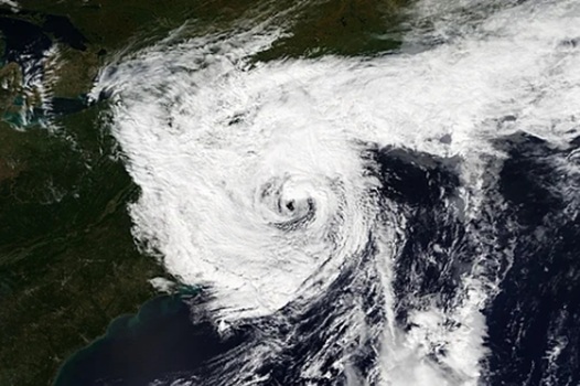
Residents across Massachusetts, Rhode Island, and Connecticut should prepare for a potential shift in weather patterns as meteorologists track the development of a possible nor’easter slated for the coming week.
While the region is currently anticipating a period of cooler and drier conditions, the atmosphere may turn increasingly volatile by the second half of the week.
The latest guidance from the National Weather Service in Boston/Norton indicates that a low-pressure system is beginning to take shape. According to the Area Forecast Discussion released by the agency, this system is expected to originate just south of the region, tracking along or near the Mid-Atlantic coast.
The Fall River Reporter noted that this developing weather event could bring rain and wind to most areas, with the possibility of snow for those located in higher elevations.
The potential for a nor’easter is tied to an upper-level shortwave currently moving from Canada toward the southeast into the Mid-Atlantic region. Because this system is still in the early stages of development, meteorologists have not yet finalized the specific impacts or the exact track the storm will take. The atmospheric conditions remain fluid, and the National Weather Service continues to monitor the guidance as the system matures.
For individuals living in the tri-state area, this serves as a reminder of the region’s vulnerability to late-season or early-fall storm dynamics. The transition from the initially expected cool, dry weather to a more unsettled pattern highlights the inherent difficulty in long-range forecasting during the autumn months.
The primary concern for local municipalities and small businesses lies in the unpredictability of these coastal storms. While the forecast remains preliminary, residents in higher elevations—particularly in parts of central and western Massachusetts—should remain alert for the possibility of wintry precipitation. Utility providers and municipal emergency management departments often utilize these initial NWS discussions to begin internal assessments of staffing levels and equipment readiness.
The uncertainty surrounding this system is typical for the region, where the interaction between cold air from Canada and warmer, moisture-rich air off the Atlantic can rapidly intensify low-pressure systems. As the week progresses, the National Weather Service is expected to refine its outlook, providing more clarity on the timing and intensity of the wind and precipitation.
For now, the region waits to see how the shortwave interacts with the coastal environment. Residents are encouraged to monitor updates from local news outlets and official government channels as the forecast becomes more certain.
Worth a look

The Plaza Motel History and Evolution in Carson City
The Plaza Motel shows how local hospitality has changed in downtown Carson City over the decades. According to...

Traveler Details Service Failures at Enterprise in Downtown Omaha
In a recent column for Live and Let's Fly, a traveler detailed a series of service failures at...

Chiefs Look to Regroup Against Jets Amid Offensive and Defensive Struggles
The Kansas City Chiefs enter Sunday's matchup against the New York Jets attempting to halt a slide that...

New McDonald’s Site Plan Approved for Former Jon Anthony Florist Site
McDonald’s Secures Approval for Former Lansing Florist Site The long-vacant Jon Anthony Florist building on Michigan Avenue is...