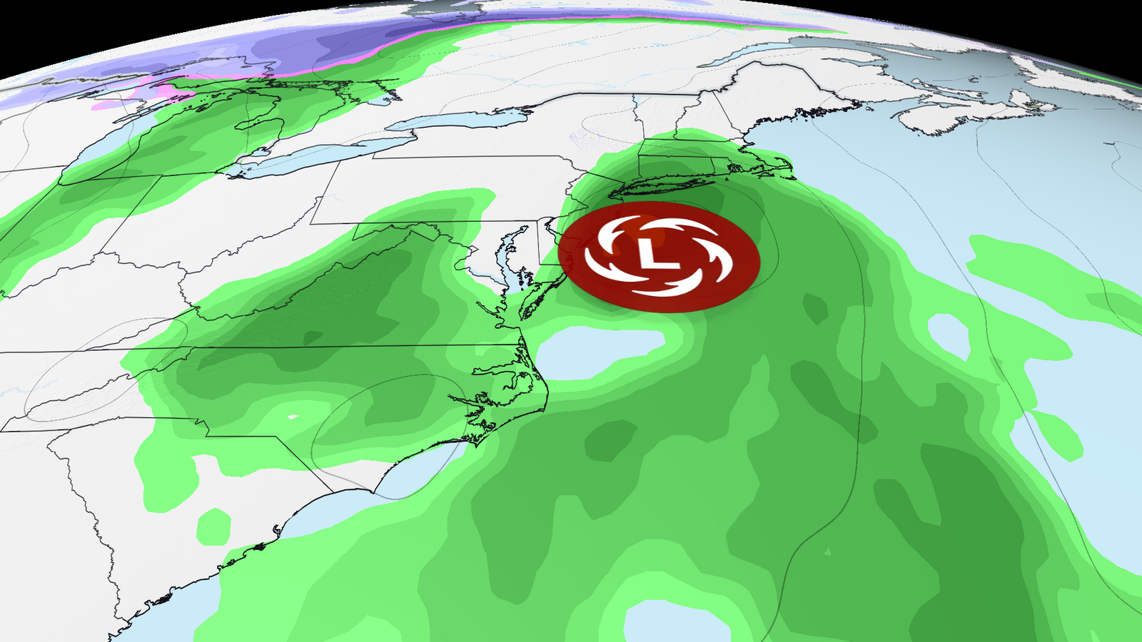
A storm that dropped over 15 inches of rain on Florida’s Atlantic coast this week is now barreling up the East Coast, threatening to snarl travel for millions heading home for Thanksgiving.
The system, which could organize into a rare late-season tropical or subtropical storm off the Southeast coast this weekend, prompted a Level 4 of 4 high risk for flooding rain from Cape Canaveral to Daytona Beach through Friday night, CNN Weather reported.
High-risk days like this are issued on fewer than 4 percent of days per year on average, yet they account for more than 80 percent of all flood-related damage and 36 percent of flood-related deaths, according to Weather Prediction Center research.
“Countless” homes in Brevard County took on water Thursday, county spokesperson Don Walker told CNN, and more than 100 people were rescued or assisted by day’s end. The scenes are eerily similar to historic flooding that hit the same area earlier this month, even inundating some of the same homes a second time.

“Jazmine Foster’s home in Melbourne, Florida, flooded on Thursday for the second time in two weeks. She said an insurance claim filed for the earlier flood was denied.”
Roughly 65 homes in the Palm Bay Estates mobile home park were under a mandatory evacuation order Thursday after a bridge washed out, cutting off the only access road, Palm Bay Fire Chief Richard Stover told CNN.
Residents were evacuated by boat to a temporary shelter. The St. Johns River near Cocoa surged past its record crest, set more than 70 years ago, on Thursday morning, and because the river drains slowly, flooding in some areas could last for weeks.
Thanksgiving travel corridor in the crosshairs
The storm’s northward trek puts the entire Interstate 95 corridor from Florida to New England in the firing line during one of the busiest travel weeks of the year. Forecast models still show notable track and timing differences, so confidence is lower than normal, CNN Weather noted.
Saturday into Saturday night, rainfall and gusty winds expand into coastal Georgia and the Carolinas, likely causing airport delays and road flooding from Jacksonville to Charleston, with beach erosion and coastal flooding. By Sunday, the Mid-Atlantic and Northeast deteriorate. Washington, D.C., airports could see rain as early as Sunday morning, though some models steer the bulk of the moisture away from the capital. Philadelphia and New York airports should stay dry Sunday morning, but rain and gusty winds could worsen conditions by afternoon.
Road travelers face slowdowns on I-95 from Virginia to New York City. Rain reaches New England — Boston, Hartford, Providence — by late Sunday afternoon or evening. The storm’s fast movement should limit serious flooding farther north, but ponding on roads is likely, especially in poor-drainage areas. Rain exits New England early Monday, though gusty winds may linger; it’s unclear whether they’ll be strong enough to cause flight delays.
Another system looms for the holiday itself
More weather trouble could follow this system. Another storm may impact the Southeast and Northeast Wednesday into Thanksgiving Day, though details remain too fuzzy to be useful, CNN Weather reported. Forecasters will refine the outlook through the weekend.
Brevard County stretches along Florida’s Atlantic coast and, with 606,612 residents in 2020, ranks as the state’s 10th-most-populous county. Its modern boundaries were fixed in 1907 after decades of shifting lines that once reached as far west as Polk County and south to coastal Dade County.
The county is named for Theodore Washington Brevard, who served as Florida comptroller from 1854 to 1860, and its seat moved to Titusville after the southern portion split off to form St. Lucie County in 1905.
Henry Flagler’s Florida East Coast Railroad reached Titusville in 1886 and Melbourne in 1894, sparking the first concerted development and the 1920s land boom. The area is also home to the Windover Archeological Site, designated a National Historic Landmark after its 1982 discovery revealed the largest collection of human remains and artifacts from the early Archaic Period, more than 8,000 years ago.

The bridge washout in Palm Bay and the St. Johns River’s record crest shows how saturated the ground was before this week’s deluge even arrived. With another potential system days away, the region’s drainage capacity — and its residents’ patience — will be tested again.

AP Calls Mississippi Senate Race for Scott Colom, First Black Senator Since Reconstruction
The Associated Press called the Mississippi Senate race for Scott Colom on Wednesday, ending a week of ballot...

KOAT Launches 37th Coat Drive at Three Walmarts for NM Kids
KOAT launches its 37th annual KOATs for Kids drive on Friday, collecting new coats at three Walmart locations...

Seattle School Board Gives Superintendent Power to Close Schools
"You are here to be the fall guy. That's what it is," Gee Scott said on KIRO Newsradio...

Republic FC Hosts Louisville City Saturday in First USL Final With Two Former Champions
Kickoff at Heart Health Park is set for 9:00 a.m. Saturday, the first time in USL Championship history...