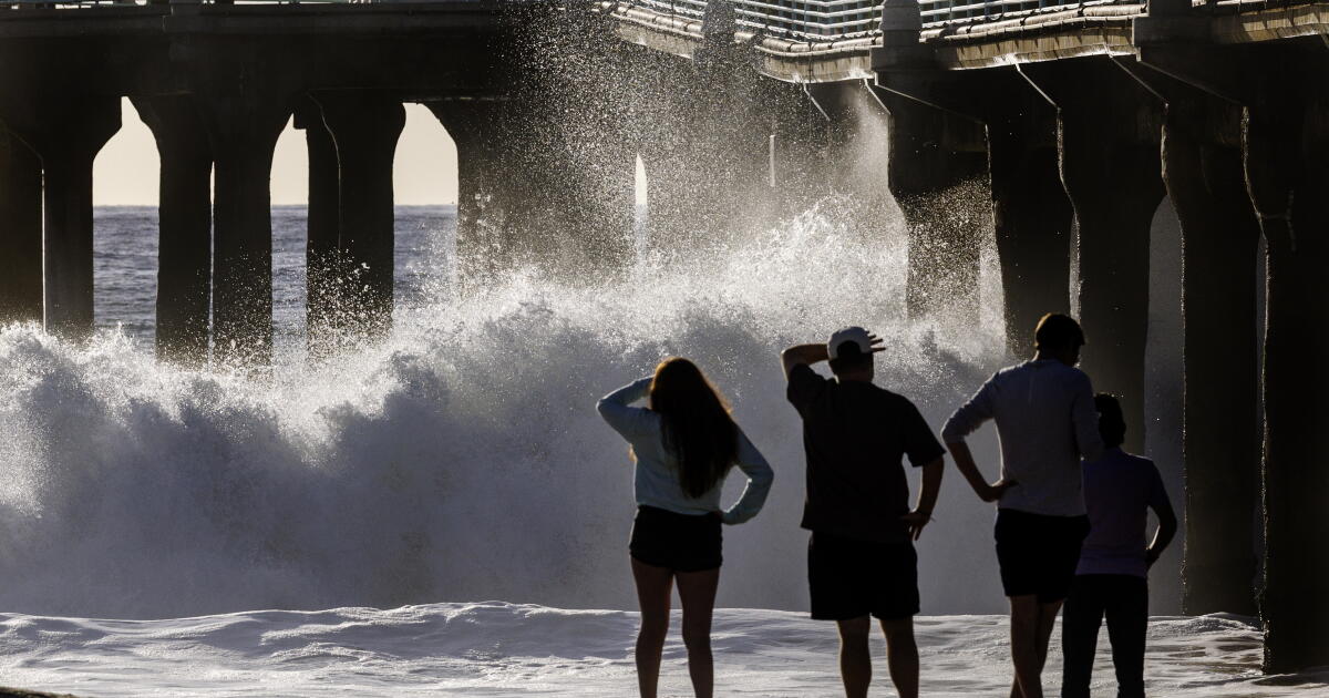
“This is, for me, the key to what happens during these El Niño years when you have a high water level, big waves and big tides all occurring at the same time,” said Reinhard Flick, a researcher at the Scripps Institution of Oceanography at UC San Diego.
The first atmospheric river of the season pummeled Northern California on Wednesday, but the real test arrives next week when king tides peak along the Southern California coast.
San Francisco recorded 2.64 inches of rain on Wednesday, shattering a 108-year-old record for November 18, while San José saw 2.04 inches, breaking a 76-year mark, Los Angeles Times reported. The deluge left waist-high water on streets, flooded buildings, stranded cars on freeways and cut power to more than 51,000 Pacific Gas & Electric customers.
Yet forecasters are fixed on the Thanksgiving week window, when tides driven by an 18.6-year lunar node cycle and a 4.4-year lunar perigee cycle will push sea levels past 8 feet from Monday through Black Friday.
“We’re facing a triple threat here in terms of coastal impacts in California associated with this El Niño event: higher waves, more rain, and higher sea levels,” said Mark Merrifield, director of the Center for Climate Change Impacts and Adaptation at Scripps.
The ocean has already been running roughly 16 inches above predicted astronomical tides for the past month, a departure far larger than any year on record. That elevated baseline eroded beaches and undermined Highway 1 in Orange and Ventura counties long before the next storm arrives.

The National Weather Service warns maximum sea levels could reach 8.1 to 8.6 feet in Los Angeles, Ventura, Santa Barbara and San Luis Obispo counties, with San Diego and Orange counties also exceeding 8 feet. Anything beyond that threshold enters all-time record territory.
On October 27, San Diego Bay hit 8.52 feet, San Pedro 8.19 feet, Santa Barbara 8.04 feet and La Jolla 7.98 feet, coinciding with flooding in Huntington Beach, Newport Beach, Redondo Beach, Long Beach and San Diego. In Huntington Beach alone, 114 structures reported damage.
“The coincidence of storms and big waves, if they occur during these periods of peak high tides, that’s when the damage and the flooding and the beach erosion is the worst,”
History offers a grim template. In the winter of 1982-83, December storms struck at low tide, softening the coast with erosion but limiting flooding. Then in late January 1983, a massive storm surge met the year’s highest tides. “That’s when all hell broke loose,” Flick said.
“We had storm surge … 13 foot waves, and look where the tides were — the highest tides of the year, basically.” The event caused the worst Southern California flooding in decades, destroying piers in Santa Monica, Seal Beach and San Diego, flooding homes from Malibu to Redondo Beach, and wrecking the wooden Scripps Pier in La Jolla, which was later rebuilt in concrete.
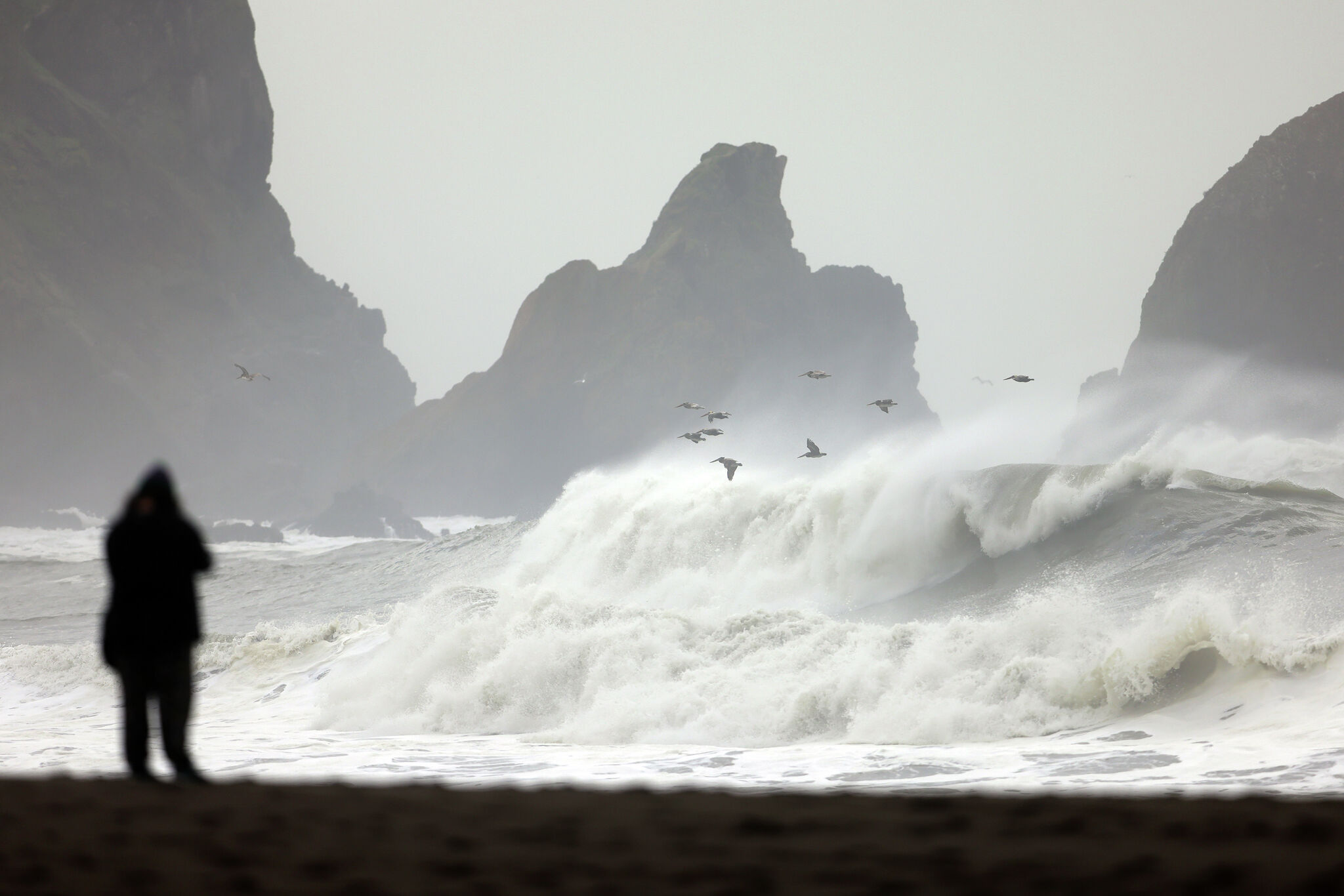
This year’s El Niño is by most measures stronger than the 1982-83 event, and the wave energy is already scaling accordingly. Research from the U.S. Geological Survey shows that during strong El Niño years, Gulf of Alaska lows churn up waves that pound the coast with 32% more power than normal, San Francisco Chronicle reported.
The relationship between wave height and destructive power is squared: a 20-foot wave hits with four times the force of a 10-foot wave; a 40-foot wave delivers 16 times the power. In December 2015, the last very strong El Niño, waves towered to 63 feet near Mendocino and washed away 180 feet of shoreline at San Francisco’s Ocean Beach. More than half the beaches surveyed by USGS suffered historic erosion that winter.
“Big waves aligning with El Niño’s high tides could cost the state billions this winter,” said Patrick Barnard, research director of the Center for Coastal Climate Resilience at UC Santa Cruz.
The North American Multi-Model Ensemble shows a greater than 90% chance of below-normal atmospheric pressure off the West Coast in December, pointing to a persistent, storm-generating low in the Gulf of Alaska. Stinson Beach, Pacifica and Santa Cruz are expected to take the brunt in the Bay Area, according to coastal scientist Gary Griggs at UC Santa Cruz.
“There’s absolutely nothing we can do to hold back the Pacific Ocean,”
The California Coastal Commission is issuing emergency armoring permits for vulnerable stretches, but Griggs calls them band-aids. “Anything we do is going to be a band-aid,” he said. The critical variable remains timing. Ryan Kittell, a National Weather Service meteorologist, said clarity on next week’s rainfall is still low, with a chance the king tide window stays dry.
Daniel Swain, a climate scientist with UC Agriculture and Natural Resources, expects a very active pattern: "There is a significant storm currently indicated for that period next week." This is going to be one to watch closely.” He added that a strong cold front could generate its own storm surge, compounding the tidal peak.”
Scripps Institution of Oceanography, founded in 1903 as the Marine Biological Association of San Diego and incorporated into the University of California in 1912, has operated a daily sea-level record from its La Jolla pier since 1916. That century-long dataset underpins the elevated baseline measurements cited in this story. The original wooden pier, wrecked during the 1982-83 El Niño floods described by Flick, was replaced by the modern concrete structure in 1988.
Long-range models continue to scream for a wetter-than-normal winter, possibly an extraordinarily wet one, with the wet signal arriving early. “The models have been screaming at us at the very top of their lungs for months now that possibly beginning as early as November, but more likely in December and January, California — including Central and Northern California — are very likely to have a much wetter-than-average winter,” Swain said.
California faces two more high-risk king tide windows after Thanksgiving: Christmas week and the week of Martin Luther King Jr. Day.
Keep reading

Indiana Libertarians Fall 253 Votes Short of 32-Year Ballot Access Threshold
Libertarian Lauri Shillings finished 253 votes short of the threshold that has kept her party on Indiana ballots...
Arizona Child Mortality Hits 20-Year Low as Infectious Disease Deaths Rise Again
Arizona’s child mortality rate hit a twenty-year low in 2025, yet infectious-disease deaths among children climbed for the...

Harrisburg Holiday Parade Route Announced With Donation Drive
Harrisburg’s annual Holiday Parade steps off Saturday at 10 a.m., marching along Front and Second streets from Market...

Jefferson Weaver Recounts Summer with Circus “Black Gang
In a personal essay for Columbus County News, Jefferson Weaver recounts the summer his newspaperman father took a...