
Trade winds will strengthen to breezy and strong speeds heading into the weekend, bringing scattered showers to windward and mountain areas across the Big Island, according to the latest forecast from Big Island Now.
High pressure building far north of the state is driving the shift, with wind gusts expected to reach 40 to 45 mph in the windier corridors.
The National Weather Service notes that short-wave troughs will swing through the islands over the weekend, enhancing trade wind showers. Hilo and Puna face a 90 percent chance of rain tonight, with overnight lows ranging from 63 to 71 degrees near the shore down to 52 to 58 degrees at the 4,000-foot elevation.
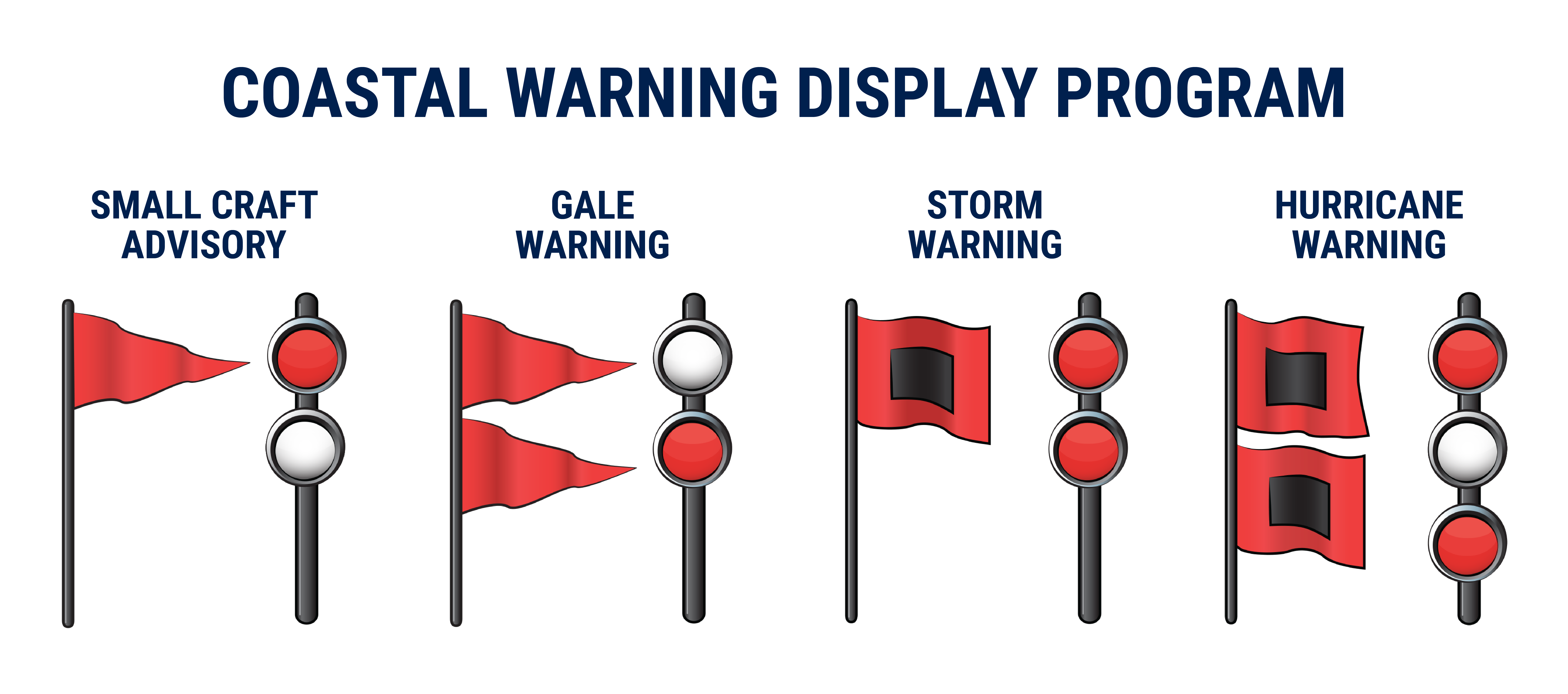
Marine conditions are deteriorating as the stronger high-pressure system passes north of the islands. A Small Craft Advisory remains in effect through 6 p.m. Friday for typically windy waters around the Big Island and Maui County, before expanding to cover remaining coastal zones.
Surf along north-facing shores will fade through the day with tiny surf anticipated on Friday, though a small north-northwest swell is forecast to build on Saturday. Meanwhile, rough surf along east-facing shores will hold near seasonal averages before increasing slightly.
Humidity levels should remain near normal on Friday due to incoming trade wind showers, keeping the fire weather threat low to moderate. Temperature inversion heights are expected to climb to between 6,000 and 8,000 feet.
The Big Island, the largest in the United States at 4,028 square miles, accounts for 63 percent of the Hawaiian archipelago’s landmass but only 13 percent of its population.
Polynesian settlers likely arrived between 900 and 1200 AD, and the island was later unified by the chief ʻUmi-a-Līloa. Captain James Cook was killed at Kealakekua Bay in 1779, and Kamehameha I consolidated control by 1791 before conquering the remaining islands. The County of Hawaiʻi was established in 1905, with Hilo as its seat.
Relief from the breezy conditions is on the horizon. An extended drying trend and lighter winds will return early next week as a subtropical ridge settles directly over the island chain.
Worth a look

Stetson Falls to No. 23 Louisville 83-69 After Early Lead
The Stetson men's basketball team gave No. 23 Louisville a tough early test on Thursday evening, jumping out...

Secured Quantum Services Deploys Toshiba QKD Systems in New Mexico
Secured Quantum Services has deployed Toshiba quantum key distribution systems and Celestica network switches in Albuquerque, New Mexico,...

Louisiana Gov. Landry, Lt. Gov. Nungesser Maintain Frosty Relationship Over Budget, Golf Disputes
Louisiana Governor Jeff Landry and Lieutenant Governor Billy Nungesser maintain a distant and frosty relationship defined by budget...

New Hampshire Secretary of State Vows First-in-Nation Primary Despite DNC Calendar
New Hampshire will keep its first-in-the-nation presidential primary status regardless of national party schedules, Secretary of State David...