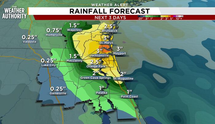
Rain-soaked communities along the I-95 corridor from St. Augustine to Brunswick, Georgia, face another 2 to 4 inches of rainfall through Saturday evening, News4JAX reported, as a slow-moving low pressure system shifts north and prolongs a flooding threat that has already dropped 7 to 8 inches on parts of Flagler County in five days.
The heaviest bands are expected to hug the coastline and the interstate, stretching west to U.S. 1 and Highway 301, before tapering off from south to north after 2 p.m. Saturday. A Flood Watch remains in effect until 2 p.m. for Duval, Nassau, Clay, Putnam, St. Johns and Flagler counties, while a Coastal Flood Advisory runs through Monday morning as onshore flow and heavy runoff coincide with astronomical high tides.
“The pattern will shift to the north, giving these areas a chance to dry out this weekend,” the News4JAX Weather Authority said in its 9:30 p.m. update Friday. “Flooding concerns will continue along the River through early next week.”
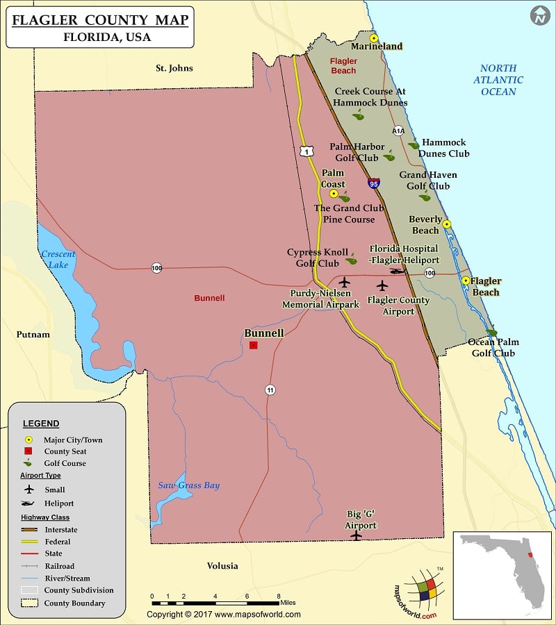
More than 1.5 inches fell between 2 a.m. and 9:30 p.m. Friday across southern St. Johns and coastal Flagler counties, pushing five-day totals near eight inches in spots. The St. Johns River, already elevated, will keep rising into early next week as runoff from the basin works its way north.
Putnam, southern St. Johns and Flagler counties have absorbed the most persistent rainfall since the event began. A Coastal Flood Warning covers eastern Putnam and Flagler counties through 1 p.m. Monday, reflecting the compounding effect of rainfall runoff and persistent northeast winds piling water into the Intracoastal Waterway and lower St. Johns River.
Northeast winds of 15 to 20 mph with higher gusts will continue through Saturday, keeping seas rough and slowing drainage in low-lying neighborhoods. The National Weather Service in Jacksonville has emphasized that tidal flooding will be enhanced by the rainfall, a classic compound-flooding scenario for the First Coast.
Earlier in the week, forecasters monitored a low for possible sub-tropical development off the Southeast coast. That potential has decreased, according to the News4JAX update, but the system’s northward track along the Atlantic continues to feed a deep plume of tropical moisture into northeast Florida and southeast Georgia.

The shift means the threat transitions from organized tropical storm winds to a prolonged, efficient rainmaker. Widespread rain will become scattered showers Saturday afternoon before slowly dissipating after sunset in the Golden Isles.
Worth a look

Home Alone Director Chris Columbus Says Sequel “Can’t Happen” Without Catherine O’Hara Hours Before Disney Announcement
Chris Columbus told Variety on Friday that a new "Home Alone" film cannot happen without Catherine O'Hara, hours...

InForum: Bison GameDay Pregame Show vs. Northern Illinois Nov 21
Bison GameDay Pregame Show airs Saturday November 21. The North Dakota State Bison face the Northern Illinois Huskies...

Maryland Racing Commission Approves 114 Thoroughbred Racing Days for TMJC in 2027
The Maryland Racing Commission approved 114 live Thoroughbred racing days for The Maryland Jockey Club in 2027 on...

White Plains, Weaver, Ashville Win Boys Basketball; Girls Teams Also Prevail
Crew Martin knocked down three 3-pointers on his way to 20 points and White Plains held off Cherokee...