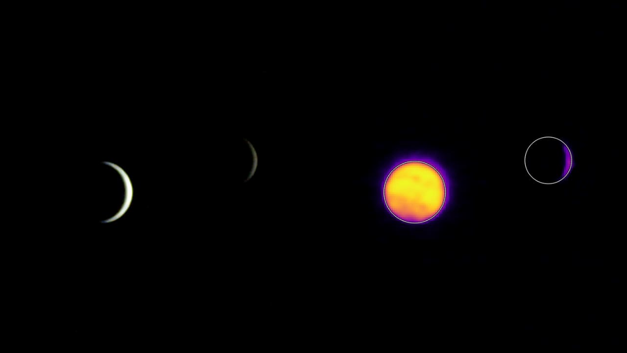
NASA’s ESCAPADE spacecraft captured rare visible and thermal infrared images of Earth and the Moon on July 3, 2026. Taken from 363,250 miles (584,600 kilometers) from Earth and 115,600 miles (186,100 kilometers) from the Moon, the photos serve as a critical calibration check for camera systems built by Northern Arizona University before the twin orbiters continue their journey toward Mars.
The images provide a stark visual contrast between the two celestial bodies. In visible light, both Earth and the Moon appear as crescents, with only around 8% of each face sunlit. However, the thermal infrared perspective reveals a different story: Earth’s nightside glows with heat from its atmosphere and surface, while the Moon remains dark and frigid.
Thermal Extremes and the NAU-Built Camera Systems
The Visible and Infrared Observation System cameras were developed by faculty and students at Northern Arizona University, with support from Rocket Lab and the University of California Berkeley. These instruments are designed to capture the emitted energy of planetary bodies, highlighting the role of insulating atmospheres. The students’ work on the cameras was led by professor Michael Shafer, professor of planetary science Christopher Edwards, and senior research scientist Chris Haberle, with additional support provided by professor David Trilling.
According to data from the mission, Earth is glowing at temperatures between minus 10 and 44 degrees Fahrenheit (250 to 280 kelvin). In contrast, the lunar far side, which lacks the insulating blankets of oceans and atmospheres, sits at a much cooler minus 280 degrees Fahrenheit (100 kelvin).
“Look close enough,” said Haberle, who processed the images, “and you may be able to spot little color variations that represent Earth’s temperature extremes.”
Chris Haberle, senior research scientist
Haberle, who processed the images, noted that these thermal variations allow for the identification of specific regions, such as Africa—which experiences some of the planet’s hottest temperatures—and Antarctica, one of the coldest.
Calibration for the Martian Magnetosphere
While these photos resemble a family portrait, they are primarily functional. Because Earth and the Moon are well-known targets, imaging them allows the team to verify the cameras’ accuracy before they reach the Red Planet.
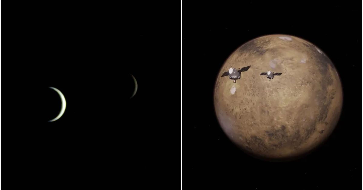
“Since Earth and the Moon are well-known targets, imaging them provides an important calibration check for ESCAPADE’s cameras.”
Rob Lillis, principal investigator at the University of California, Berkeley
We are thrilled that ESCAPADE was able to accommodate these excellent space-qualified cameras which will search for visible Martian aurora and investigate thermal properties of the Martian surface and atmosphere. Lillis
The mission, known as ESCAPADE (Escape and Plasma Acceleration and Dynamics Explorers), launched from Cape Canaveral on November 13, 2025. It is designed to study the hybrid Martian magnetosphere and determine how the planet got stripped of its atmosphere due to solar wind—a million-mile-per-hour stream of material from the Sun. According to NASA, the mission hopes to understand how Mars lost its once-thick atmosphere, which may have previously supported liquid water and possibly life.
The Flight Path to September 2027
The twin spacecraft are currently in a “loiter” orbit around the second Earth-Sun Lagrange point, a location in space about 1 million miles from Earth.
- November 2026: The spacecraft will fly by Earth, using the planet’s gravity to slingshot toward Mars.
- September 2027: Arrival at Mars.
- Mid-2028: Data collection begins after several months of entering different orbits for the two science phases.
Once at Mars, the mission will execute two distinct science phases. In phase 1, the orbiters will fly in nearly the same orbit in a string of pearls
formation. In phase 2, they will move into different orbits to study separate regions of the Martian magnetic environment simultaneously. The NAU-made cameras are expected to capture true-color views of Mars from never-before-seen angles and provide infrared data on the evolution of the polar caps.
The project also serves as a pipeline for future researchers. For the upcoming operations and analysis phase, Edwards and his colleagues plan to turn to students for help analyzing the images.
Keep reading
Japan Launches Kaguya Spacecraft to Map Moon in 2007
On September 13, 2007, Japan launched its advanced Kaguya spacecraft from the Tanegashima Space Centre aboard an H-IIA...

Astronomers Identify Eos, a Massive Molecular-Hydrogen Cloud Near the Sun
Astronomers have identified Eos, a massive molecular-hydrogen cloud located roughly 300 light-years away and spanning 40 full-Moon widths...
Researchers Find Diamond Melting Point Is Lower Than Previously Measured
Researchers zapping synthetic diamond plates with a powerful ultraviolet laser discovered the mineral's melting point is more than...
NASA and IBM Launch AI Model to Analyze 17 Years of Lunar Data
NASA and IBM released the NASA-IBM Lunar Foundation Model on Thursday, September 10.