
Wildfire smoke choked central and eastern Washington last August, leaving air quality in many small towns in hazardous territory for weeks and altering the light for anyone working outdoors, Fstoppers reported.
Driving east on I-90 toward Spokane during that smoky stretch, photographer Brae Hunziker and large-format photographer Bryan Birks stopped in small towns along the highway to document roadside history, farmland, and fading rural architecture. The thick smoke flattened colors and limited how long photographers could spend outside, forcing a faster pace on a route through communities shaped by railroads, agriculture, and resource extraction.
The first stop was Ritzville, a town of fewer than 2,000 people where I-90 meets U.S. 395. Around 1900, it was regarded as the biggest wheat shipping point in the world, moving nearly 2 million bushels through its warehouses in 1901 and 1902. When the interstate bypassed downtown, commercial development slowed, preserving much of the early-century streetscape.
About 25 minutes down the road lies Sprague, which began in the 1870s as a sheep camp called Hoodooville before taking its name from Union general and railroad executive John W. Sprague.
The Northern Pacific Railroad once operated a major locomotive repair center there, until an 1895 fire destroyed much of the town and prompted the railroad to rebuild in Spokane instead. Today, about 500 people live among the quiet streets where remnants of the rail era still stand.

Hunziker shot the journey on a Pentax 67II, using 55mm and 105mm lenses. He split his film evenly between Kodak Gold 200 and Kodak Ektacolor Pro 400, cropping several frames into panoramic 6×14 proportions that favor horizontal subjects like storefronts and grain cars.
On the second day, the route headed north from Spokane on U.S. 395 toward Colville and Kettle Falls through the Okanogan Highlands, a landscape carved by ice sheets from the last ice age. Colville, a commercial center of about 5,000 people, features one of the few remaining RadioShack stores in the country.
Just to the west, Kettle Falls sits near a submerged series of Columbia River cascades that served as a major Indigenous fishing site before the Grand Coulee Dam flooded the area in the 1930s.
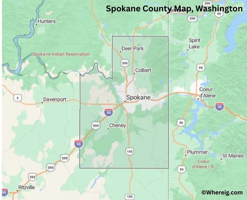
Wildfires destroyed nearly 650 homes across Washington that season, with the heaviest losses occurring in Spokane County, where more than 65,000 residents faced evacuation orders. Hunziker said that taking any exit off I-90 between the Vantage Bridge and Spokane reveals immediate subjects for photography along Washington’s historic eastern corridors.
Keep reading

How to Watch Kennesaw State at No. 18 Alabama Basketball – Yahoo Sports
Alabama basketball is officially hitting the road, but first, they have one more business trip to handle in...

Wyoming SUN Bucks Report Shows Success in Summer Food Assistance
The Wyoming Department of Family Services released a final report outlining the outcomes of the SUN Bucks program,...
Milwaukee Hemp Businesses Face Stricter Federal THC Limits in December
A new federal law taking effect on December 11 will impose stricter THC limits on hemp-derived products, forcing...
WV State Parks Foundation Launches $220,000 Trail Improvement Campaign
State park trails across West Virginia face mounting maintenance backlogs as a newly launched private fundraising campaign seeks...