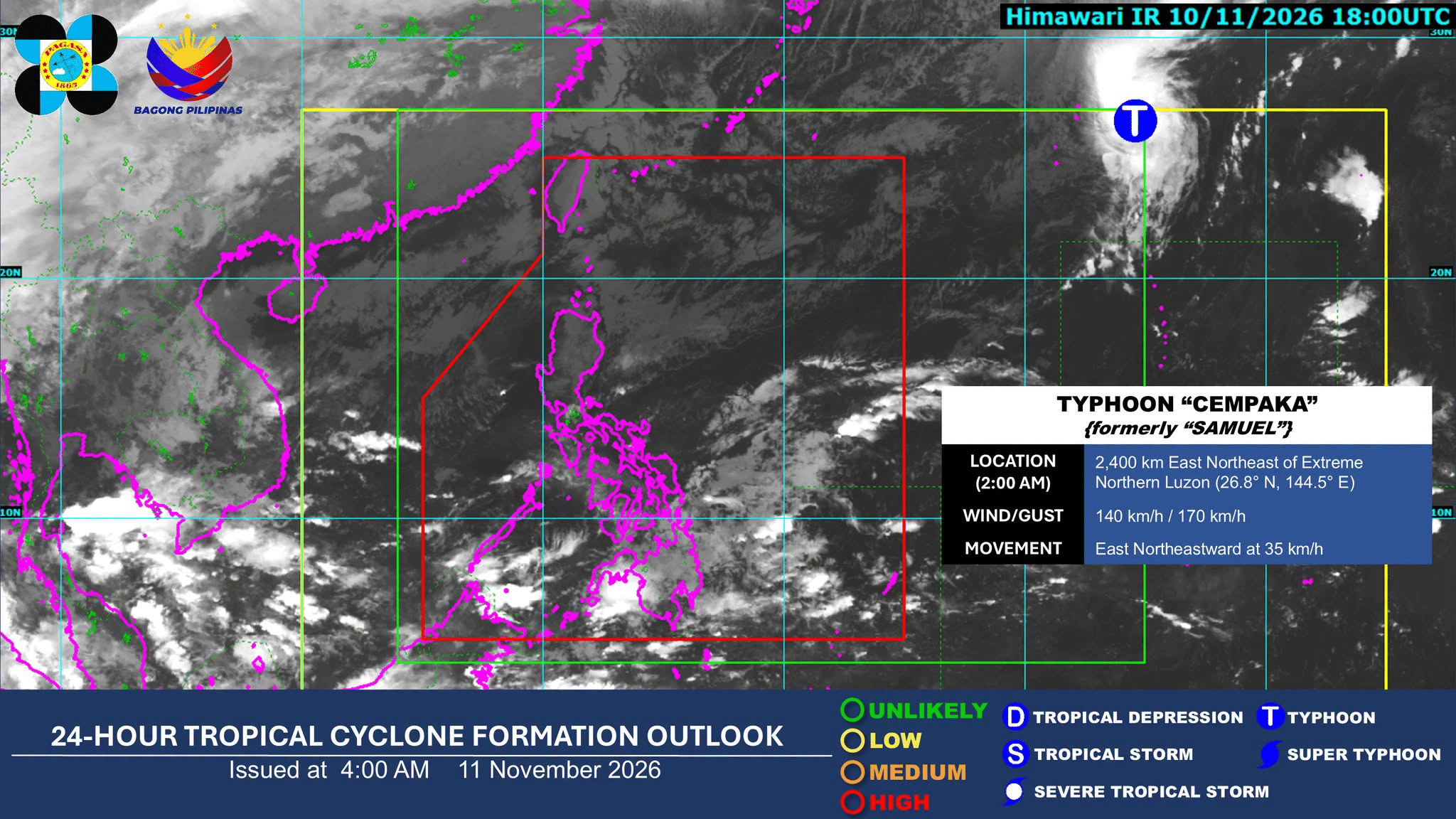
The northeast monsoon, known locally as amihan, and the easterlies are set to trigger widespread rainfall across the Philippines on Wednesday, Nov. 11, according to the state weather bureau, Pagasa.
As reported by Inquirer.net, the amihan is expected to bring rains over parts of Luzon, specifically targeting Cagayan, Isabela, Aurora, Quezon, and Camarines Norte. While Metro Manila and the rest of Luzon may only see isolated light rains and cloudy skies, weather patterns are changing across the archipelago.
The Philippine Atmospheric, Geophysical, and Astronomical Services Administration (Pagasa) has identified a complex interplay of climate drivers that will dictate conditions as the country moves toward the holiday season. These include the amihan, the easterlies, and a “very strong” El Niño phenomenon, according to Daily Tribune.
The combination of these weather systems presents immediate physical risks to several regions. While the amihan focuses on Luzon, the easterlies are expected to impact the Visayas and Mindanao. reported that the convergence of cold winds from the northeast monsoon and warm winds from the easterlies is forming a shearline, which could trigger thunderstorms in Camarines Sur, Catanduanes, Albay, and Sorsogon.
Pagasa has issued warnings regarding the potential for flash floods and landslides in areas where moderate to heavy rains are expected.

- Luzon: Cagayan, Isabela, Aurora, Quezon, and Camarines Norte (due to amihan).
- Visayas: Eastern Visayas, Central Visayas, and parts of Southern Leyte and Bohol (due to easterlies).
- Mindanao: Caraga, Davao Region, Misamis Oriental, and Camiguin (due to easterlies).
The Philippine News Agency noted that the easterlies will specifically bring scattered rain showers and thunderstorms to the Caraga and Davao regions. In Cebu, Cebu Daily News reported that while weather may remain generally fair, residents should prepare for isolated rain showers and thunderstorms. Despite the rain, the heat index in Cebu could still reach 37 degrees Celsius, placing it in the “extreme caution” category.
| Source | Cempaka Wind Speed (kph) | Cempaka Gusts (kph) | Location Detail |
|---|---|---|---|
| Inquirer.net | 140 | 170 | 2,440 km east-northeast of Extreme Northern Luzon |
| BusinessWorld Online | 150 | 185 | Monitoring outside PAR |
| Cebu Daily News | 150 | 185 | 1,590 km east-northeast of extreme Northern Luzon |
The upcoming months present a contradictory climate profile. While the amihan will lower nighttime temperatures across much of the country, the prevailing El Niño ensures that daytime heat remains elevated. Ana Liza Solis, assistant weather services chief at the Pagasa Climatology and Agrometeorology Division, noted that these contrasting patterns will persist as the country approaches Christmas, according to Daily Tribune.
There is also a looming concern regarding the heat index. While extreme heat index levels are currently isolated, Pagasa projects that dangerous heat index readings could spread during the first quarter of 2027. Experts warn that hyper-saturated humidity can often lead to localized atmospheric downdrafts, which trigger the very thunderstorms that eventually dissipate the intense heat.
As the year draws to a close, the state weather bureau remains vigilant. While 19 tropical cyclones have entered the Philippine Area of Responsibility so far in 2026, there remains an equal chance that no further storms will form before the end of December, or that one final typhoon—potentially a super typhoon—could enter the region, according to Solis.

Whether the seasonal transition remains manageable or escalates into a more volatile period for the agricultural and coastal sectors remains the primary concern for local authorities.

Brandon Sklenar Opens Up About His Personal Battle With Body Dysmorphia
Actor Brandon Sklenar is opening up about a personal struggle with body dysmorphia as he begins promoting his...

Trump and Albanese Face Ultimatum to Fix Economy to Keep Jobs
Economic anxiety is reshaping politics in both the United States and Australia. Voters are sending a blunt message...

ASAM Releases Clinical Guide for Managing Medetomidine Exposure
The American Society of Addiction Medicine (ASAM) has released the first national clinical guide for managing the intoxication...

Epion Study Associates Keratoconus Severity and Age with ECD Decline
Keratoconus severity correlates with cell density decline Corneal endothelial cell density (ECD) drops as keratoconus advances and patients...