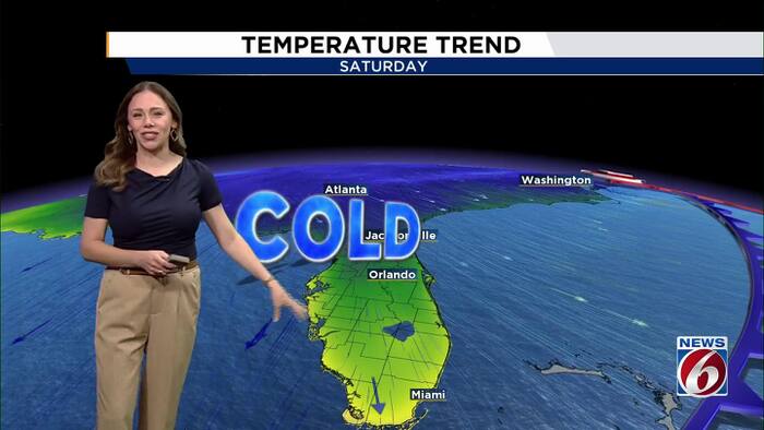
Central Florida weather will change late Thursday night as a strong cold front approaches the region.
According to a report from WKMG, the arrival of this system will bring the coldest temperatures recorded so far this fall.
The transition begins with a relatively mild start to the workweek. On Monday and Tuesday, residents can expect a mix of clouds and sunshine with minimal precipitation. High temperatures will hover in the low 80s, while morning lows will sit between the upper 50s and upper 60s. Patchy fog may impact visibility during the early morning hours on both days.
The atmosphere begins to shift on Wednesday. A disturbance moving across Florida is expected to increase rain chances to between 30% and 40% during the afternoon and evening. Despite the potential for scattered showers and thunderstorms, daytime highs are forecast to remain steady in the low 80s.
By Thursday, clouds and lingering showers will persist until the cold front pushes through late that night and into early Friday morning. While some showers may occur south of Orlando, widespread heavy rain is not anticipated during this transition.

The most dramatic change occurs as the front settles in, ushering in much cooler and drier air. On Friday afternoon, temperatures will struggle to reach the upper 60s or low 70s. Gusty northwest winds are expected to accompany this shift, which will make the air feel even colder than the thermometer suggests.
The weekend marks the peak of the cold snap. Saturday and Sunday mornings are projected to be the coldest of the season to date. In much of Central Florida, temperatures could drop into the mid to upper 40s. Areas closer to the Space and Treasure coasts may see slightly milder morning lows in the low to middle 50s.

The impact of the wind chill will be a primary factor for those outdoors. For residents in areas near or north of Orlando, there is a 30% to 40% chance of experiencing wind chills in the upper 30s during both Saturday and Sunday mornings.
The following table outlines the projected temperature shifts for the week:
| Day | Expected Highs | Expected Lows | Weather Conditions |
|---|---|---|---|
| Monday & Tuesday | Low 80s | Upper 50s – Upper 60s | Clouds, sun, patchy fog |
| Wednesday | Low 80s | Not specified | 30%–40% chance of rain/storms |
| Thursday | Not specified | Not specified | Clouds and lingering showers |
| Friday | Upper 60s – Low 70s | Not specified | Gusty northwest winds |
| Saturday | Low to Mid 60s | Mid to Upper 40s | Coldest morning temperatures |
| Sunday | Returning to 70s | Mid to Upper 40s | Gradual rebound |
While the weekend mornings will remain chilly, the afternoons will show signs of recovery. Saturday highs are expected to stay in the low to mid-60s. By Sunday, temperatures are forecast to gradually rebound, with parts of the area seeing a return to the 70s.
Related reading

Candlelight Weekend Kicks Off Holiday Festivities in Downtown Frankfort
Downtown Frankfort transitions into the holiday season this week as Candlelight Weekend kicks off on Thursday. The multi-day...

Liv Diaz named Peach Belt Defensive Player of the Week – Georgia College
Liv Diaz recorded a career-high 27 digs in a single match to help secure her selection as the...

Capital for Change Celebrates 10 Years of Expanded Operations
“To go into Bloomfield and to an all-white neighborhood to pose as the buyer of a house and...

California Voters Reject Proposition 40 Billionaire Tax Proposal
California voters have rejected a proposal to charge billionaires a one-time 5% tax on most of their wealth,...