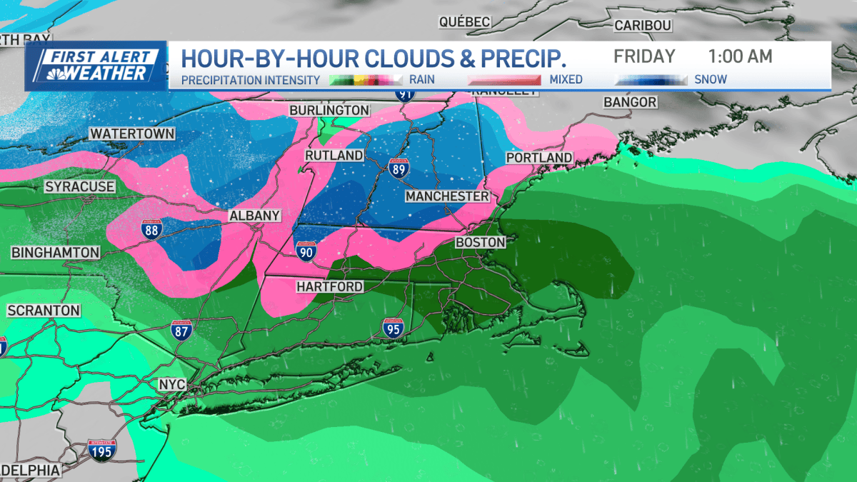
A developing low-pressure system off the Mid-Atlantic coast could bring the season’s first snowflakes to parts of the New England region this week, NBC10 Boston reported.
The exact path of the storm remains highly uncertain, leaving residents in the Boston area unsure if they will face a wintry mix or simply a rainy, windy weekend. This uncertainty dictates whether the region sees its first major snow accumulation or stays dry.
Current forecast models present two distinct possibilities for the upcoming weather pattern.
One set of models tracks the center of the storm close to southern New England late Thursday evening and into Friday. Under this scenario, much of the Boston area would likely experience chilly rain.
However, some wet snow or a wintry mix could develop over higher terrain during this period. The core of the colder air required for widespread snow might not arrive until Saturday, which could mean most of Greater Boston misses out on a snowy forecast for now.
Even if snow fails to materialize, the storm could bring heavy wind. Forecasters expect gusty winds from the north-northeast reaching speeds of 30 to 40 mph.

Other forecast models suggest a different outcome, keeping the storm completely offshore. If this scenario plays out, the forecast for the end of the week would remain dry for most of the region.
A storm tracking further out to sea would not eliminate all weather impacts. Residents near the coast would still face gusty winds and rough surf conditions.
Temperatures are expected to remain relatively mild for the season, with highs in the 40s and lows in the 30s over the weekend.
| Weather Variable | Forecast Detail |
|---|---|
| High Temperatures | In the 40s |
| Low Temperatures | In the 30s |
| Wind Gusts | 30–40 mph |
As the low-pressure system continues to organize off the coast, the accuracy of these models will depend on how the storm’s track evolves through Friday.
Related reading

Indotronix Seeks Remote Talent Acquisition Early Career Recruiter
Indotronix is recruiting a Talent Acquisition Specialist to manage early-career and college recruiting efforts for the Aerospace &...

Nebraska DC Rob Aurich Signs Two-Year Contract Extension
Nebraska defensive coordinator Rob Aurich has signed a two-year contract extension, ESPN reported Monday. The move comes as...

Thomas Massie Files Resolution to Impeach Pete Hegseth
The House of Representatives opened its session on Monday with a direct challenge to the Trump administration, as...

Emergency Order to Keep West Michigan Coal Plant Open Set to Expire
The federal emergency order keeping the J.H. Campbell coal-fired power plant in West Michigan operational is scheduled to...