Sacramento County Maps Out Winter Storm Preparations as Strong El Niño Looms
Sacramento County officials laid out a detailed blueprint for a potentially punishing winter on Nov. 3, warning that a strong El Niño could steer heavy rain and flooding toward the region while urging residents not to wait for the forecast to firm up before preparing. During the Board of Supervisors meeting, the County’s Office of Emergency Services presented its comprehensive storm-season strategy, drawing on technical briefings from National Weather Service meteorologists who described this year’s El Niño as potentially record-breaking. Sacramento County reported that the presentation spanned everything from the mechanics of how forecasters track shifting weather patterns to the concrete steps households should take immediately, before the first major storm arrives.
With the wet season approaching, officials noted that while El Niño increases the likelihood of above-average rainfall, it does not guarantee a deluge, and even a single powerful storm can trigger localized flooding, downed trees and extended power outages across the region.
How El Niño Shapes the Jet Stream
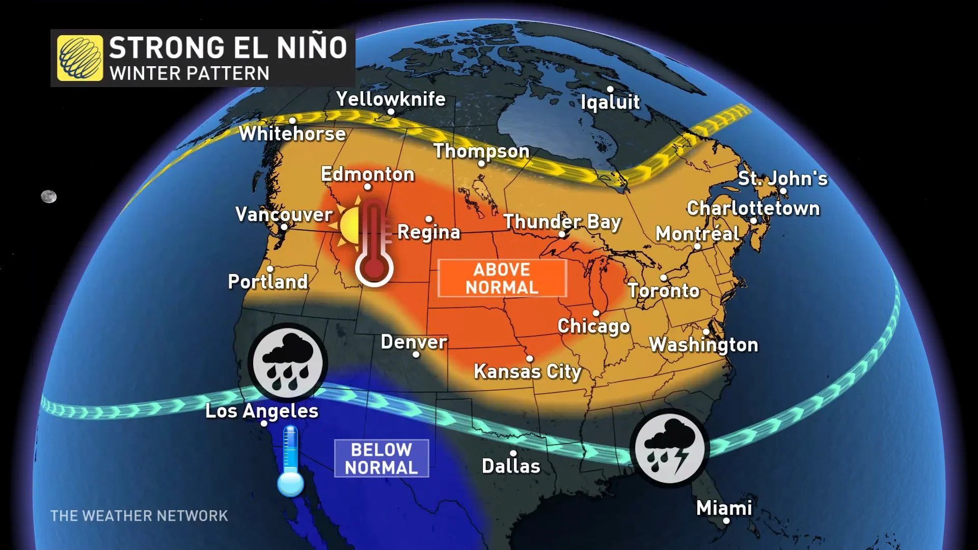
NWS Meteorologist Courtney Carpenter walked supervisors through the science behind the forecast, explaining that El Niño represents the warm phase of the El Niño-Southern Oscillation, a recurring climate pattern centered in the tropical Pacific Ocean. Under normal conditions, strong winds along the Equator push warm surface water west toward Asia; during El Niño, those trade winds weaken, allowing warmer water to shift east toward the Americas. That displaced heat releases moisture into the atmosphere and can alter the position of the jet stream, the high-altitude river of air that helps steer storm systems across North America.
“El Niño is the warm phase of a climate pattern called El Niño-Southern Oscillation (ENSO), which occurs in the tropical Pacific Ocean. Normally, strong winds along the Equator push warm ocean water west toward Asia. During El Niño, those winds weaken, allowing warmer water to shift east toward the Americas. This releases heat and moisture into the atmosphere and can change the position of the jet stream, which helps steer weather systems across North America. El Niño is not a storm or an atmospheric river. It is a climate pattern that can influence weather conditions around the world,” said Carpenter.
This year’s event is tracking toward very strong territory, with ocean temperatures in the tropical Pacific running several degrees warmer than average. Those warmer waters can contribute significantly more heat and moisture to the atmosphere, raising the potential for heavier rainfall and more intense storm systems along the West Coast. To track these evolving conditions, the NWS Sacramento office relies on an array of tools including weather models, satellite imagery, radar networks and thousands of surface observations. The office works closely with local emergency management agencies, including Sacramento County OES, to help communities prepare for and respond to hazardous weather.
Coordinating a Countywide Response
Mary Jo Flynn detailed how her office serves as the coordination hub, bringing together representatives from cities, special districts and nonprofit organizations to discuss potential emergency scenarios and catalog the resources each entity can provide. With more than 20 years of experience in emergency services, Flynn stressed that effective preparation means knowing what to expect and having a clear plan for responding, not merely stocking supplies in a closet.
“Our office brings together representatives from cities, special districts and nonprofit organizations to discuss potential emergency scenarios and the resources and services each can provide. This helps everyone understand what resources are available and how to access them during an emergency,” said Flynn.
For residents, the county outlined specific steps to take now. People can register for emergency alerts or update their contact information at Ready.SacCounty.gov, and follow real-time updates from the National Weather Service Sacramento office, the Department of Water Resources at StormReady.org, and local radio and television news. Officials also encouraged neighbors to check in with one another and discuss how to share information and assistance if flooding, downed trees or power outages occur. The county advised residents to establish plans for contacting and reuniting with family members, consider obtaining flood insurance, and make copies of important documents to store in a waterproof location. Flynn noted that people genuinely try to help one another during emergencies, with neighbors, nonprofits and faith-based organizations all playing critical roles, and pointed to volunteer opportunities such as signing up in advance with the Sacramento Medical Reserve Corps.

One Storm Can Trigger Flooding Regardless of Forecast
Forecasters emphasized that while this strong El Niño raises the odds of a wet winter, the climate pattern does not promise one, and no model can predict exactly how it will affect Sacramento County this season. That uncertainty is precisely why officials are pushing preparation now: because even one major storm can cause significant flooding and disruption regardless of the seasonal outlook. The full El Niño presentation from the Nov. 3 Board of Supervisors meeting is available for residents through the county’s agenda portal.
As winter approaches, Sacramento County OES will maintain close coordination with the National Weather Service and local partner agencies, standing ready to activate emergency resources if the jet stream delivers the moisture that forecasters continue to monitor across the Pacific.
As we enjoy the cooler weather that comes with fall, it’s a great time to start preparing for what the next season will bring. This year, Sacramento County’s partners at the National Weather Services are expecting a strong El Nino year, which means the potential for heavy rain,… pic.twitter.com/rBV1egDjrS
More on El Niño
Related reading

Idaho voters reject abortion rights measure to keep ban intact
Pregnant Idahoans who need an abortion will keep driving to Utah, and the doctors who stayed behind will...

Democrats Poised to Flip Georgia House for First Time in Over 20 Years
Democrats have netted enough seats to seize control of the Georgia House of Representatives for the first time...

Happy Days’ stench limited to back entrance, sniff test finds—no odor on Waiʻalae Ave frontage
The rot is real but contained: as of Halloween, the stench from the collapsed Happy Days restaurant in...

Thomas Howard Hall, 56, landscaper and DuPont Country Club groundskeeper, dies October 23, 2026
Thomas Howard "Tom" Hall, 56, passed away suddenly on October 23, 2026, leaving behind the manicured fairways he...