Sierra Nevada’s Defining Landmarks Offer A Geologic Cross-Section of California
When travelers look westward toward the spine of California, they rarely anticipate the sheer scale of the landscape awaiting them. The state’s Sierra Nevada range contains nearly every terrestrial extreme imaginable within a single mountain system. From ancient granite monoliths carved by glacial ice to subterranean corridors once echoing with the strike of a gold miner’s pick, the range compresses millions of years of natural and human history into a handful of distinct corridors.
Understanding these destinations requires looking past the standard postcard imagery to examine how geology, timing, and conservation policy dictate access. While millions flock to well-worn viewpoints, park managers and seasonal shifts constantly reshape how visitors experience these spaces.
Granite Monoliths and Valley Panoramas
At Tunnel View in Yosemite National Park, the entire glacial valley opens to the public at once without requiring a single step of hiking. Positioned at the east end of the Wawona Tunnel on Highway 41—a route that opened to traffic in 1933—the transition from nearly a mile of darkness into bright daylight remains one of the most recognizable reveals in the American West. El Capitan rises 3,000 feet on the left, while Bridalveil Fall sits opposite beside the Cathedral Rocks.
500 million years of Earth’s history are written in the rocks of the Sierra Nevada. 🗺️⛰️The Sierra Nevada is one of the most iconic landscapes in the western U.S., a major mountain range stretching north to south along eastern California and into a small portion of western… pic.twitter.com/ffyGLDfyKg

Historical accounts indicate that Thomas Ayres produced the valley’s initial visual documentation in 1855 at Artist Point, situated just up the slope. While the site stays open year-round, late afternoon provides the sharpest illumination before shadows consume the valley floor.
Further east on the range’s dramatic escarpment, Mount Whitney reaches 14,505 feet as the highest point in the contiguous United States. Visitors driving Whitney Portal Road encounter switchbacks and granite walls without ever lacing up hiking boots. Those attempting the 22-mile round-trip summit trail face a rigorous 6,200-foot elevation gain crossing from Inyo National Forest into Sequoia National Park. Peak-season permits between May 1 and November 1 are awarded by lottery, with applications open from February 1 to March 1, leaving off-season climbs subject to unpredictable ice and snow.
Ancient Giants of the Forest Floor
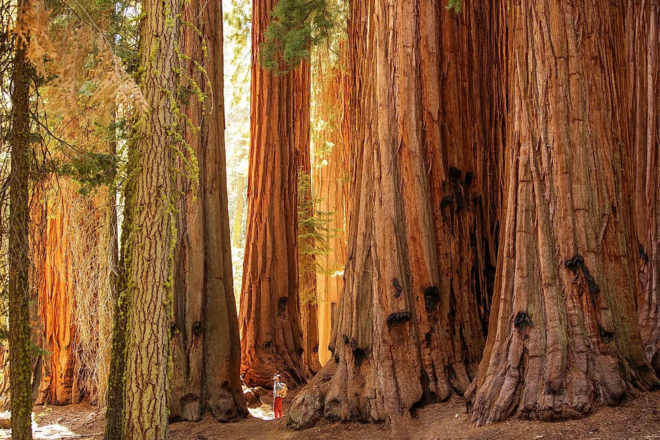
Moving south along Highway 41 brings travelers to the Mariposa Grove of Giant Sequoias, Yosemite’s largest sequoia grove. Home to more than 500 mature trees.
Across the divide in Sequoia National Park stands the General Sherman Tree. While neither the tallest, widest, or oldest, it reigns as the largest known living single-stem tree on the planet by volume of wood. Standing roughly 275 feet tall with a ground circumference of nearly 103 feet, the 2,000-year-old specimen was declared the largest in the world in 1931. The surrounding Giant Forest links to the Congress Trail, where visitors can continue past the House and Senate groups.
The General Grant Tree mirrors this immense scale within Kings Canyon National Park as the planet’s second-largest specimen following the General Sherman, having received designation as the official national Christmas tree back in 1926. Stretching from the Sierra foothills close to Fresno up toward Grant Grove, Highway 180 eventually descends into one of North America’s deepest canyons, which was carved by the South Fork of the Kings River.
Alpine Waters and Historic Trails
High on the northern stretch of the range, Emerald Bay is a glacier-carved inlet on Tahoe’s west shore. Designated a National Natural Landmark in 1969, the bay houses Fannette Island and its stone tea house, which closes from February through mid-June for nesting geese. On the shoreline stands Vikingsholm, a 38-room mansion built in 1929 by Lora Josephine Knight. The structure showcases intricate carvings, hand-forged ironwork, and a sod roof planted with living grass, modeled after 11th-century Scandinavian architecture.
Reaching the estate requires walking the one-mile trail from the Harvey West lot, as there is no vehicle access to the shoreline.
Further down the eastern slope near Mammoth Lakes, Devils Postpile National Monument preserves a wall of basalt columns up to 60 feet high, protected by presidential proclamation since 1911. Formed by a lava flow less than 100,000 years old that cooled and cracked, and glaciers later sheared off one face, exposing them in cross-section.
Gold Country’s Subterranean Legacy
Shifting from the high alpine passes to the western foothills reveals the industrial scale of California’s Gold Rush. Grass Valley’s Empire Mine stands out as one of the state’s earliest, deepest, and most productive gold excavations, as well as a premier example of a preserved hard-rock operation in the area. Between 1850 and its closure in 1956, the mine produced 5.8 million ounces of gold from 367 miles of underground passages.
Although water completely fills the lower tunnels, the welcome center features the “Secret Room”—distinguished by its covered-up windows—which displays a miniature replica of the complete underground tunnel system. Set among revitalized landscapes featuring a mirror-like pool, decorative water jets, and greenhouses, the Empire Cottage on the surface was created by Willis Polk in 1897 to serve mine proprietor William Bourn Jr.
Related reading

Ohio Dominican Women’s Golf Finishes 8th at PGA HOPE Collegiate
Rishty Paces ODU at Historic First PGA HOPE Collegiate in Springfield The Ohio Dominican Panthers women's golf team...

NYSE to launch binary return options for 12 underlying securities
"We've seen this incredible growth in the US options market over the last several years," said Kevin Tyrrell,...

Minnesota Wild second-period strength drives Western road trip success
Second-period strength drives the Minnesota Wild on a grueling Western road trip The second period of any National...

Colts agree to trade DeForest Buckner to 49ers, NFL Network reports
Colts Deal DeForest Buckner to 49ers as Indianapolis Sheds Pro Bowl Talent The Indianapolis Colts are blowing it...