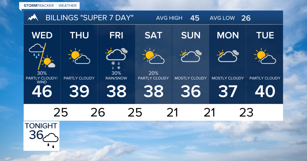
A storm bringing snow and 60 mph gusts moves into south-central and southeast Montana and northern Wyoming, KTVQ reported.
Short-sleeve weather across south-central and southeast Montana and northern Wyoming is coming to an abrupt halt as rain, snow, and strong winds move into the region, KTVQ reported.
A storm system tracking out of the Great Basin is pushing clouds, rain, and snow showers across the area. Most locations west of a Sheridan-to-Baker line are expected to pick up at least a tenth of an inch of precipitation, with higher totals settling southeast of Billings by Tuesday night.
Colder air arriving behind the system will turn much of that precipitation into snow. Accumulations are projected to reach around an inch near Livingston, about 2 inches or more in Paradise Valley, and higher amounts in the mountains.
Bozeman Pass could receive as much as 6 inches of snow. That accumulation, combined with blowing snow, threatens to create difficult travel conditions around Livingston and Judith Gap.
On Wednesday, the storm moves east into the Dakotas. Lower elevations will likely see rain mix with or change entirely to snow during the morning hours before tapering off.
Winds pose the biggest hazard after the precipitation. Widespread gusts will top 40 mph, while the US-191 corridor could experience gusts reaching into the 50s.
Far southeast Montana faces the strongest winds. Areas around Baker will see frequent gusts in the 50s and occasional spikes reaching 60 mph.
| Location | Expected Condition | Wind / Snow Details |
|---|---|---|
| Bozeman Pass | Heavy Snow | Up to 6 inches possible |
| US-191 Corridor | High Winds | Gusts reaching the 50s mph |
| Baker Area | Severe Gusts | Frequent gusts in the 50s, occasional 60 mph |
Mountain-wave winds could also develop briefly near Sheridan and the Bighorn Mountains on Wednesday. Temperatures will drop into the lower to middle 40s.

Weak high pressure brings a quieter, dry day on Thursday with highs near 40 degrees. Morning fog may form in areas with lingering ground moisture where skies clear and winds die down.
Friday brings another incoming weather system with highs ranging from the upper 30s to the lower 40s. Snow is possible across parts of the region, though forecasted totals remain uncertain.
Chances for rain and snow linger into Saturday as the late-week system pushes through. Current trends point to a weaker and farther-south storm track, keeping lower-elevation snowfall generally below an inch.
Elevations above 4,000 feet could pick up 1 to 2 inches, while mountain areas may receive several inches. Sunday through Tuesday will maintain cool, seasonable conditions with highs in the 30s and lower 40s and only minor chances for light rain or snow.
Worth a look

Columbus Blue Jackets Offer Holiday Gift Packs With Tickets and HOMAGE Apparel
Packages starting at $115 give fans two game tickets and an exclusive long-sleeve tee through December 31, nhl.com...
Froth Coffeehouse Offers Neutral Bridal Shower Space and Wedding Morning Delivery
A Scandinavian grandmother's home was the design target when owner Hope Burchill built Froth Coffeehouse in Fargo, giving...

Laramie Man Sentenced to 30 Years for Child Sexual Exploitation, Jailbreak Attempt
A 23-year-old Laramie man will spend three decades behind federal bars for child sex crimes, concluding a legal...

New Mexico Judicial Commission Approves Higher Pensions, Faster Vesting for Judges
New Mexico judges and magistrates will vest in their retirement plans faster and reach higher maximum pensions under...