
Utah residents facing the final countdown for Halloween costumes may need to pack an umbrella, as two separate weather systems are expected to move through the state this weekend. While the timing remains fluid, the National Weather Service indicates a high probability of rain, with the most potent system arriving late Saturday night and persisting into early next week.
The forecast creates a classic meteorological gamble for Saturday evening’s trick-or-treating. According to reporting from The Salt Lake Tribune, forecasters are currently split on the exact timing of the precipitation, leaving a window where it will either be raining during peak hours or it won’t. For those planning their routes, the stakes are a matter of convenience and costume preservation, as the second of the two systems is expected to bring widespread accumulations.
Potent storm follows mild Friday showers
The first weather event is slated for Friday, which some regions in the East call Mischief Night. This system is the result of a deepening trough along the West Coast merging with tropical moisture from the south. However, current models suggest this initial wave will be relatively mild, likely resulting in only scattered showers concentrated in southern Utah.
With just days to go until the spookiest holiday of the year, the American Red Cross of Utah is urging Utahns to prevent their Halloween night from turning tragic by practicing proper safety while trick-or-treating.What to know: https://t.co/zB30jEO28I pic.twitter.com/8A3JrZNqLj
The real concern for the Wasatch Front arrives later. A second, more potent storm is forecast to hit late Saturday night and continue through Sunday and Monday. The variance in current modeling is significant: optimistic projections suggest up to a half-inch of rain across much of the state, while wetter models indicate widespread accumulations between one and one and a half inches.
For those in higher elevations, the rain won’t stay liquid for long. The National Weather Service forecast discussion notes that precipitation should transition to snow in areas over 7,000 to 8,000 feet by Sunday night and Monday morning.
The long-term trend of Halloween weather
While the immediate forecast is volatile, a deeper dive into historical data reveals a slow but steady shift in Salt Lake City’s autumn climate. Analysis of daily low temperatures from the Salt Lake City weather station dating back to 1930 shows an upward trend of 0.48 degrees Fahrenheit per decade.
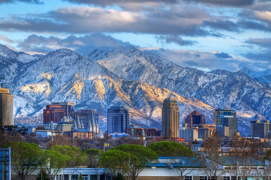
This warming trend isn’t a simple byproduct of global climate change. Much of the increase is attributed to the urban heat island effect, where the expansion of pavement and buildings in the Salt Lake Valley traps heat, keeping nighttime temperatures warmer than they would be in rural surroundings. This specific urban warming explains about 7% of the temperature variation over the last 96 years; the rest is driven by the inherent randomness of yearly weather patterns.
Despite the warming, the risk of rain remains a historical constant. About 24% of Halloweens since 1930 have seen measurable precipitation. However, a “White Halloween” remains an extreme rarity for the valley. In the last century, Salt Lake City has seen measurable snow on October 31 only five times: 1956, 1971, 1977, 2003, and 2004.
| Historical Metric (Salt Lake City) | Data Point |
|---|---|
| Temperature Trend since 1930 | +0.48°F per decade |
| Probability of Precipitation | ~24% of Halloweens |
| Forecasted Low (Halloween Night) | 54°F |
The reliability gap in short-term forecasting
The current uncertainty stems from a lack of consensus in the modeling regarding exactly when and where the core of the second system will land. Because hour-by-hour forecasts several days out are minimally reliable, residents are left with a “scattered rain” probability for the primary trick-or-treating window, followed by a sharp spike in precipitation later in the evening.

This unpredictability places the burden on the community to remain flexible. While temperatures will stay well above freezing along the Wasatch Front—meaning an inch of snow on the ground is virtually impossible this year—the potential for an inch or more of rain could turn neighborhood sidewalks into streams by Sunday.
Since 1948, there’s never been an inch or more of snow on the ground on Halloween. That streak is safe this year, but the moisture levels suggest that for many, the most frightening part of the weekend will be the weather forecast.
Keep reading

PM General Manager at Cook Out: High Pay with a 4 Day Work Week
Cook Out is seeking a Restaurant PM General Manager, offering a salary between $55,000 and $80,000. The position...

Utah vs. Michigan: Morgan Scalley Thrives While Kyle Whittingham Struggles
In 2026, the contrasting fortunes of Utah and Michigan have sparked a debate over coaching decisions and program...

Platt and Huang: Good People Cannot Enter Heaven Based on Merit
Good people do not enter heaven based on their own merit because biblical teaching emphasizes human sinfulness in...
Dr. Kirk Nooks Visits TCAT Dickson for Leadership Motion Tour
Dr. Kirk A. Nooks, President and CEO of the Council on Occupational Education (COE), visited the Tennessee College...