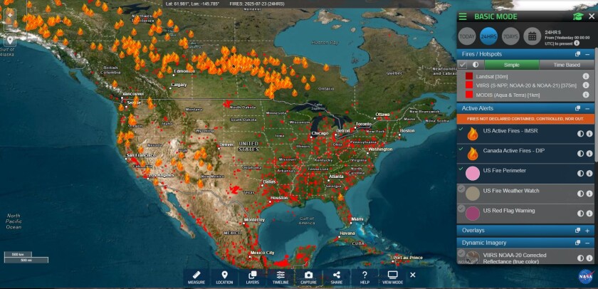
Tracking Fires Through the Western Fire Chiefs Association Fire Map
When emergency officials and residents track active wildfire activity, smoke movement, and fire-weather threats across the western United States and Alaska, platforms like the Western Fire Chiefs Association (WFCA) Fire Map provide near real-time intelligence derived from satellite data and federal incident tracking systems.
According to the Western Fire Chiefs Association, wildfire tracking relies on satellite detections from NASA FIRMS—incorporating VIIRS, MODIS, and Landsat thermal sensors—alongside NOAA’s GOES geostationary satellites operating with a five-minute refresh rate. These raw detections are verified by Satellites on Fire (SoF), an artificial intelligence system designed to filter and confirm wildfire hotspots across multiple sensor inputs.
Interactive Platform Integrates Incident Records and Live Dispatch Calls
The interactive platform consolidates multiple data streams to give users a comprehensive view of active incidents. Official IRWIN incident records and federal FEDS perimeters display active fire boundaries alongside growth tracking and containment status. The map also integrates live 911 dispatch calls for fires, medical situations, and other emergencies through PulsePoint.
Users monitoring conditions can toggle several specialized data layers:
- Multi-satellite heat detections combining polar-orbiting and geostationary thermal sensors.
- Short-range smoke and lightning observations alongside early perimeter and 3-hour spread forecasts for California fires via FIRIS.
- Live firefighting aircraft tracking, including air tankers, helicopters, and reconnaissance flights filtered to a maintained allowlist of wildfire-tasked tail numbers.
- Real-time feeds from ALERTCalifornia, ALERTWest, and partner live fire camera networks.
- Meteorological context provided by National Weather Service Red Flag warnings and Storm Prediction Center fire-weather outlooks.
The platform allows users to explore live data directly through the WFCA Fire Map, where deep links capture specific viewports for sharing or bookmarking regional incidents. Emergency agencies emphasize that fire dispatch and location data remain approximate and are subject to real-time operational updates.
Related reading

No Clear Winner in Pivotal Israeli Election as Netanyahu Faces Tight Race
Israel's High-Stakes Turnout Yields No Clear Winner in Tight Parliamentary Race With a majority of the votes counted...

Indianapolis Trick-or-Treat Hours Set for 6 to 8 p.m
As the countdown to Halloween reaches its final hours, communities across Central Indiana are locking down their schedules,...

Sophia Bush Details Alleged Abuse Behind Her Chicago P.D. Exit in New Memoir
Nearly a decade after walking away from her starring role on NBC’s hit police procedural, actress Sophia Bush...

US Government Sues Idaho Over Water Rights at Idaho National Laboratory
The federal government has sued the state of Idaho in U.S. District Court, seeking to block state officials...