If you are planning to travel through the Sierra Nevada or drive during the morning commute in Reno, Sparks, or Carson City this Wednesday, November 18, you should prepare for a messy, high-stakes start to the day.
A moisture-rich Pacific storm system is set to collide with a cold front, bringing heavy snow and dangerous wind gusts that will turn mountain passes into near-impassable terrain.
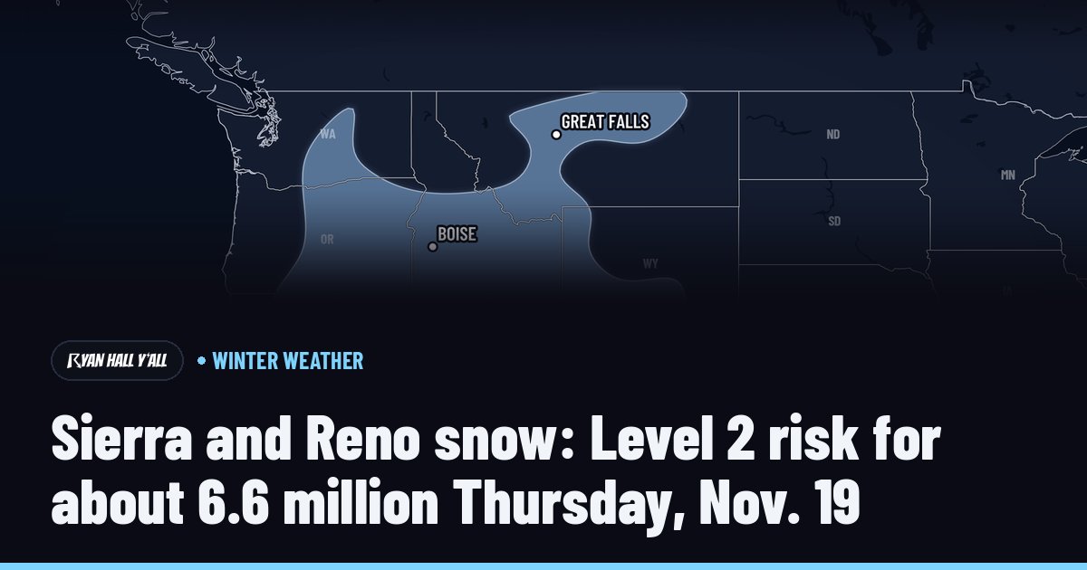
According to the latest forecast from Ryan Hall, Y’all, a Slight risk—Level 2 out of 5—has been issued for approximately 1.08 million people across northern California and western Nevada. While the valley floors may only see a brief, slushy window of snow early Wednesday, the mountains are bracing for a multi-day event that threatens to bring several feet of accumulation.
The core of this storm is focused squarely on the higher elevations. Meteorologists tracking the system expect heavy snowfall to begin late Tuesday night and persist through Wednesday afternoon. Snow accumulation totals are high: elevations above 5,000 feet could see 1 to 3 feet of snow, while the terrain above 8,000 feet may be buried under 3 to 4 feet, with the highest peaks potentially reaching 6 to 7 feet.
Travelers on critical arteries like Interstate 80 over Donner Pass and U.S. 50 over Echo Summit should prepare for whiteout conditions. Beyond the sheer volume of snow, wind is a major complicating factor. Ridge-top gusts are forecasted to exceed 60 mph, while lower mountain elevations can expect sustained gusts between 40 and 55 mph. These winds will likely cause rapid drifting, effectively erasing cleared roads in a matter of minutes.

For those living in the valleys, the forecast is more nuanced. The primary window for snow in Reno, Sparks, and Carson City is narrow, occurring roughly between 4 AM and 7 AM Pacific on Wednesday. This timing is dictated by the “snow level”—the altitude where precipitation transitions from rain to snow.
Early Wednesday, that line is expected to drop between 2,500 and 3,500 feet, which is low enough to bring a dusting or slushy accumulation to the valley floor.
However, as the storm’s heaviest moisture moves through, the snow level is projected to climb to between 4,500 and 6,000 feet, lifting the threat away from the urban centers for the remainder of the day. The primary risk here is not a major accumulation, but rather a slick, treacherous morning commute on bridges and overpasses.
The situation remains fluid, however. Colder air trailing behind the front could drop snow levels back down to 3,000 to 4,000 feet by Wednesday night, potentially creating a secondary round of winter weather for the valleys. Officials and meteorologists are urging residents to monitor local updates as the exact timing of these shifts remains subject to change.
This weather event is not a quick-moving storm. The system is expected to linger, with heavy, consistent snow continuing to pile up on the higher terrain throughout Thursday and Friday, November 19 and 20. The Ryan Hall, Y’all winter storm outlook maintains a Slight risk for the Sierra Nevada and the western Great Basin through Thursday, signaling that the mountain travel issues are far from over.
If you have plans to head into the mountains late this week, the consensus among weather experts is simple: delay if possible. For those who must travel, carrying chains, extra water, heavy blankets, and maintaining a full tank of gas are essential safety measures.
The combination of intense snowfall rates—reaching 1 to 2 inches per hour—and high winds will make standard mountain travel very difficult to impossible for the next several days.
Related reading

Ohio University Expands BSN Program While Sustaining Strong Student Outcomes
Ohio University is increasing its Bachelor of Science in Nursing (BSN) enrollment to address the growing need for...

New York City Is Embarking on a Significant Restructuring of Its Police Department
New York City is embarking on a significant restructuring of its police department, as Mayor Zohran Mamdani announced...

CT Man Running Manchester Road Race to Honor Late Uncle – Hartford Courant
“It’s helped me cope with the passing of my brother,” Mike Tomasiewicz said of running the 4.737-mile race,...

Lincoln Food Banks Prepare for Increased Holiday Demand
“Folks want to have a memorable and meaningful holiday for themselves,” Michaella Kumke said, noting the seasonal pressure...