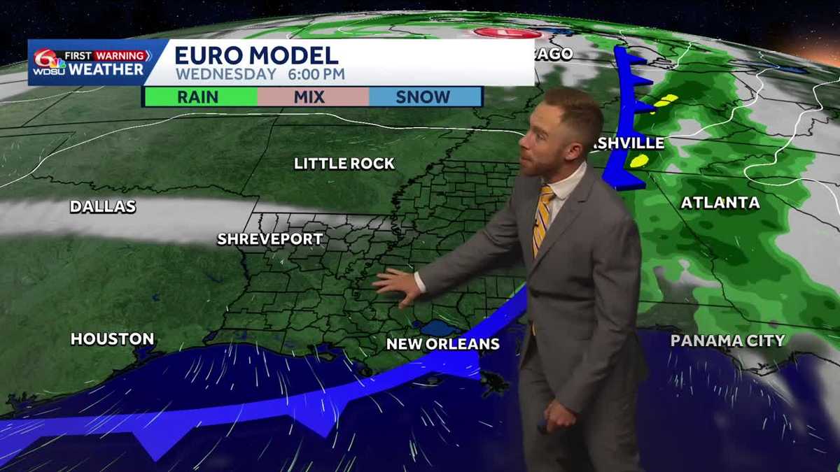
Southeast Louisiana residents barely had time to dry out from weekend downpours dumping up to 17 inches of rain before a new cold front lined up to bring scattered storms back to the region by midweek. According to WDSU, a cold front brings a 30% chance of rain as voters head to the polls on Tuesday, following a period of drier conditions that offered temporary relief across the Gulf Coast.
The severity of the initial weekend deluge varied drastically by location. Metairie, Kenner, and Bucktown absorbed between 6 and 8 inches of rain, while Northern Washington Parish measured 6 to 7 inches. Just across state lines, Pearl River County, Mississippi, recorded the heaviest totals in the region, logging an astonishing 15 to 17 inches in a tight six-hour window near Crossroads. That excessive runoff pushed local creeks past their banks, triggering flood warnings alongside coastal flood advisories across St. Tammany, St. Bernard, and Eastern Orleans parishes driven by high perigee tides.
Midweek Storms and Election Day Outlook
Rain chances will remain suppressed below 20% through Monday afternoon across the local viewing area, giving communities a brief window to clear blocked drains and assess property damage. That calm will break as a cold front pushes east, introducing scattered storms starting Tuesday afternoon and lasting through Wednesday. While the highest threat for severe weather and flash flooding remains concentrated to the north across northern Louisiana and western Mississippi, Southeast Louisiana will still see isolated downpours and brief thunder starting around 4 p.m. Tuesday.
Total rainfall amounts for the metro area are projected to stay around half an inch or less, keeping the immediate threat well below weekend levels. However, voters casting ballots on Election Day will need to factor the weather into their schedules. Rain chances sit at 30% for Tuesday and tick up to 40% on Wednesday, meaning spotty showers could greet people heading to local polling places.
Drier and cooler air is expected to filter into the region behind the front by Wednesday night, though lingering atmospheric moisture could still support isolated showers through the remainder of the workweek.
Keep reading

Jags cruise by the Colts, AFC South lead up to 3 games – WTOC
Jacksonville Controls the Colts as AFC South Lead Expands Indianapolis hadn’t won in Jacksonville since 2014. That streak...
November 1, 2026 Dover Saddlery Highland Series and Championships Presented by THIS Results
Dover Saddlery Highland Series and Championships Spotlight Competition Results Equestrian athletes gathered for the Dover Saddlery Highland Series...

Connecticut market snapshots: Comparing jobs, businesses and property taxes
Connecticut municipalities face stark economic contrasts according to the Connecticut Commercial Opportunity Index, developed by the Yankee Institute...

The Tip of the Iceberg” – Bob Dylan: Fort Collins, Colorado, May 23rd 1976. | Johnny B
Just a week before the arrival of his massive box set, The Live Recordings 2026, Bob Dylan delivered...