
Tracking Fire Activity in Hendricks County and Beyond Through the WFCA Fire Map
Wildfire tracking has entered a more integrated digital space as the Western Fire Chiefs Association operates its real-time fire map, a resource utilized for monitoring active incidents, tracking perimeters, and reviewing live emergency dispatch data across regions including the western United States and Alaska. The platform, detailed at wfca.com/fire-map, aggregates satellite detections and meteorological data to provide situational awareness for residents and public safety officials alike.
Data Feeds and Satellite Technology Powering the Map
The map functions by combining multiple streams of satellite intelligence and ground-level telemetry. Detections rely on polar-orbiting thermal sensors from NASA FIRMS, including VIIRS, MODIS, and Landsat, alongside geostationary monitoring from NOAA’s GOES satellites, which provide five-minute refresh rates.
To reduce false positives, the system integrates Satellites on Fire, an artificial intelligence verification layer that fuses these multi-satellite inputs to establish higher-resolution perimeters and active fire locations. Official incident records from IRWIN and federal FEDS perimeters track growth and containment status, while local emergency response integrates live 911 dispatch calls for fire, medical, and other incidents via PulsePoint.
Meteorological Integration and Specialized Forecasts
Beyond thermal detection, the platform incorporates atmospheric data to contextualize active incidents. The National Weather Service and NOAA’s Storm Prediction Center supply live fire-weather warnings, including Red Flag Warnings, alongside wind and humidity metrics.
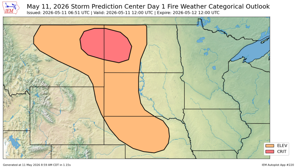
Additional layers provide smoke and lightning observations, short-range spread forecasts for specific regions via tools like FIRIS, and live feeds from firefighting aircraft tracked through maintained allowlists of wildfire-tasked tail numbers. Users can also access real-time feeds from camera networks such as ALERTCalifornia and ALERTWest for visual confirmation of smoke and active flames.
While the map aggregates extensive data from federal, state, and local sources, dispatch locations and boundary parameters remain approximate. The platform notes that no representation or warranty is provided regarding the absolute timeliness, accuracy, or completeness of the displayed information.
Keep reading

Amick Farms expands South Carolina footprint with new Edgefield County operations
Amick Farms Invests $54.78 Million to Build Trenton Hatchery Amick Farms is expanding its South Carolina footprint with...

Log in | Nevada Portal
A Centralized Digital Hub for Case Management Litigants, attorneys, and the public now have access to a centralized...

SNHU Men’s Soccer Claims NE10 Regular Season – Northeast 10 Conference
Southern New Hampshire University has secured the No. 1 seed in the Northeast 10 Men's Soccer Championship for...

A Song of Grief and Union in “Lincoln in the Bardo” | The New Yorker
Missy Mazzoli’s “Lincoln in the Bardo” Opens at the Metropolitan Opera The sixth opera by American composer Missy...