
Three weather systems bring rain and flood risks to the Philippines
Residents across much of the Philippines should prepare for a wet Sunday, November 8, as a complex intersection of three distinct weather systems keeps much of the archipelago under cloudy skies and active rainfall, according to reports from Inquirer and Cebu Daily News.
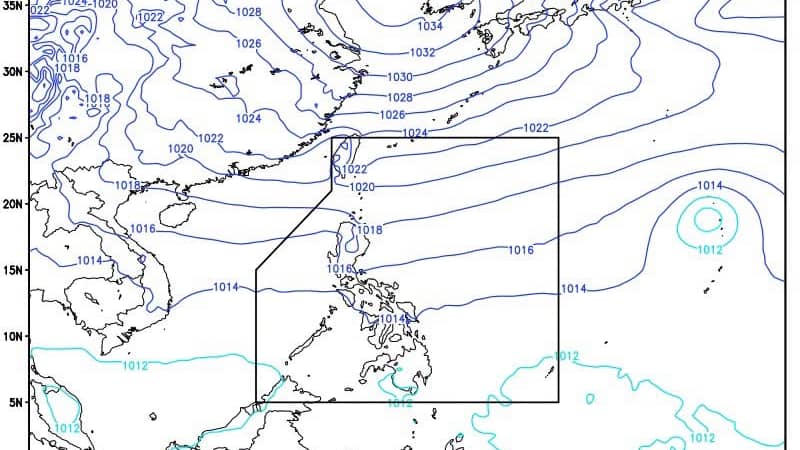
The Philippine Atmospheric, Geophysical and Astronomical Services Administration (Pagasa) has identified the easterlies, the northeast monsoon (locally known as the amihan), and a shear line as the primary drivers of the unsettled weather. While some areas may only see isolated showers, the combination of these systems poses specific hazards for vulnerable communities. Pagasa has issued warnings regarding the potential for flash floods and landslides in areas experiencing moderate to heavy rainfall.
Localized threats in Southern Luzon and Visayas
The most immediate concerns for flooding and landslides center on the impact of the shear line—the boundary where northeasterly and easterly winds meet. According to the Daily Tribune, this system is expected to bring scattered to widespread rains and thunderstorms to Aurora, Quezon, and Camarines Norte. The threat extends into parts of MIMAROPA, specifically Marinduque and Romblon, where the easterlies are forecast to produce moderate to occasionally heavy rainfall.
In the Visayas and Mindanao regions, the easterlies are maintaining a steady grip. Pagasa reports that Eastern Visayas, Central Visayas, Caraga, Northern Mindanao, the Zamboanga Peninsula, and Davao Oriental will likely face cloudy skies paired with scattered rain showers and thunderstorms. For those in these regions, the “so what” is clear: the unpredictable nature of these thunderstorms means residents in low-lying or mountainous areas must stay alert for sudden shifts in rain intensity.
Weather patterns by region
| Weather System | Primary Regions Affected | Expected Conditions |
|---|---|---|
| Easterlies | Eastern/Central Visayas, Caraga, Northern Mindanao, Zamboanga Peninsula, Davao Oriental, Metro Manila | Cloudy skies, scattered rains, and thunderstorms |
| Northeast Monsoon (Amihan) | Cagayan Valley, Apayao, Kalinga, Mountain Province, Ifugao, Ilocos Region, Central Luzon | Cloudy skies with light rains |
| Shear Line | Aurora, Quezon, Camarines Norte | Scattered rains and isolated thunderstorms |
Tropical Storm Cempaka moves east of Northern Luzon
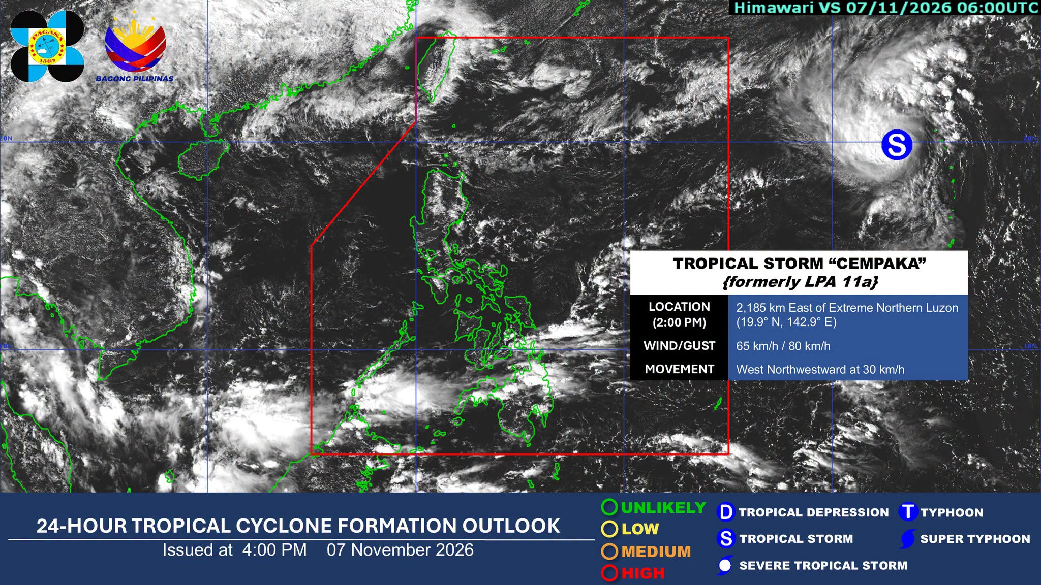
Adding a layer of complexity to the domestic weather pattern is Tropical Storm Cempaka. As of 3 p.m. on Saturday, Pagasa tracked the storm approximately 2,175 kilometers east of Extreme Northern Luzon. While the storm remains outside the Philippine Area of Responsibility (PAR), its presence influences the broader atmospheric conditions in the region.
Cempaka, which intensified from a tropical depression to a tropical storm around 8 a.m., is currently moving west-northwestward at 30 kph. The storm carries maximum sustained winds of 65 kph near the center, with gusts reaching up to 80 kph, according to GMA Network. Although the storm is not a direct threat to landmasses at this moment, its movement and strength contribute to the unsettled maritime conditions and wind patterns affecting the northern part of the country.
Coastal conditions and maritime safety
The weather isn’t just affecting those on land; the sea conditions are shifting significantly depending on the region. In Northern Luzon, maritime activity may face challenges as moderate to rough seas are expected, with wave heights potentially reaching between 1.5 meters and 4.0 meters, as noted by GMA Network.
In contrast, the rest of the country can expect relatively calmer waters. Coastal areas in Visayas and Mindanao, as well as the remainder of Luzon, should see slight to moderate waves ranging from 0.6 to 2.5 meters. This disparity highlights the importance for fisherfolk and sea travelers to check localized bulletins, as the conditions in the north are notably more volatile due to the combination of the amihan and the approaching tropical storm.
As the weekend progresses, the primary focus for local authorities remains on monitoring the rainfall accumulation in Quezon and the Visayas, where the risk of landslides remains the most critical variable for community safety.
Worth a look

Bepirovirsen Shows Durable Functional Cure Rates in Chronic Hepatitis B Trials
Bepirovirsen maintains functional cure rates through week 96 in hepatitis B trials Patients treated with bepirovirsen for chronic...

Yogi Adityanath demands apology from SP leaders before Akhilesh Yadav visit
Ayodhya is bracing for a significant political and religious intersection on December 12, as Samajwadi Party (SP) chief...

Seneca Valley Virus Turns Cold Neuroendocrine Tumors Hot
Dr. Chauhan tests SVV-001 virus to turn "cold" neuroendocrine tumors "hot" A new clinical approach is testing whether...

Mary Lou McDonald Calls for State Acquisition of Moore Street at Reclaim Moore Street Rally
“We will live in a united Ireland,” Sinn Féin leader Mary Lou McDonald declared to a crowd gathered...